LAAMU ATOLL, Republic of Maldives -- On behalf of the U.S. Pacific Command (USPACOM), the U.S. Army Corps of Engineers (USACE) collaborated with the Maldives National Defence Force (MNDF) and the Maldives Environmental Protection Agency (EPA) to prepare an Environmental Sensitivity Index (ESI) atlas for Laamu Atoll in the Republic of Maldives.
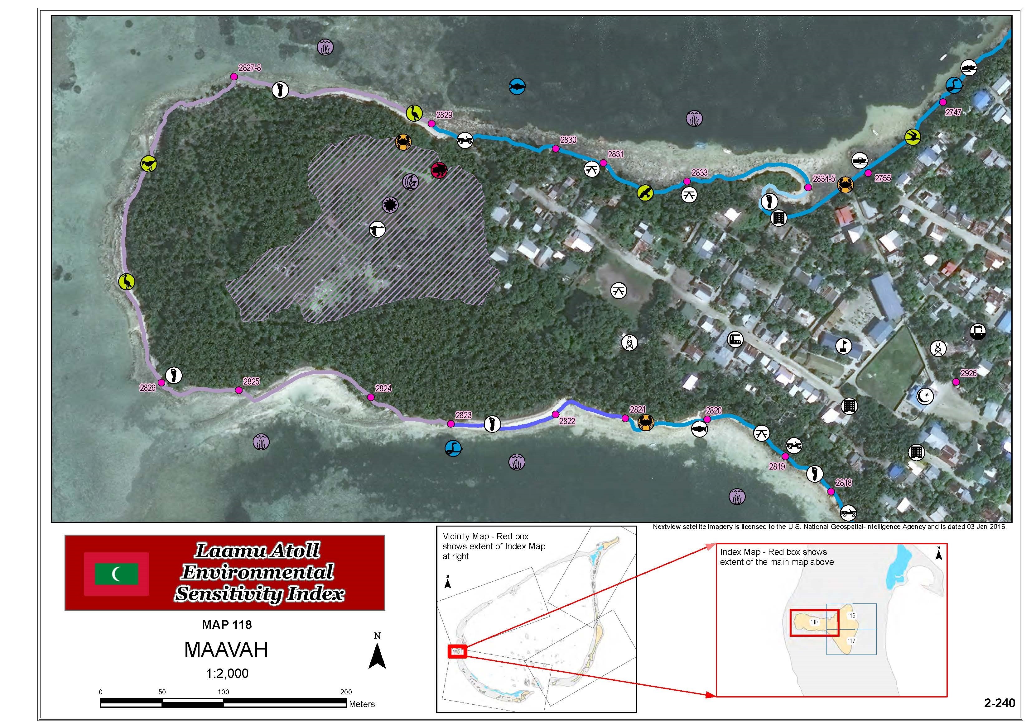
ESI maps provide a concise summary of coastal resources that are at risk if an oil spill occurs. Examples of at-risk resources include biological resources, such as birds and fish; sensitive shorelines, such as marshes and tidal flats; and human-use resources, such as subsistence gathering or fish processing. According to the National Oceanic and Atmospheric Administration (NOAA), ESI maps can help responders meet one of the main response objectives: reducing the environmental consequences of the spill and the cleanup efforts. Additionally, ESI maps can be used by planners--before a spill happens--to identify vulnerable locations, establish protection priorities, and identify cleanup strategies.
"The Maldives National Defence Force is profoundly grateful to the U.S. Pacific Command for conducting the ESI Project in Laamu Atoll," said MNDF Vice Chief of Defense Force Brig. Gen. Ahmed Shahid. "The successful completion of the project provided the MNDF with vital information and resources that will greatly assist in shaping the response to an oil spill or any other natural disaster in the Laamu Atoll region."
"ESI mapping of the entire country remains the greater objective, and, therefore, MNDF will endeavor to build on this achievement working together with USPACOM," added Shahid.
The Laamu Atoll ESI project took approximately 15 months to complete. The project commenced in December 2014, following recommendations from the South Asia Regional Environmental Security Form. The project was completed in three phases, which included a scoping trip, field work, and the development and delivery of the final ESI GIS database and atlas. The result is an interactive electronic atlas, hardcopy maps, and a robust GIS database. The MNDF Coast Guard will utilize the final products to prioritize its oil spill response actions in the atoll. EPA will use the atlas to define new environmental sensitivity areas in the atoll, reference its resource as an environmental baseline, and increase awareness of the biological diversity of Laamu Atoll. MNDF and EPA are also now well equipped to replicate the ESI methodology in other atolls, if necessary.
"The Laamu Atoll ESI project serves as a great example of civil-military cooperation between the U.S. and Maldives," stated Mr. Christopher Sholes, USPACOM Environmental Program Manager. "All core team members needed to leverage each other's capabilities to succeed. It demonstrates that USPACOM, MNDF, and the Maldives EPA prioritize environmental security in a changing world."
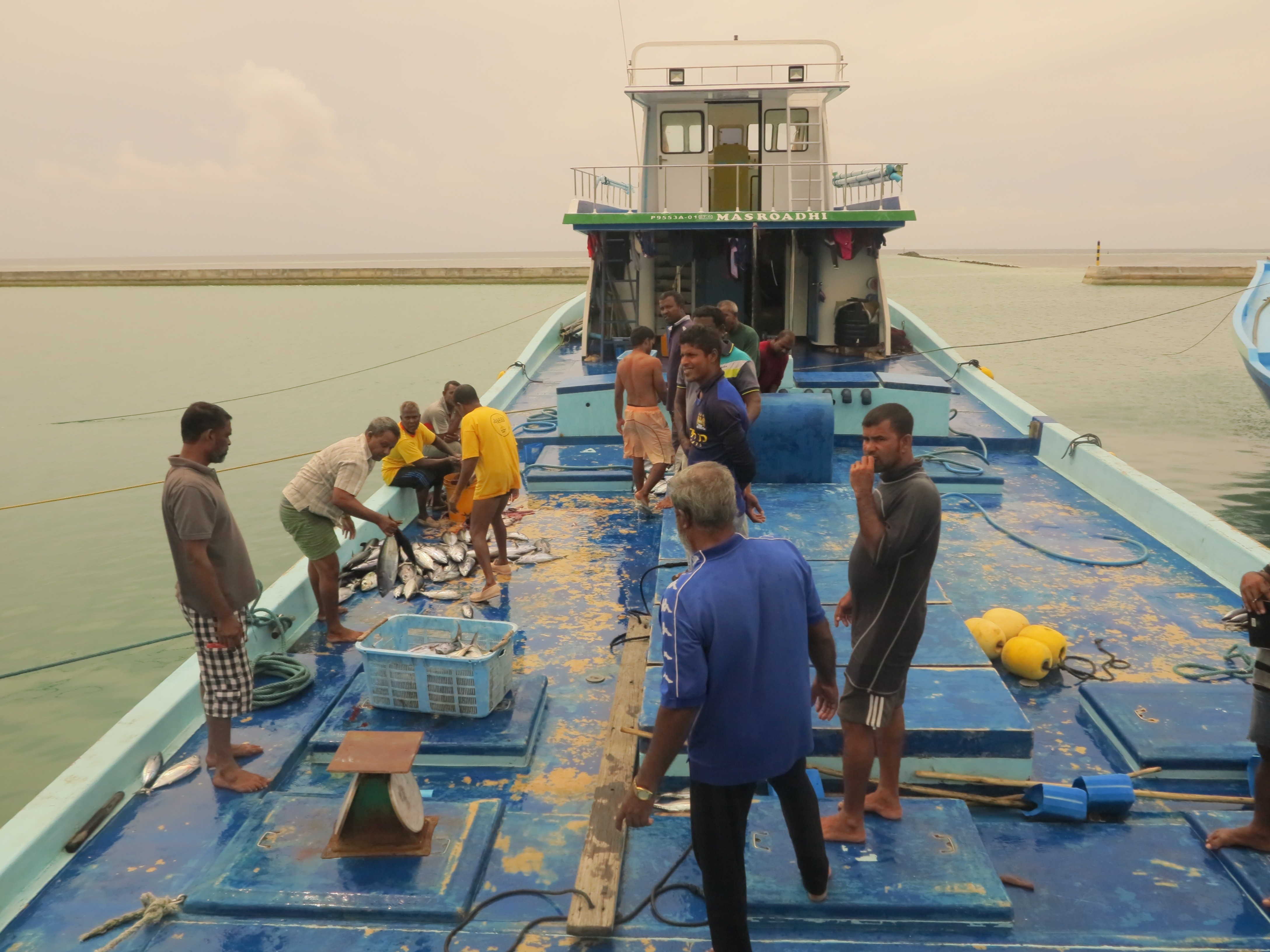
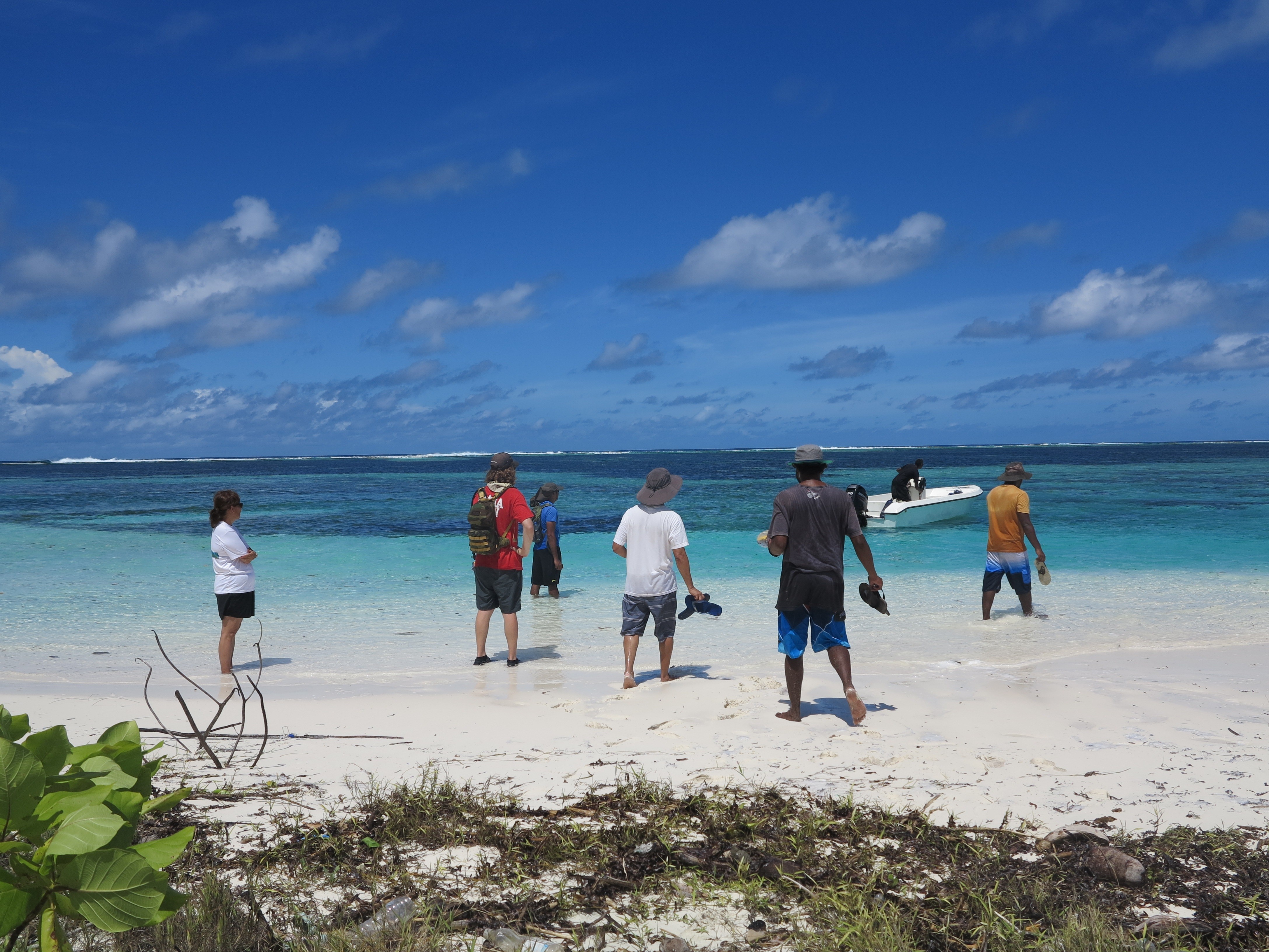
The Laamu Atoll ESI atlas includes detailed biological resource, shoreline, and human-use mapping for more than 44 islands in the atoll. USACE, MNDF and EPA conducted the field work in August 2015, walking over 150 kilometers of shoreline to collect the necessary information to prepare the atlas.
"During the field data collection, it be would sunny and hot in the morning and rain in the afternoon," said Staff Sgt. Ibrahim Faisal, who is the J3/7 Non-Commissioned Officer In-Charge for the Maldives National Defence Force. "We had to walk miles of sandy beach or rocky shore (lines), as well as get into waist-high water in a single setting."
The team experienced monsoon swells, along with the environmental and logistical challenges unique to the Maldives.
"Though it was challenging, the team adapted," said Faisal "USACE, MNDF and EPA's joint effort and planning led to the successful completion of field work."
The team also collected more than 1,200 biological features, and more than 800 human-use resources. Coastal erosion and other miscellaneous information was also collected using a standard data dictionary. The results were compiled in a comprehensive Geographic Information System (GIS), which allows for the data to be analyzed. For example, users of the Laamu Atoll ESI database can now query the data to determine the most vulnerable shorelines to a potential oil spill, as well as determine the locations of specific biological or human resources.
Laamu Atoll was chosen as the project location given its proximity to the One and a Half Degree shipping channel. Throughout the year, hundreds of large oil tankers pass through the channel, carrying oil between Africa and Asia. If an accident were to occur, Laamu Atoll's unique ecosystem would be a risk. Currently, Laamu Atoll has six locations already designated by the EPA as environmental sensitive areas.
Social Sharing