The i... VIEW ORIGINAL
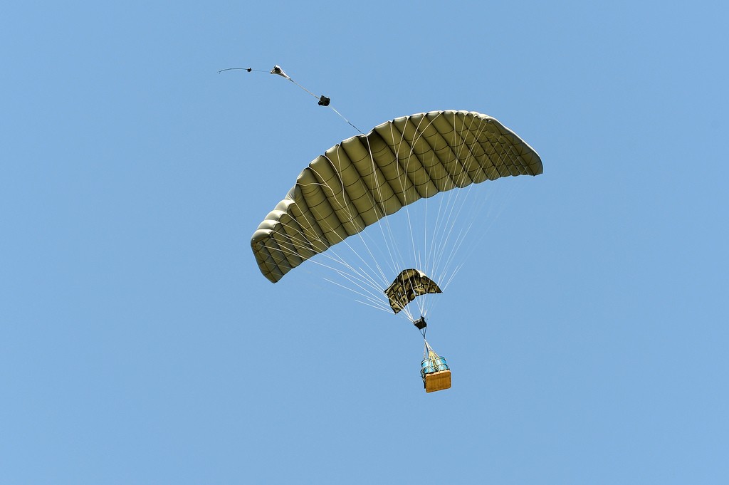
NATICK, Mass. (Aug. 7, 2013) -- The Joint Precision Air Drop System, or JPADS, recently received a guidance system software upgrade, greatly increasing its accuracy. JPADS uses a GPS-guided cargo parachute enabling U.S. troops to be resupplied by air in a wide variety of terrains, climates and geographically secluded areas.
Developing more robust airdrop software is essential as precision airdrop is often the only feasible way Soldiers can safely and efficiently receive critical supplies, especially in places like Afghanistan where there is mountainous terrain and remote isolated outposts.
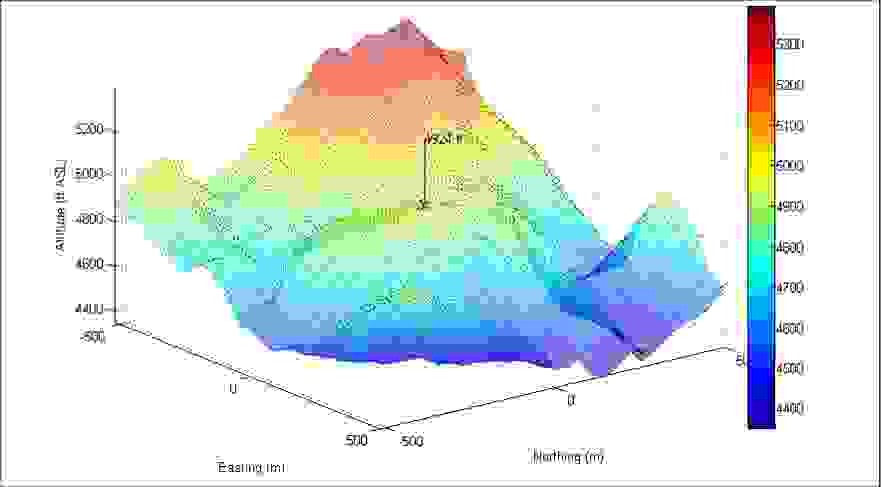
A key ingredient of the new software is the ability to provide a virtual overlay of different drop zones located all over the world. With this integrated simulation capability, the system's physical guidance and control components were optimized to avoid terrain obstacles which otherwise would cause the JPADS to crash or miss its target.
JPADS is a unique resupply capability that can be dropped from up to 25,000 ft and flies itself to a target drop zone on the ground. The resulting vertical and horizontal offsets from the target drop zone result in minimized exposure to threat to the aircrew.
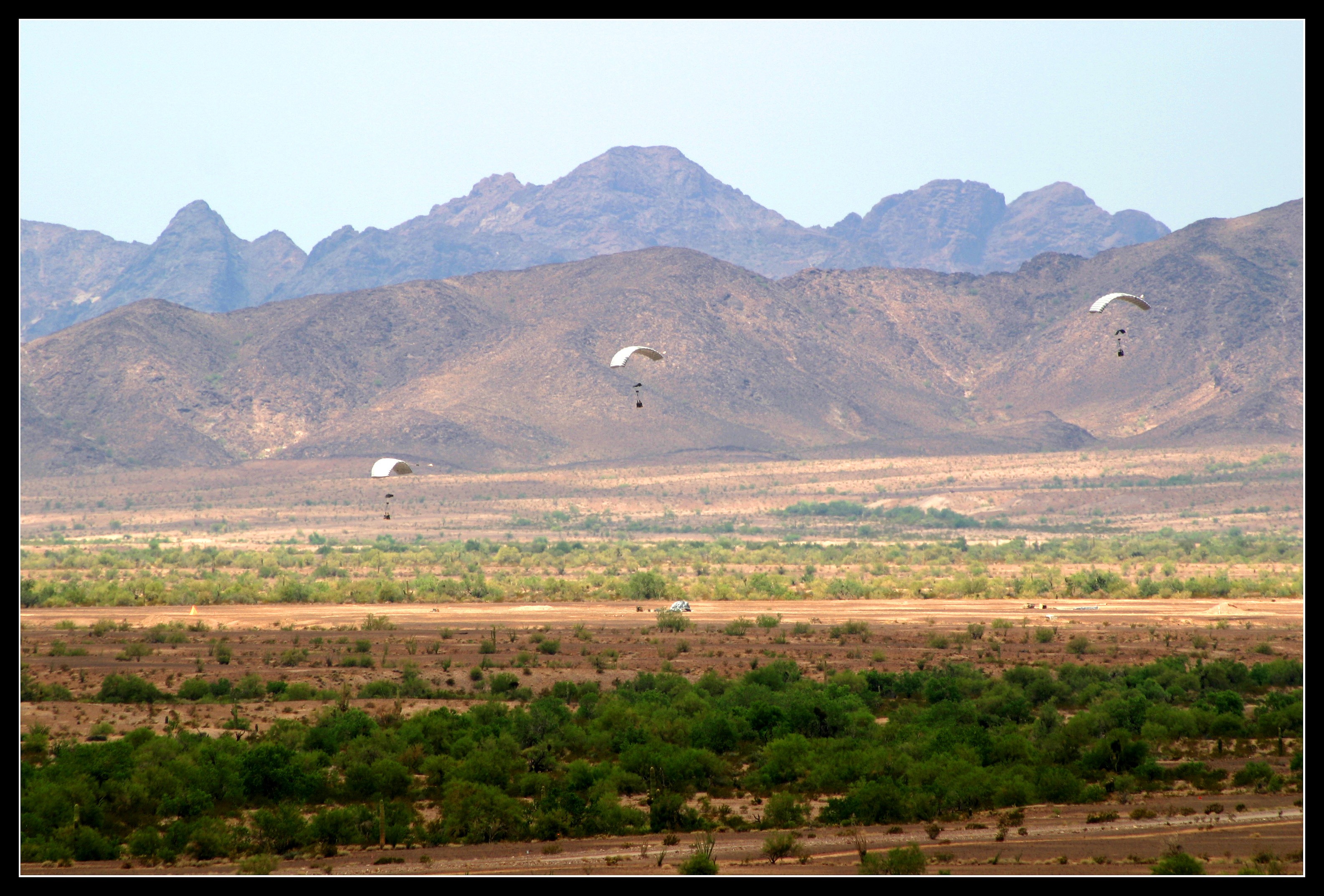
The Airborne Guidance Unit, which contains the airdrop software and controls the direction of the parachute, avoided virtual terrain obstacles during software testing at Yuma Proving Ground, Ariz. After the AGU and payload were dropped, the AGU altered its course as if a mountain or obstacle were in its way - while in reality there was no physical mountain at Yuma.
"We had an actual airdrop and we were simulating the terrain environment in which the system was really going to be deployed," said Keith Bergeron, NSRDEC aerospace engineer. "That's cool."
This improved capability addressed a Joint Urgent Operational Needs Statement that came from the field in May 2010 to create software that was capable of avoiding terrain. The resulting technology solution was fielded quickly due to close collaboration between the Natick Soldier Research, Development and Engineering Center and Project Manager Force Sustainment Systems.
Sensors, GPS, motors, and a microprocessor complete the AGU, which is contained in a ruggedized box. The parachute is similar to those used by skydivers and is steered to its GPS target by the AGU.
"The AGU is basically a flying computer," said Greg Noetscher. "It's translating terrain from the [Area of Operational Responsibility] or something very similar to that over to our hemisphere to simulate the terrain. The JUONS helped us to address the 3-D nature of the world, basically."
The airdrop software relies on Digital Terrain Elevation Data in order to know the landscape of different locations. The National Geospatial Agency helped support this effort by providing advice on different types of DTEDs and flight accuracy.
NSRDEC has been working on guidance software for over a decade. With the new requirements and new environment the system had to adapt, and the co-location of NSRDEC and PM FSS made this upgrade easier.
"This is stuff we were already working on," Bergeron said. "We were leaning forward, and that really helped the transition."
This software was fielded February 2011 in the AOR for the JPADS-2K as an urgent materiel release. PM FSS and NSRDEC worked with the Charles Stark Draper Laboratory, a non-profit research and development lab located in nearby Cambridge, Massachusetts to develop the software as the program of record for the terrain avoidance upgrade for JPADS.
Now the Army or the Air Force mission planner can access the information that will be wirelessly or physically installed in the AGU; the new software doesn't require any user training.
"The software can automatically update," said Eric Campagna, PM FSS JPADS-2K project leader. "So the infrastructure we're creating right now to support the distribution is going to be a JPADS website that automatically pulls the information and retains it."
PM FSS is putting the software onto different platforms, not just the JPADS-2K. About 1,500 systems will soon have the software, which will also pull information from the NGA's servers in order to distribute information to the field.
"This science and technology (S&T) baseline stemmed into one set of software that functions now with three platforms," Campagna said. "The reduced cost and sustainment is great because software sustainment is killer in a high-dollar system."
With a unified guidance software system, the transition from science and technology development to the field is that much easier. Plus, PM FSS gets feedback from the field on a regular basis and can contact NSRDEC for support as needed.
"It's not only a joint effort between S&T and PM FSS here at Natick, but it's a joint service effort between Army, Air Force, and Marines," Noetscher said.
More reliable airdrop software increases accuracy, minimizing exposure for troops on the ground recovering supplies and the JPADS as well as aircraft in the sky. Additionally the use of the JPADS saves Soldiers' lives by reducing the dependence on ground convoy requirements and reducing the number of helicopter re-supply missions, making Soldiers in all of the forces less susceptible to the risk of enemy attacks and improvised explosive devices.
--
NSRDEC is part of the U.S. Army Research, Development and Engineering Command, which has the mission to develop technology and engineering solutions for America's Soldiers.
RDECOM is a major subordinate command of the U.S. Army Materiel Command. AMC is the Army's premier provider of materiel readiness -- technology, acquisition support, materiel development, logistics power projection, and sustainment -- to the total force, across the spectrum of joint military operations. If a Soldier shoots it, drives it, flies it, wears it, eats it or communicates with it, AMC provides it.
Social Sharing