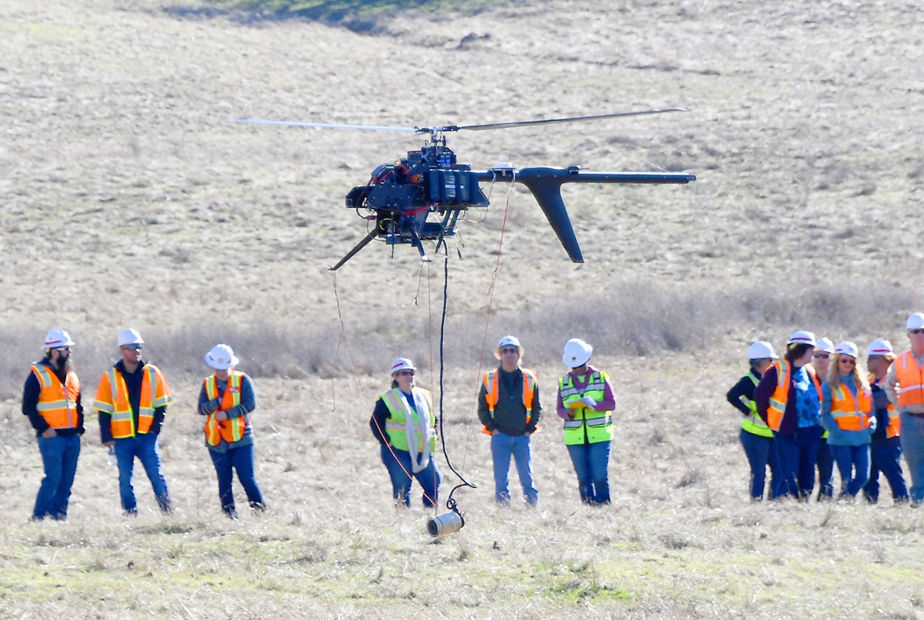

On a recent sunny California winter day, approximately 25 people gathered in a scenic and rural field to watch a demonstration that could change the way potentially dangerous munitions are found. Under the supervision of the U.S. Army Corps of Engineers Sacramento District, a team of contractors fired-up a tri-blade, Unmanned Aerial System (UAS) and lifted off from a straw-covered pasture in the Spenceville Wildlife Area, 14 miles east of Marysville. It wasn't just any old pasture, however, the site was chosen because it is part of a Formerly Used Defense Site (FUDS) known as Former Camp Beale.
Among those watching the demonstration with anxious curiosity were Sacramento District's Tim Crummett, former Camp Beale FUDS project manager; Kyle Lindsay, a geophysicist; FUDS program manager Chris Goddard, and James Lukasko, technical team lead. Other interested agencies on site included the State of California Department of Toxic Substance Control; representatives from Beale Air Force Base, USACE's Head of Military Munition Response Program, and FUDS Project Managers from the Corps' Los Angeles District.
Nearby, Crummett stood among those scrutinizing the process, watching to ensure the magnetometer strayed no more than a few feet from the ground and discussing the procedure with colleagues.
"This is an innovative use of a drone system towing a magnetometer to search for munitions," said Crummett. "This is the first time it's being tried, and our first opportunity to see if this is going to work."
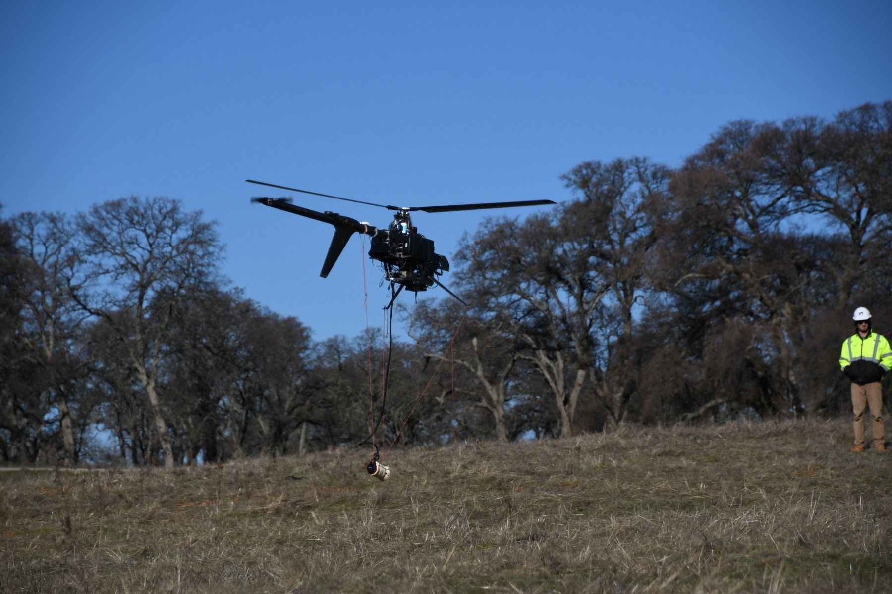
The description of the demonstration sounds high-tech: A cutting-edge use of a UAS, LiDAR (Light Detection and Ranging), GPS and magnetometer in a pilot study to search for subsurface munitions in steep terrain or sensitive habitats. But the demonstration was also aided by a clever bit of low-tech. The helicopter-like drone rose up, two simple strands of orange cord supporting the magnetometer and a third cord keeping it aimed in the proper direction. Nearby, a pilot used a video game-like controller to manage flight, his goal of making tidy parallel field crossings aided by an almost windless day, although still fighting occasional prop wash from the low altitude flying.
According to Lindsay, the district's onsite geophysicist during the testing, the Corps is conducting this pilot study to increase accessibility in challenging terrain when searching for munitions left-behind at formerly used defense sites.
"Currently, munitions-personnel must use a ground-based EM61 metal detector pulled by tractor or carried along by two operators; not a very practical system to search for munitions in inaccessible terrain, wetlands or biologically sensitive areas," said Lindsay.
"This is an evaluation to see if this is equivalent to industry standards," added FUDS program manager Chris Goddard.
As a control for the test, the team buried some inert munitions-type objects in the area in order to compare the results from the pilot study with what the team knows to actually be true.
"We will find out in a couple weeks when we get the results of our survey. The data is currently being evaluated," said Goddard.
One of the goals of the pilot study is to be able to use the technology to find relatively small munitions across large areas of habitat. Kind of the munitions version of 'the needle in the haystack.'
According to Goddard, it currently takes about eight to nine hours to scan and map an area the size of an acre, but the hope is the pilot study will make that process faster without losing any accuracy.
"The field we scanned was selected because there is potential munitions in the area. We recently found a 105 millimeter anti-tank munition. But the goal is to be able to use this technology to find munitions that are 37 millimeters - about the size of large bullet - or larger, and find them up to a depth of about 12 inches," said Lindsay.
Should the results come back proving the combination of drone, LiDAR and magnetometer are a more efficient method of searching, the FUDS team looks forward to pushing out the finding to colleagues.
"If this works as good as we believe it is going to, eventually, this could become the new industry-wide standard for finding munitions in sensitive habitat," said Goddard.
Social Sharing