REDSTONE ARSENAL, Ala. — Visual Based Navigation. While it harkens back to the Transcontinental Airway System – created exactly a century ago in 1923 – VBN is not necessarily quaint. Where the Transcontinental Airway System was a sequential lighted airway along the transcontinental airmail route, revolutionizing flight before radio frequency navigation, U.S. Army Combat Capabilities Development Command Aviation & Missile Center's implementation of VBN is a bit more dynamic.
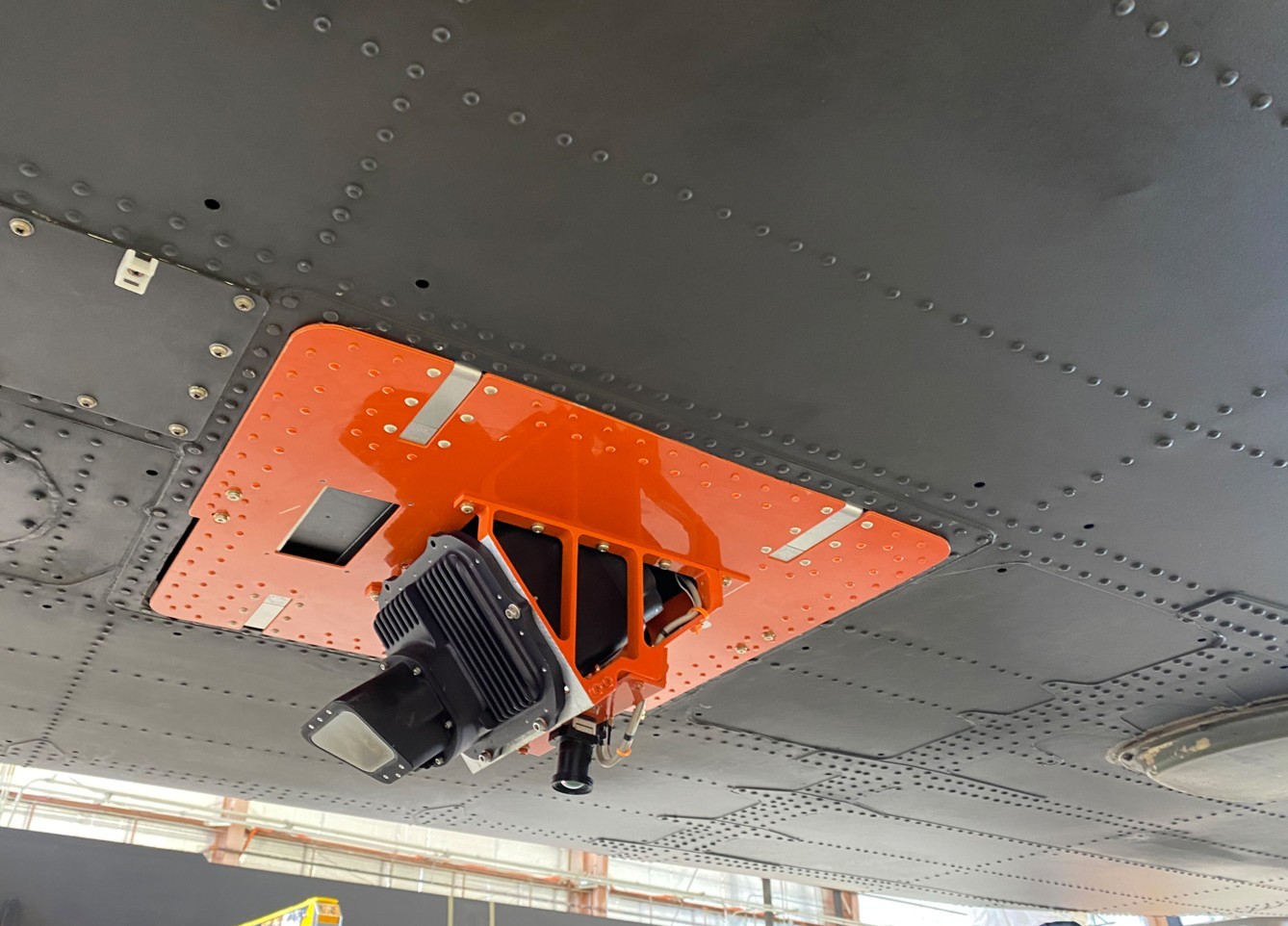
Today, there is of course, sophisticated, global positioning systems at Army pilot’s fingertips. But what happens when GPS is not available? DEVCOM Aviation & Missile Center researchers recently tested their VBN system at their Fort Eustis, Virginia, location, where they attached a camera to the base of an experimental Black Hawk. While in flight, the camera captured terrain imagery that was then cross-referenced with a map database, accurately pinpointing the helicopter’s location for its pilot.

The test was a win for one of Army Futures Command’s top modernization priorities — Assured Positioning, Navigation and Timing, which looks for solutions to combat near-peer threats operating in the electromagnetic spectrum domain. But also important to note, the technology, developed by industry partners at Leidos is, “100% government owned,” said AvMC Navigation Technical Area Lead Dr. Greg Reynolds.
The test, a combined effort of AvMC’s Rotorcraft In-Flight Labs and Flight Test Division and Missiles Navigation Technology Division, and Program Executive Office Aviation’s PM Assured Airspace Access Systems, was a success — but the kind of success that wouldn’t have happened without years of work, Reynolds said.
After the initial test was completed, the crew left the technology on their aircraft for future flights in ride-along status, giving Reynolds and his team an unexpected boon of data, helping them streamline the algorithm for increased accuracy.
Reynolds praised Experimental Test Pilot Lt. Col. Wes Ogden, who flew the test, and the Fort Eustis crew, noting that after his crew returned home, they had full confidence in their counterparts continuing. Ogden said that Test Engineer Kevin Thomazios and his leadership was to thank for that.
What is exciting about Visual Based Navigation is that the scope of the technology goes beyond manned aircraft.
“In manned missions, position aiding drastically reduces crew workload by alleviating the need to manually follow the aircraft’s route on a map using nearby terrain features,” Ogden said. “But there are several other exciting uses for this type of technology. One of the areas I focus on in my position is full-scale autonomy at terrain flight altitudes. For any autonomous vehicle operation, accurate position information is critical to safe and effective mission accomplishment. If an uninhabited aircraft loses GPS signal, it will need a backup system to provide its position so it can continue the mission and recover safely back to friendly lines.
"This type of capability would absolutely enable that.”
━━━━━━━━━━━━━━━
The DEVCOM Aviation & Missile Center, headquartered at Redstone Arsenal, Alabama, is the Army’s research and development focal point for advanced technology in aviation and missile systems. It is part of the U.S. Army Combat Capabilities Development Command (DEVCOM), a major subordinate command of the U.S. Army Futures Command. AvMC is responsible for delivering collaborative and innovative aviation and missile capabilities for responsive and cost-effective research, development and life cycle engineering solutions, as required by the Army’s strategic priorities and support to its Cross-Functional Teams.
Social Sharing