
on Oct. 24 during the Dense Urban Counter Unmanned Aircraft System Materiel Experiment 21-1, which examined the performance of a number of UAS detection systems in a dense urban environment.
VIEW ORIGINAL
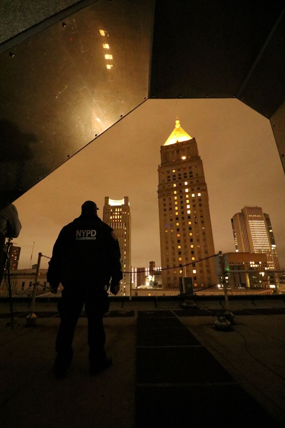
New York City Police Department Counterterrorism Division, observes CUAS
detection testing from a rooftop as Dense Urban CUAS Materiel Experiment
21-1 was underway in lower Manhattan on Oct. 24.
VIEW ORIGINAL
NEW YORK CITY, N.Y. – This city may not sleep, but between 3-9 a.m. on a weekend, and on the streets near Foley Square, it sure slows down. In the darkness on Oct. 24 and 25, few pedestrians could be seen, traffic was blocked into the square, and for the most part, noise was distant and subdued.
The skies above, however, were bustling.
Over the course of the two days officers from the New York Police Department Technical Assistance Response Unit flew 49 scripted small unmanned aircraft system trial flights, sometimes with multiple aircraft, and performing a host of intentional maneuvers: shooting straight up and down, scooting low between buildings, buzzing down alley ways and hovering next to courthouse buildings.
An observer would have a hard time finding the tiny blinking red and green lights emitting from these relatively small aircraft when seeking them amongst the vastness of the city-scape.
But the aircraft were most definitely being watched.
Dozens of exotic antennas were mounted on building and in vehicles, many directed into a blocked-off area. On a nearby rooftop, dozens of personnel were monitoring LED screens and participating in an experiment led by the U.S. Army Futures Command Subterranean Dense Urban Community of Practice in partnership with the New York Police Department Counter Terrorism Division. Their mission was to detect, track, identify and classify small unmanned aircraft systems in a dense urban environment.
The sensors were designed to find the aircraft using either radar or by detecting the signals that were emitted during communications between the aircraft and their pilots.
Five different sensor systems were tested at the experiment with coordination from U.S. government organizations, including the U.S. Army Combat Capabilities Development Command’s (DEVCOM) Armaments Center, C5ISR Center, the Defense Innovation Unit and the Defense Threat Reduction Agency.
“We are working in close coordination with the local and federal partners to conduct an experiment that can only be accomplished effectively in a place like New York City,” said the Dense Urban Counter Unmanned Aircraft System Materiel Experiment 21-1 leader, Robert Hesse from the DEVCOM Armaments Center.
New York City served as the perfect laboratory for the experiment. “This is probably the most complex and interesting environment for a test place anywhere in the world,” said Art Mogil, Innovation Officer for the U.S. Army Futures Command’s 75th Innovation Command.
Mogil, a former infantryman and Special Forces engineer, spent 23 years with NYPD, including 16 with the Counter Terrorism Division where he sometimes worked with research, development, technology and engineering projects.
“One of the lessons learned I’ve had over the years being here in the city is that you’d have a vendor bring a product into the city that worked perfectly in a pristine environment, said Mogil: “New York City: you have buildings that are steel, glass a thousand feet high … eight and one-half million people with cell phones putting on TVs, having radios, and all those RF signals are going through the air creating a complicated environment. Now, if you have that one technology that worked without any interference? Here, that system no longer performs as well.”
Master Sgt. Matthew Gogas, Capability Developer for unmanned systems, 75th Ranger Regiment provided a similar assessment. “The range of RF frequencies and the tall buildings as obstacles provide numerous challenges for this technology to positively identify threats in the area compared to other environments where you’re basically out in an open field.”
The challenge created by the various types of urban interference was fully expected. Consequently, the sensor providers did not come to pass, fail, win or lose, but to learn, explained Hesse. Conducting a “live city” urban terrain experiment, including obtaining flying permits and coordinating for the necessary times and access, requires extensive planning. Consequently, dense urban UAS experiments are difficult and extremely rare.
But they are also necessary. In order to develop sensors that function as required in an urban setting, it is necessary to obtain engineering quality data to help with sensor development. “Whether they’re successful or not, they are able to capture that data to help improve that technology and improve their capabilities, which will help in the future,” said Gogas.
Experiments also help the military and homeland defenders gain a better understanding of the equipment, where and how to emplace it and how to create better protection plans, according to Mogil.
Prior to the experiment, flight paths, launch locations and the number of UAS launched were not disclosed. Sensor operators were told where they could place their equipment and the area designated for protection, according to Roger Cutitta from the DEVCOM C5ISR Center.
The 49 UAS flight missions, known as trials, contributed to making the test a true challenge. Some flight plans were designed as easily detectible “softballs” while others were designed more to blend with the urban background.
Forty different UAVs were brought to the experiment, each with subtle differences. The aircraft varied in size and included one custom built UAS that “was like a hobbyist might put together,” said Ron Slater from the DEVCOM C5ISR Center.
Several of the aircraft had 3-D printed boxes mounted on their chassis either to serve either as notional payloads or to alter their profiles, said Cutitta. The aircraft preparers employed variations in the frequencies and waveforms used in the communications between the aircraft and controller. Some of those emissions were recognizable because they matched data from libraries of known aircraft, while others deviated from the norms.
The dense urban landscape also provided plenty of challenges not just for the sensors, but for the operators. Slater led a team that prepared aircraft for the flights and then provided them to the NYPD TARU pilots “ready to fly.” His team also served as spotters during the flights, and they gathered data afterward. The experiment’s success rested on successfully launching aircraft, following flight plans and gathering accurate time, geo-location and elevation data from the aircraft.
“We would pull data from the aircraft, flight logs from GPS data, etcetera,” said Slater. The data from the aircraft would be critical to assist in properly evaluating the sensor data.
“It was a difficult environment,” said Slater. “The buildings created wind tunnels, and they interfered with GPS signals. The metal in the buildings created compass errors that meant extra calibration for us.” Radio frequency interference was a problem that Slater anticipated but that was not so problematic during the actual trials.
Slater was confident in the success of his mission. “Overall, things went better than I thought it would go. I was anticipating worse but it turned out really well. We think we were able to give them good data.”
Throughout the experiment, it was clear from the LED screens that many UAS flights were being tracked. The exact fidelity of the sensors would not be known until all the data from the UAS and the sensors was compared and analyzed in the days and weeks ahead.
During the experiment, Gogas talked to the sensor operators to gain initial insights. “There were definitely some major differences between the two approaches that were used. The radar types seemed to have a bigger challenge operating in the dense urban environment compared to the RF signature types, which seemed to have a better result in capturing what they were looking for.”
The radar systems found it difficult to detect UAS that blended in with background clutter, and it was has a harder to detect UAVs when they stopped moving. “A flock of birds came flying by the test, which filled the radar with false targets,” said Cutitta. “There is a lot of stuff that can be done in the future to mitigate that.”
“One of the big benefits that was shown here today was the advantage of collaboration of sensors,” said Cutitta. Collaboration of sensors is when sensors are connected via communications. Cutitta gave an example of a UAV disappearing behind a building. If there was a passive sensor tucked away behind the building and set up to collaborate, it could relay that information so the geo-location of the UAS remained known.
“Even though the test may not have been fully representative, it is significantly more than we have right now in terms of being able to get to a dense urban environment and actually demonstrate and get to experiment with these systems and learn how these assets would behave and what effects they would have on our sensors,” said Cutitta. “It is very hard to get airspace. It is very hard to go out and find places where we can do these types of tests.”
Detecting UAS is Part One of a larger problem that will continue to evolve, which is to defeat UAS that pose a threat in cities or in military operations in a dense urban environment: “UAS systems in the wrong hands pose a significant and emerging threat,” said Hesse.
Although effective UAS defeat technologies are the goal, technologies that defeat or disable UAS were not part of the experiment. Hesse explained that for CUAS MATEX 21-1 it was necessary to focus on sensors. UAS defeat technologies will always depend on first being able to detect, track, identify and classify threat aircraft, so the experiments helped with progress toward the goal.
Defeating the threat UAS in an urban environment will remain a work in progress, said Gogas. “It’s going to take an approach of different technologies layered on top of each other to truly capture all the potential threats that are out there.”
The UAS threat has been emerging for more than a decade. In 2005 Mogil attended a series of threat briefs when he first heard about them. “They actually had several videos on how UAS were used to deploy explosives in a targeted way, and it kind of opened my eyes.” In more recent years, Mogil has learned via threat reports that terrorists and extremists were using UAS to deliver explosives, perform chemical dispersal and to conduct operational surveillance to aid in attacks.
The mobile platform of a UAS can access locations by air, which opens possibilities for deployment that are not yet foreseen.
“A lot of what the city has invested for security, especially for large public events and critical locations, is on fencing and bollards and all sorts of vehicle barriers, but now you have a platform that can circumvent these measures,” said Mogil.
“It will be an ongoing cat and mouse,” said Cutitta.
Social Sharing