

For the first time since operation of the Moose Creek Dam began in 1981, ice jams in the Chena River were the reason that the U.S. Army Corps of Engineers – Alaska District regulated stream flow to successfully prevent flooding of communities in the Fairbanks North Star Borough from April 24 to 30.
Typically, the Moose Creek Dam, part of the Chena River Lakes Flood Control Project, operates during high water events associated with snow melt or high rainwater to reduce risks to people and property in Fairbanks, North Pole and Fort Wainwright.
However, according to the National Oceanic and Atmospheric Administration, this year the Fairbanks area saw an unusually cold winter with temperatures remaining below freezing from December to February for the first time in 21 years and it stayed cold into spring.
This climate anomaly created the conditions for a dynamic breakup of ice in the river. The ice fractured into big pieces that floated down the river this year but in a typical year, ice melts in place or slushes into the water as it warms over time, known as a thermal breakup
“Ice was one to two feet thick on the river and we rarely see ice that thick during breakup,” said Nathan Epps, chief of the Hydraulics and Hydrology Section for the Alaska District.
The melting ice created jams downstream of the Moose Creek Dam and prevented water from traveling down the river at its typical rate, causing a buildup of water in the river.
“We usually have a dynamic breakup on the Chena River only once every seven to 10 years,” said Julie Anderson, chief of the Operations Branch for the Alaska District.
By April 24, ice jams were observed near the Steamboat Landing neighborhood, Nordale Road bridge and Hunts Creek gauge near Pleasant Valley. Backwater caused flooding on Freeman Road, which provides access to Steamboat Landing as well.
Members of the Chena Project team monitor river levels during the open water season along the Chena, Little Chena and Tanana rivers which allowed them to observe the elevated stream flow.
“The ice jams were very unique…,” Epps said. “This was uncharted territory but we were able to put our heads together to come up with a solution and we think we helped people out this way.”
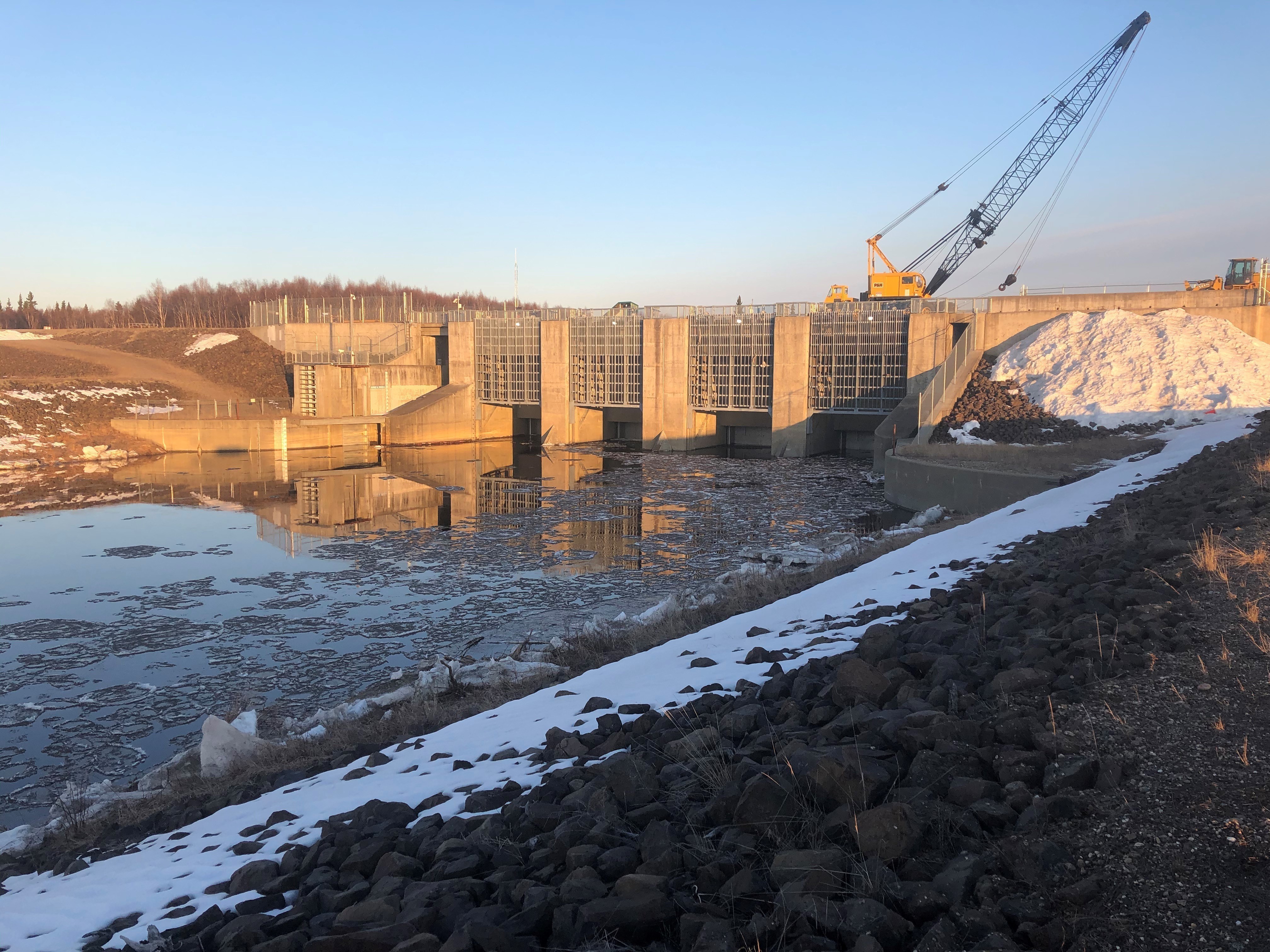
When stream flow reached 5,200 cubic feet per second on April 24, the Alaska District partially closed the gates in the control works. This decision led to reduced buildup of water downstream by storing water, ice and debris upstream of the dam while river levels were high. It marked the 27th time the Moose Creek Dam has been operated and the first time it was operated for ice conditions.
While the dam is activated, the Alaska District monitors river levels 24 hours a day until water can be released safely without placing communities at risk of flooding.
“Usually we are operating to constrict the water to 8,000 cubic feet per second through the project but this operation we were operating to match outflow at Fairbanks which is unusual,” Anderson said. “We only wanted to release as much water as the river could handle without backing up so we were operating at much lower levels through the project to match outflow in Fairbanks.”
Operating the dam diverted the buildup of water back within the river channel instead of in uncontrolled areas downstream. This action prevented the ice from creating floods while allowing the ice jams enough time to melt or continue downstream.
The team began opening the dam’s gates to release water back into the Chena River early on the morning of April 30 when it was determined to be safe from flooding with stream flow reduced to 2,170 cubic feet per second and downstream river levels continuing to fall.
“This is an event that involves a whole lot of coordination and a whole lot of people – Hydraulics and Hydrology Section, Geotechnical and Materials Section, Operations Branch, Emergency Management Office and the Cold Regions Research and Engineering Lab – so it is a team effort to operate the project and make it successful,” Anderson said.
The Chena Flood Control Project began in 1968 when Congress authorized its construction under Public Law 90-483.
The Chena River Flood Control Project has a flood regulation objective of 12,000 cubic feet per second through downtown Fairbanks to ensure the discharge is well within the channel capacity of the Chena River.
As a dry dam, Moose Creek does not typically retain water, allowing the Chena River to run without regulation. Instead, the dam only impounds water during high water events that would cause flooding in the downstream communities.
The floodway holds a water pool up to an elevation of 525.6 feet with additional water diverted into the Tanana River. This overflow scenario occurred only once – during the 1992 flood event when water was impounded for 18 days.
When determining flood conditions, the flow of water in the Chena and Little Chena rivers as well as seepage are all taken into account to determine the correct amount of water to allow to pass through the Moose Creek Dam.
As of April 2020, the Chena River Flood Control Project has prevented an estimated $398 million in damages for residents in the Fairbanks North Star Borough.
The U.S. Army Corps of Engineers – Alaska District continues to monitor conditions along the Chena River during spring break up season and is prepared to operate Moose Creek Dam as necessary to prevent future flooding.
Social Sharing