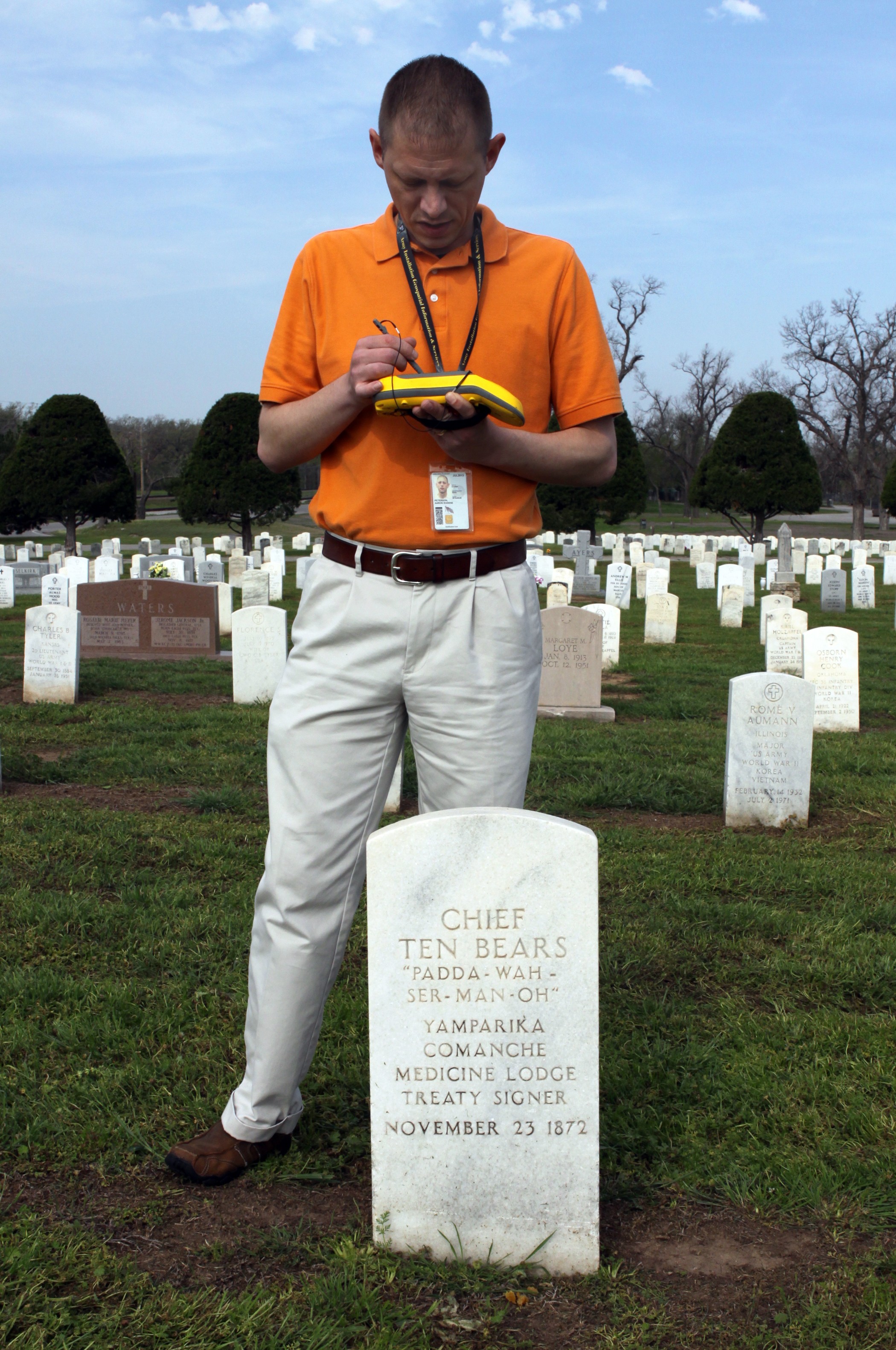
FORT SILL, Okla. (April 12, 2012) -- Former Staff Sgt. Aaron Peterson knows there is a lot of history all over Fort Sill. But when he walks around post, he doesn't just see buildings and monuments, he see points on a map that the average person can't see. He's using his Army training to map Fort Sill's cemeteries.
"I was a Soldier in the Army from 2000 to 2006, and I was a cartographer, a mapper," said Peterson. Now he works for the Fort Sill Directorate of Public Works as a Geospatial Information Systems specialist cartographer.
"People think that with a cemetery, once you inter someone and place a head stone, that there is very little maintenance to be done after that, maybe mowing the grass now and then. But that's not the case. Every day there is someone out here working," he said.
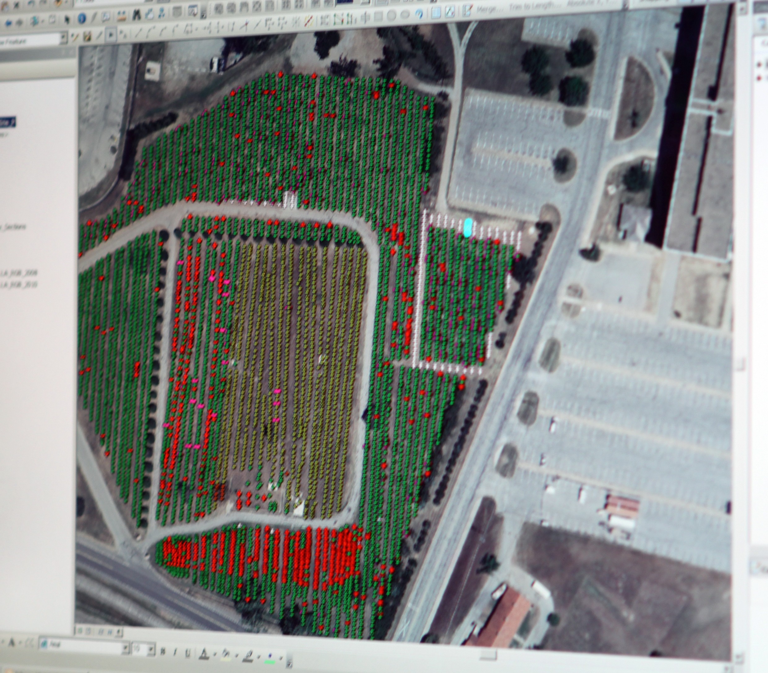
The main post cemetery was established along with Fort Sill in 1869. Peterson has been working to bring Fort Sill's data systems up to modern Army standards, using Global Positioning System satellites, aerial imagery and computers.
"The old information storage method about the graves -- using maps and index card files -- was a little dated. We had the information but we didn't have a good connected database for our post cemetery," he said. Peterson added that as new technology emerged, Fort Sill is the first volunteer installation to integrate the new technology, which was recently developed at Arlington National Cemetery.
Now each grave site is being mapped with handheld GPS units and photographs are being taken of each headstone. This information will be digitally linked and made available via an internal Web mapping application.
Peterson said they have 7,225 interments and reservations for interments that they are tracking at the Fort Sill Post Cemetery. Once the survey of the last two sections are completed he estimates that number will increase to approximately 7,300.
All of the other cemeteries on Fort Sill are Native American cemeteries and have a total of 749 current graves. The five National Historic Native American cemeteries on Fort Sill are Otipoby Comanche; Chief Chihuahua Apache East; Beef Creek Apache, which is Geronimo's resting place; Bailsto Apache West and Comanche Mission. A sixth Native American area is the Chief's Knoll section of the Fort Sill cemetery, which is the National Historic portion of the cemetery.
Peterson pointed out is that by regulation there are no sections in the cemetery based on rank, religion or race. So as you walk through the cemetery you will see major generals buried next to privates and American Indian scouts.
Some of the notable interments in the Fort Sill Post Cemetery include Comanche Chief Quanah Parker; I-See-O, the last Kiowa Indian scout for the Army; Chief Ten Bears, who signed the Medicine Lodge Treaty to establish Comanche tribal lands; and Medal of Honor recipient Col. Jack Treadwell. Geronimo is buried in the Beef Creek Apache Cemetery.
"We can't maintain the Native American cemeteries in traditional Army standards because they are private cemeteries on government property. So we can't put a government headstone on a private grave. When you see temporary monuments in those cemeteries, it's because the family can't afford a headstone. But we document it still so that the Army and the Fort Sill community will never forget that person is buried there. That's all we are allowed to do by regulation," Peterson said.
"We receive no direct sustainment funds to maintain the Fort Sill cemeteries. All of our cemetery maintenance funding comes out of post operation funds. And so we continue to implement these improvements even in tough economic times because that's how much it means to the commander and to the Directorate of Public Works," Peterson said. "We constantly have to re-level the headstones and ground on many of the graves, because they will settle and shift over time," he added.
Peterson has received help with the cemetery mapping project from some Soldiers in the Warrior Transition Unit.
"We're trying to get more Wounded Warriors out here. We had three who were helping us and they did a great job, but all three of them returned to active duty. We have a couple who have volunteered and are just getting started," he said. "For our Wounded Warriors, it's a way of giving back, kind of closing some of those painful parts of their lives."
As one of the oldest continuously operating Frontier Army posts, Fort Sill's history runs deep. For Peterson, his work is much more than just putting marks on a map; it's a matter of maintaining the historical features of Fort Sill and the surrounding area. With nearly 500,000 data features, the Army's largest geospatial database, the Fort Sill database represents a national historical treasure trove.
"As a cartographer, I get to see all of the old maps. I've got maps of the Fort Sill cantonment going all the way back into the 1900s. I've got a 1945 map that depicts the Japanese internment camps here and the German prisoner of war camps on the other side of the post," Peterson said. "It is amazing that we had so much going on here at Fort Sill."
"This is what I do, not just mapping but other services as well. We offer survey support, geospatial analysis and mapping for the entire post. The cemeteries project was one that we were inspired to do," Peterson said.
The Fort Sill Post Cemetery is at Macomb and Condon roads. It is open daily from 8 a.m. to 5 p.m. On Memorial Day the cemetery is open until 7 p.m.
Related Links:
Soldiers complete documentation of Arlington National Cemetery
Geospatial mapping enhances Arlington National Cemetery management
Social Sharing