FORT SILL, Okla. -- When artillery rounds fly through the sky there are multiple pieces in the Army's arsenal of Soldiers that make it happen. From the forward observers, cannon crewmembers and field artillery automated tactical data system specialists. Another vital player on the fires team are the 13T field artillery surveyor/meteorological crewmembers.
"The fun part of field artillery is pulling the cord and seeing it go boom, but in order for that round to get there you need these guys," said Capt. Ryan Smith, B Battery, 1st Battalion, 78th Field Artillery commander.
Advanced Individual Training students in the 13T course are quickly learning their profession. The course is a consolidated and condensed version of the former 13W FA meteorological crewmember and 13S FA surveyor military occupational specialties.
The highly technical material is taught in I-See-O Hall with a maximum of 18 students per class. The students learn radio communications, followed by four weeks of surveyor instruction, and then four weeks of meteorology instruction.
"What's unique about field artillery is everyone has their own specific job that helps out the team," said Smith. "And these guys are kind of behind the scenes because the sexy part of field artillery is not this."
Sexy or not, 13Ts cover three of the five requirements so the field artillery can hit their target to include: firing unit location, meteorological information and computational procedures.
"Everyone is responsible for computational procedures. Doing your job right. This computer system works fine but 'garbage in, garbage out.' If you don't put in the correct information it's not going to work," said Smith.
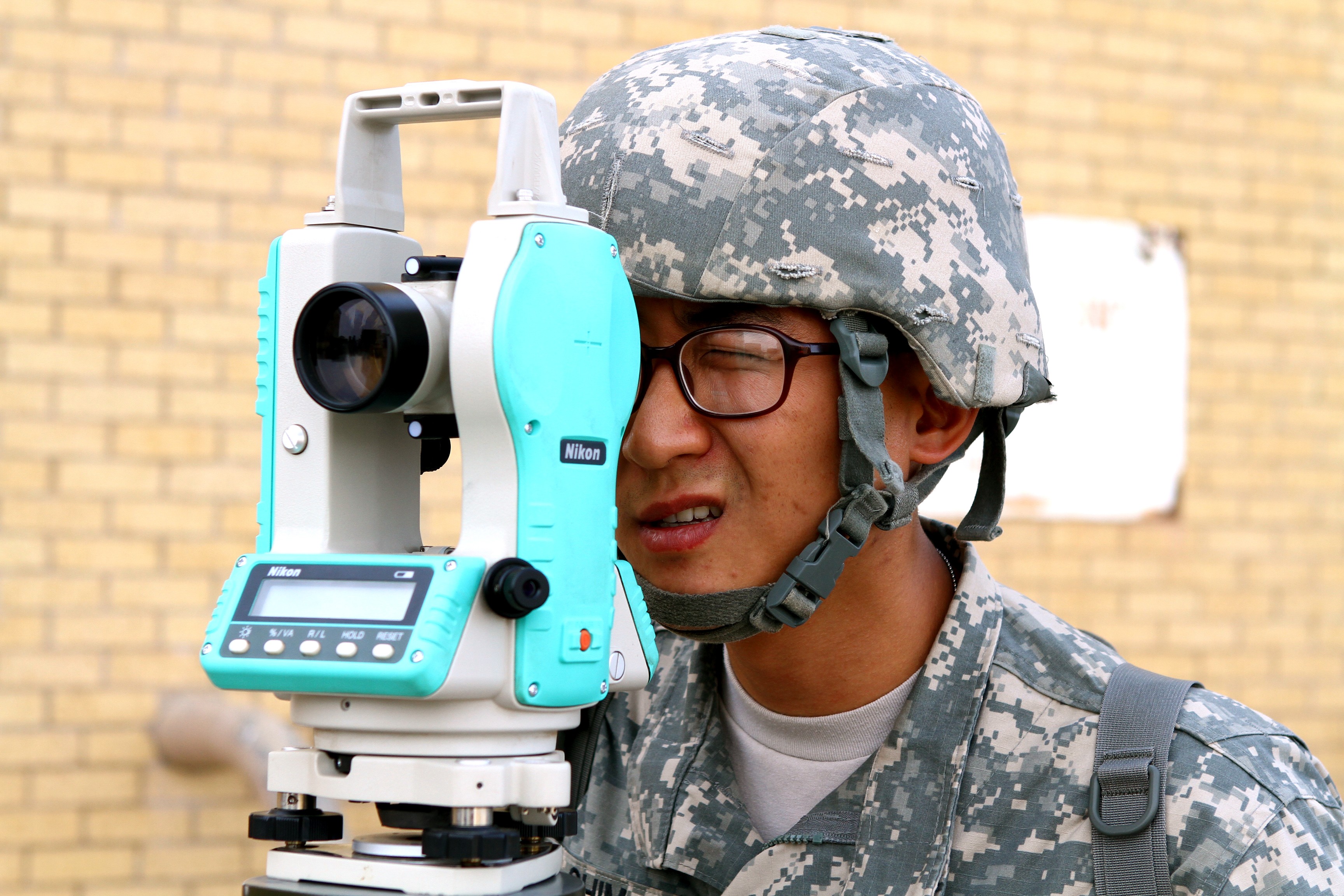
When fighting in someone else's backyard, Soldiers need their exact coordinates when they hit the ground. The 13Ts learn how to provide a more accurate location than a GPS so when the field artillery team fires at the enemy, they can be sure they hit their target.
"Your normal GPS will get you within 10 meters of position. Using the Improved Position Azimuth Determining System they can get you within four meters," said Lingerfelt.
Performing a "one position mark" and a "two position mark" a group of students proved they had the right surveyor skills to give the gun line accurate baseline data. By calculating the elevation and distance between their equipment it allows the rest of the field artillery team to lay their guns down in the right direction.
The seven-day forecast may be important to a person picking the right uniform for the week, but getting an accurate weather forecast is crucial to sending an artillery round down range.
"The way artillery fires, the wind speed, direction and even air temperature affect our projectile," said Smith. "We're all weather fires."
When the field artillery goes to a gunfight they are looking to fire quickly and effectively. Therefore, the 'Tangos' don't actually predict the weather, instead they "nowcast," it. They gather information on how the weather is at that time and send it out in "met messages." These messages are sent every two hours during the most transitional weather periods.
"At different times of day the weather is stabilizing. The mornings and the evenings are the transitional period," said Lingerfelt. "It's crazy because of the temperature changes. During the middle of the day or during the middle of the night you've got a more stable temperature so you don't have to send out as many messages."
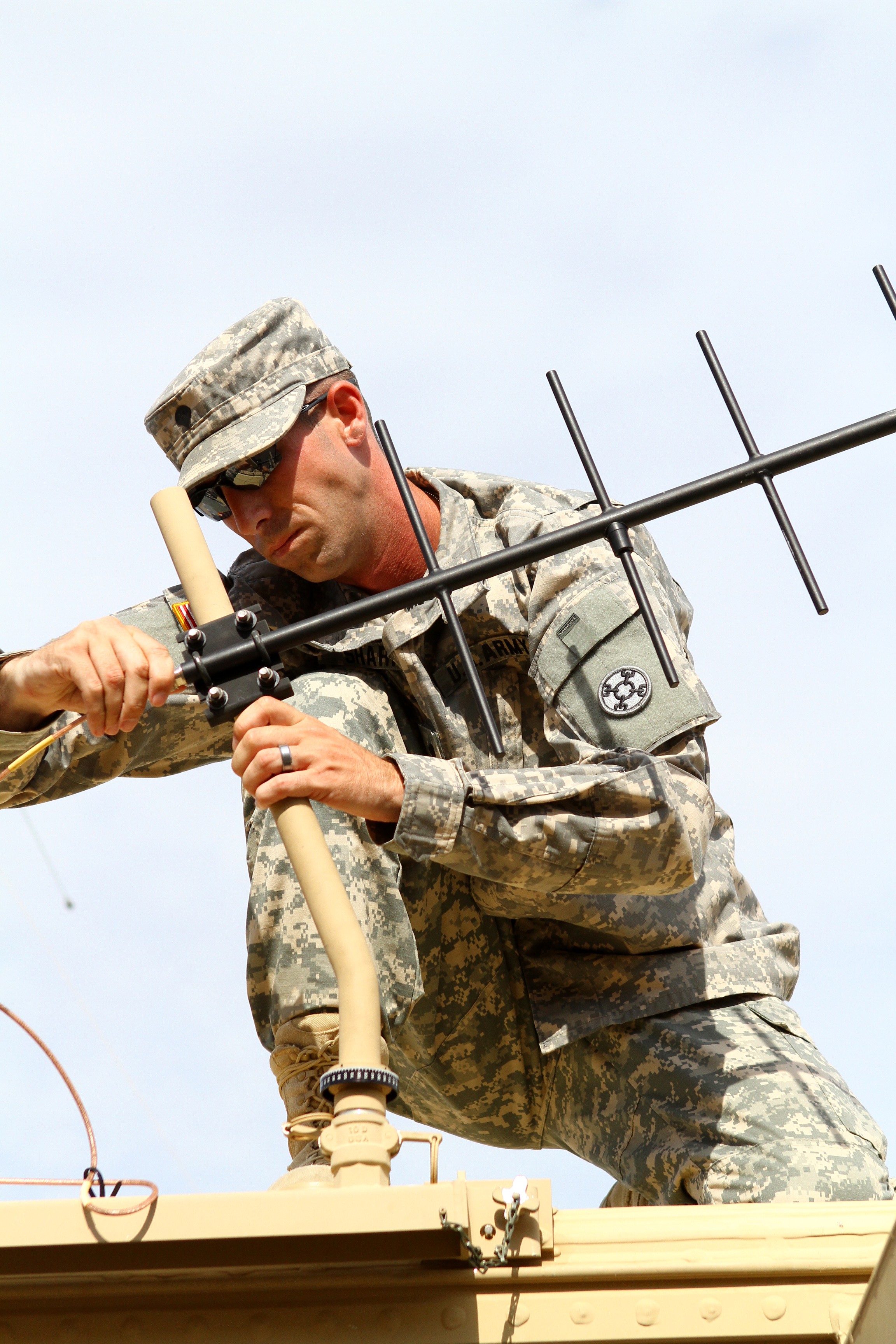
The students learn to gather the information in several different ways. Using the Meteorological Measuring Set-Profiler, they set up a satellite and gather information from the Navy's Operational Global Atmospheric Prediction System. It receives weather data from the different layers in the atmosphere, which are then sent to the fire direction center in different lines of meteorological data.
"The lines compare to the different levels of atmosphere. So if they're shooting higher they'll want more lines of met to cover the atmosphere," said Lingerfelt.
The students also gather surface data, such as the wind conditions and barometric pressure on the ground.
A more popular part of the curriculum would be when students release weather balloons, although that portion may soon be eliminated from instruction. Each balloon is equipped with a radiosonde, a tiny piece of equipment that measures various atmospheric parameters and transmits it to a fixed receiver. Each radiosonde costs roughly $350 and can only be used once.
"You might do five or six flights a day and the radiosonde goes up in the balloon and it's gone," said Lingerfelt. "So they're getting away from using the balloons because of logistics and also because they could give away your location on the battlefield. If you're set up in a position and you're sending up balloons all day the enemy can spot that. So the Army said we can figure out a way to do this better and more tactical than this."
The weather balloons are still taught as a backup system but the Tangos now have other equipment available to give them the same data.
At the end of the course the AIT students get to put their knowledge into action during a live fire exercise. They will join the rest of the field artillery AIT students and perform as they would in battle. After they survey and gather meteorological data they send the information to the gun line and wait for the end result.
"This whole process is to make that round more accurate as it flies through the air," said Lingerfelt.
Social Sharing