FORT LEONARD WOOD, Mo. -- Looking into the sky and knowing what you are observing can mean the difference between life and death -- especially if it's severe weather. That's why the Springfield Office of the National Weather Service presented a severe weather briefing during Fort Leonard Wood's annual Safety Day on May 16.
"Where we live, we are subject to a lot of severe weather. It was good information for us. It was more in-depth than I get on the news," said Chief Warrant Officer 5 Scott Owens, U.S. Army Engineer School.
The spotter training course was designed to enhance awareness of local weather patterns, how storms are classified and verified, and protective safety measures.
Meteorologist Doug Cramer taught the session. He was on duty at the Springfield Office of the National Weather Service when the EF-3 tornado hit Fort Leonard Wood Dec. 31, 2010.
"I actually issued the tornado warning for Pulaski County that day when it came through on New Year's Eve," Cramer said.
Cramer uses radar, spotters and environment conditions like wind, temperature and dew point to issue warnings.
"We have a lot of really awesome technology, but ultimately what can be perfect is a well-trained spotter," Cramer said. "Then we can have 100 percent confidence in knowing what is under that thunderstorm."
With the number of troops training outside everyday, Cramer believes having an understanding of severe weather is critical for the Fort Leonard Wood community.
"As we all know, we are close to tornado alley," Cramer said. "Texas is number one, Kansas is number two and the state of Missouri over the last 10 years was ranked number three in the entire United States."
According to Cramer, Missouri gets its moisture from the Gulf of Mexico making conditions warm and moist, which sets the stage for thunderstorms.
"The cold front is the most common trigger in Missouri," Cramer said.
After explaining the components of severe weather, Cramer cleared up the difference between a tornado watch and a tornado warning.
"A watch means conditions are favorable for a tornado in about the next six hours. A warning means we are actually looking at something on the radar, like rotation or have reports of a sighting that looks like it could produce a tornado in the next 45 minutes," Cramer said.
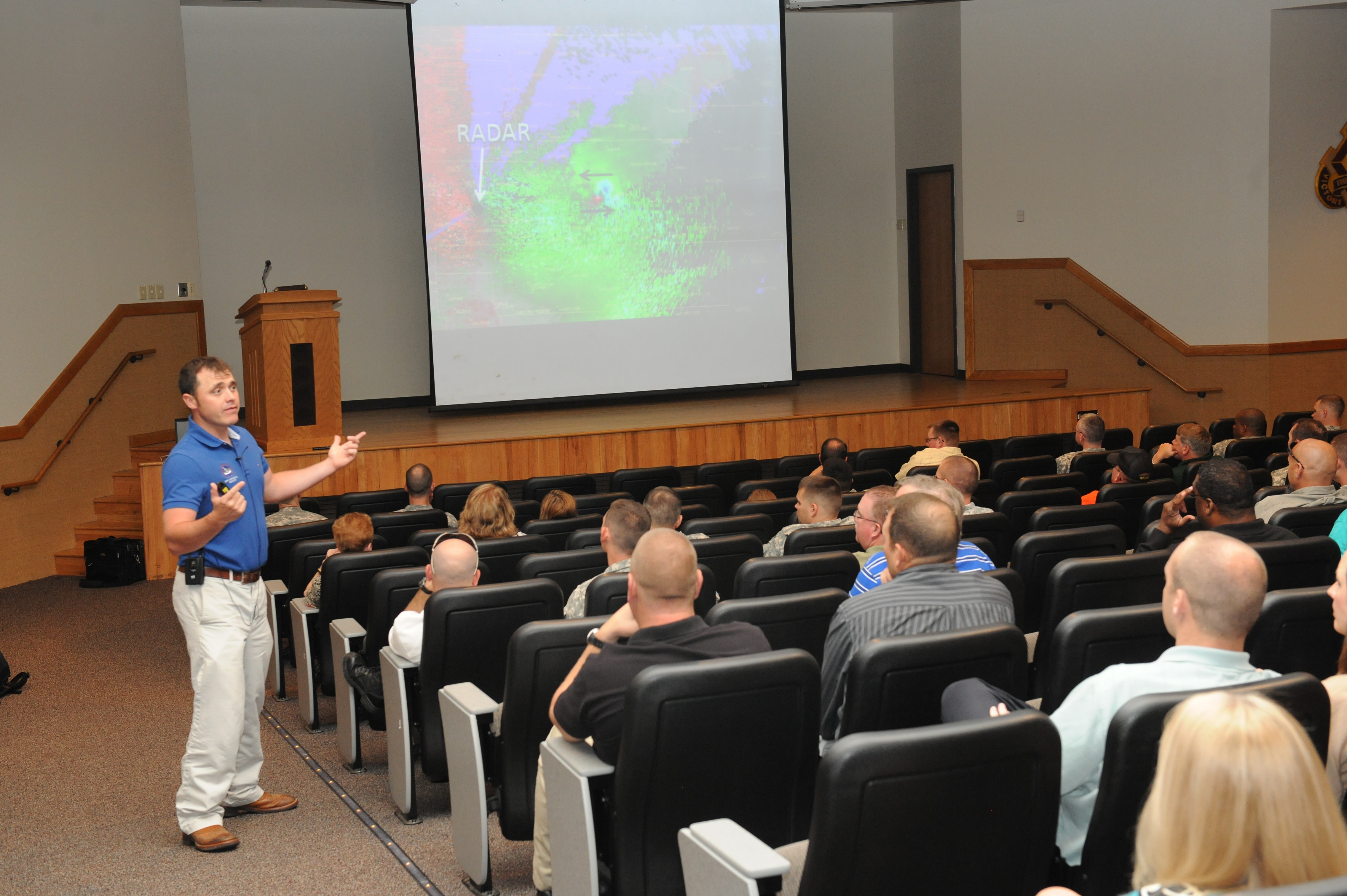
Cramer explained in detail how radars work by measuring energy and speed.
"It's important for spotters to understand how radar works," Cramer said.
Owens found the radar portion of the course to be especially interesting.
"When I look at the radar now, I have the tools to interpret what it is saying. Before, I was just looking at the different colors," Owens said.
The course also broke down the differences between supercells, squall lines and pulse thunderstorms, commonly known as downbursts.
"Now, I understand how severe weather can occur," Owens said. "I didn't realize how the updraft and downdrafts effected the supercells."
Cramer stressed that lightning is often underestimated as a hazard of severe weather.
"You guys get far more lighting strikes on post then you do tornadoes obviously. You have to really be careful with lightning -- it's pretty scary," Cramer said. "I can see a tornado and I understand the movement of the tornado, so I can try to stay out of it's path. You can't do that with a lightning strike."
Even though the National Weather Service appreciates the reports of trained weather spotters, Cramer doesn't want anybody to risk their lives when it comes to severe weather.
"The biggest thing is you don't want to be exposed outdoors," Cramer said.
Owens said he left the spotter training course with a better understanding of specific weather-related terminology and severe weather forecasting models.
"People take for granted the danger that weather can do. It's important to pause, learn about it and realize it can happen to us too," Owens said.
Social Sharing