A system developed for the National Guard Bureau that provides better situational awareness for commanders and Soldiers on the ground has been fielded and tested in all 54 U.S. states and territories.
The Geospatial Information Interoperability Exploitation-Portable system, commonly referred to as GIIEP, provides a means to collect, distribute and share releasable vital information to all levels of support in a timely manner.
"The GIIEP system allows more information to be shared between civilian and National Guard authorities, which is a unique capability," said Curtis Miller, GIIEP project lead, U.S. Army Space and Missile Defense Command/Army Forces Strategic Command. "It also allows for information to be shared across state boundaries."
GIIEP was developed by USASMDC/ARSTRAT, the NGB and the U.S. Air Force to streamline national processes and procedures to improve the quality, timeliness and relevance of information provided to Department of Defense and civil authorities during critical incidents or contingencies.
"It provides that Soldier, Airman or incident commander near-real time access to the best available still and video imagery and also collaboration tools and geo-spatial locations," Miller said. "The GIIEP system has the capability to receive and distribute video from multiple military platforms that are used within the United States and in the theaters where our Soldiers need this support."
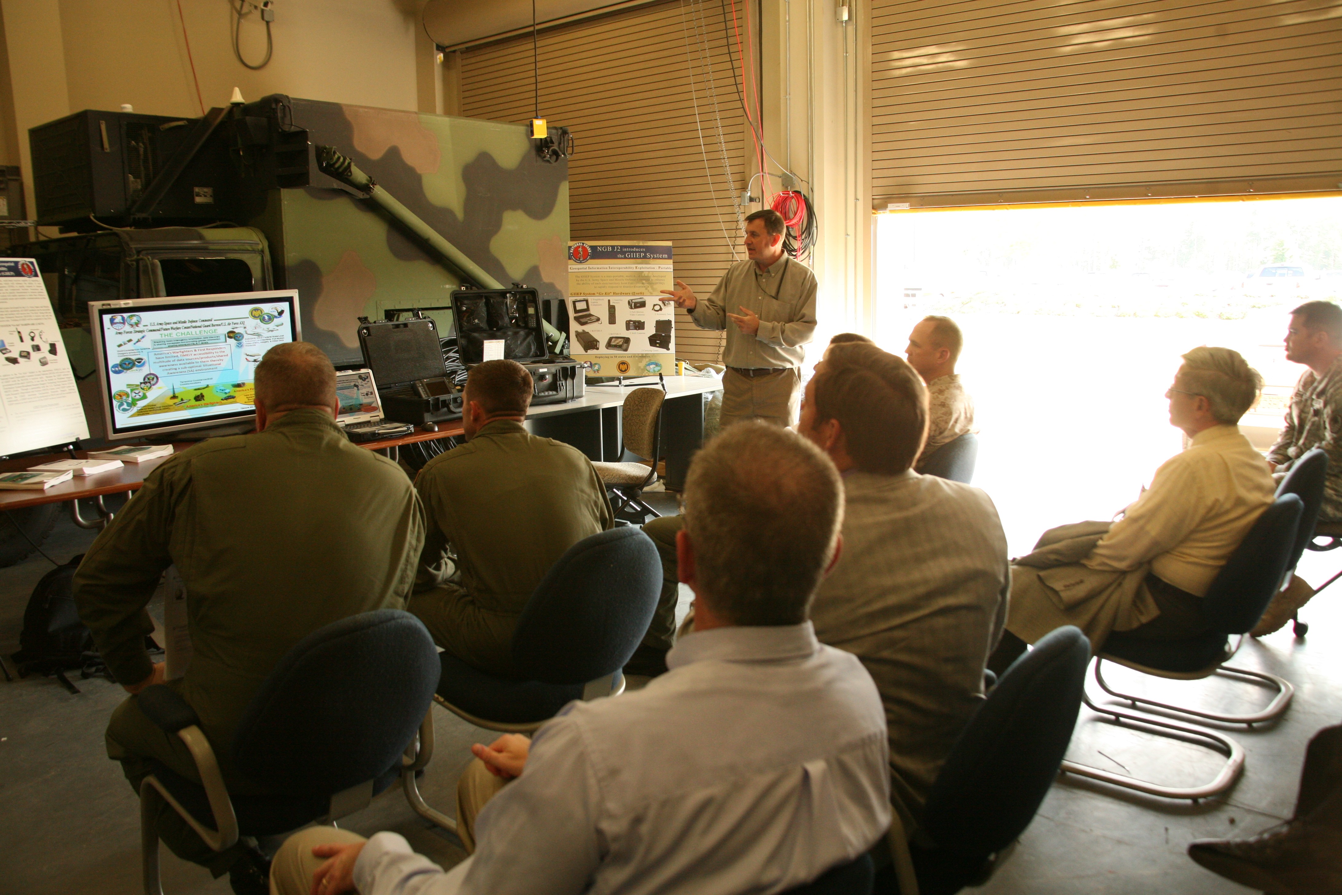
GIIEP integrates three USASMDC/ARSTRAT software products: the Advanced Warfare Environment, or AWarE; the AWarE Video Elements; and Virtual Alabama.
AWarE is a tool for situational awareness, and can display Red and Blue air and ground picture on a two dimensional or three dimensional presentation layer in near-real time. AWarE Video Elements receives, stores and processes video footage from numerous video types. The Virtual Alabama program uses existing state asset imagery and infrastructure data to create a three dimensional visualization.
A GIIEP "Go Kit" contains two sets and includes: two satellite phones, two laptop computers, one Remotely Operated Video Enhanced Receiver (ROVER)-4, one ROVER-5, two still cameras, two full-motion video cameras, two carrying cases, and necessary accessories.
The most note-worthy recent use of the system was during the Gulf of Mexico oil spill clean-up this summer.
"It was used daily by the Mississippi and Alabama National Guards to share data with the U.S. Air Force North and other command centers," Miller said. "The Civil Air Patrol from the Southeast region used the system on aircraft to help in locating surface oil in the Gulf of Mexico and to verify the protective booms were working properly. The data collected was used to coordinate clean-up activities with the other civil agencies and corporations involved."
There is currently no plan to commercialize the GIIEP system, but Miller said the command is working with other government agencies to integrate the GIIEP capability into their operations.
"If an authorized user is interested in the system, that person should work primarily with the National Guard Bureau," he said. "However, the Space and Missile Defense Command can also accept requests from other government agencies."
Carrie.E.David@us.army.mil
Social Sharing