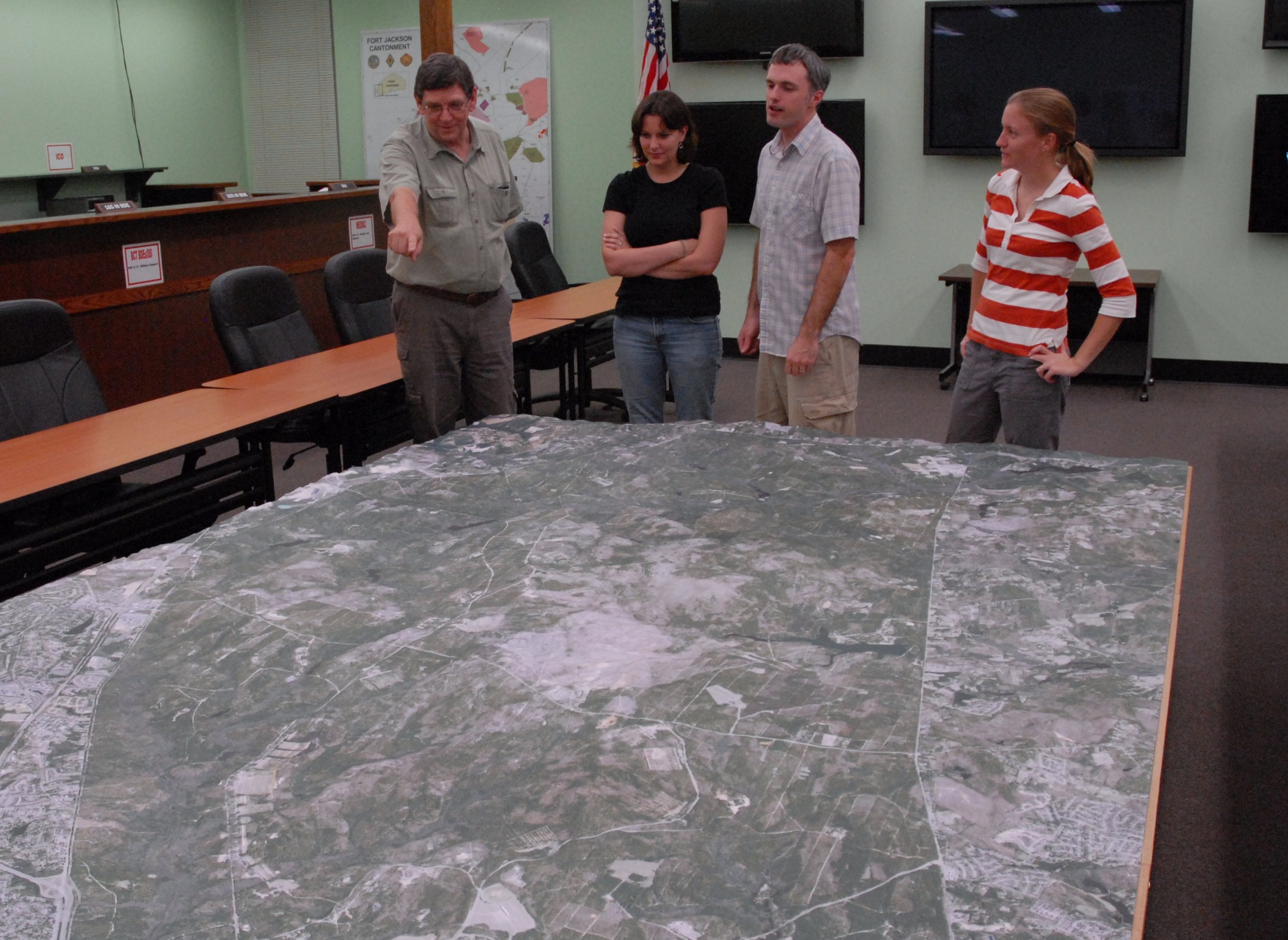
FORT JACKSON, S.C. -- A new high-tech solid terrain model to be located in the Emergency Operations Center will help Fort Jackson's leaders make better decisions and plan for emergencies.
The three dimensional, 7-by-12-foot model of Fort Jackson will be used as a realistic training aid for Soldiers and support staff during weekly operational planning.
"The idea is to have everything in front of the decision makers," said Bill Hayes, the Integrated Training Area Management coordinator. "People seldom get on the ground anymore so we decided to bring the ground to them."
Hayes said the model can help leaders make better decisions in a variety of scenarios, such as antiterrorism exercises, emergency response drills or risk assessments.
Leaders can also use the realistic model to help them better visualize how decisions on training locations could impact sensitive environmental spots, as well as be used for situational awareness during actual emergencies.
"For example, the engineers could design a road using this," he said. "It has enormous value beyond the decision- making process."
The model depicts all of Fort Jackson's approximately 55,000 acres and was built by using data obtained from "LIDAR," or Light Detection and Ranging.
The model is mounted to a table which is then locked into a stationary position. A sophisticated projection system consisting of several LCD projectors and Geographic Information System enabled display control computers will be mounted overhead and calibrated to accurately project data onto the model.
Various GIS layers and images can then be projected onto the model depicting environmental restrictions, such as wetlands or endangered species, and training features, such as range surface danger zones.
"Visualization is such a big thing when you're planning," said Karen Ellett, a GIS analyst. "This is priceless. It's a great planning tool."
Social Sharing