GNSS deception and denial refers to the intentional interference in which devices and signal disrupts GNSS code and signals through reduced positioning accuracy or facilitating a complete lack of position availability.
The objective of the project was to understand the spatial and temporal distribution of GNSS interference in Northeastern Shanghai. Then it is drawing possible connections and conclusions that are applicable to the wider INDOPACOM region.
VIEW ORIGINAL
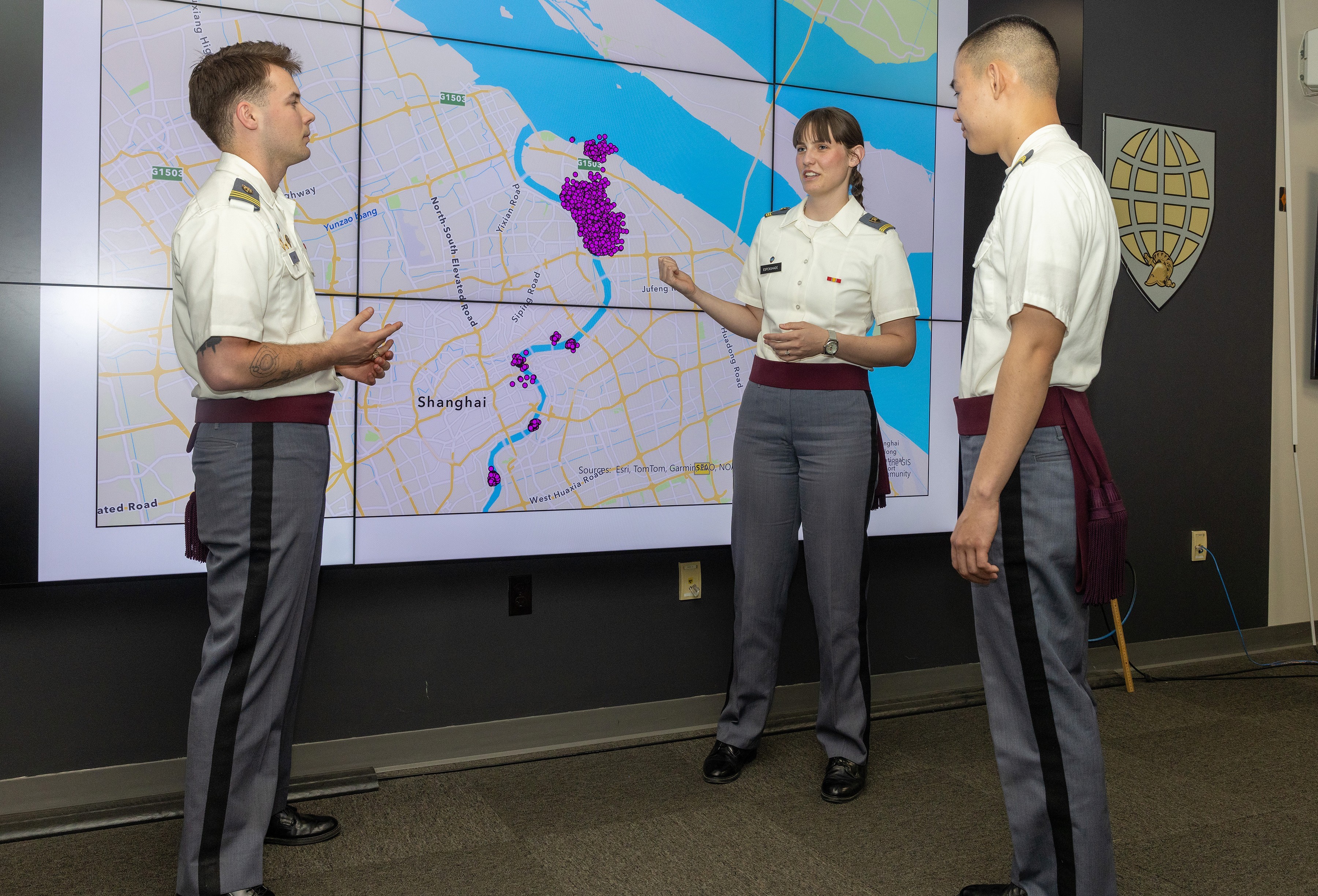
Electronic warfare is the future of international Geo-conflict; its use is not only pragmatic but practical. The use of Global Navigation Satellite System (GNSS) data by state and non-state actors in the South Pacific reveals economic and strategic motivations of said parties. Cadets at the United States Military Academy investigated this hypothesis as a senior thesis. Cadets Matalyn Espenshade, Ocean Mao, and George Lewis spent the past year developing “A Case Study of GNSS Interference Patterns in INDOPACOM,” a data visualization project in the vicinity of the Huangpu River and Northeastern Shanghai.
The Cadets’ project demonstrated promising applicability in their illustrated maps of ‘spoofing,’ a term used to describe the malicious interference of a global navigation system by another party. Essentially, the project on a small scale developed a model to illustrate where spoofing happens and where the perpetrators could be. This lays the foundations for program building for varied locations at a much bigger scale when the prospect of electronic warfare becomes increasingly plausible. Understanding who, how and where spoofers could be the marked advantage necessary to win the next war.
The researchers found the scope of the location limited the ability for a deeper analysis of the patterns cross referenced with patterns in the U.S. Indo-Pacific Command region gives a more holistic picture of the activity in this area. It is the hope of the cadets that this research provides a better understanding of the activity in this area and a platform to discuss the wider implications of these patterns.
“Our project aided our development as future officers,” the group explained, “by giving us exposure to how the intelligence community tries to analyze swaths of data to create an informed picture of possible threats to American interests.”
Furthermore, the group reflected on their research experience, stating, “we were able to learn a lot about how GNSS interference can be put into practice in a non-theoretical sense. While we had learned about tactics similar to jamming and spoofing before, this case study allowed me to see the actual data behind what a large scale GNSS interference operation could look like.”
This project is part of West Point's 26th annual Projects Day Research Symposium that showcases more than 350 cadet-led research projects. Learn more about the Department of Geography and Environmental Science at https://bit.ly/WP_GEnE and check out more project features at https://www.westpoint.edu/werx.
Social Sharing