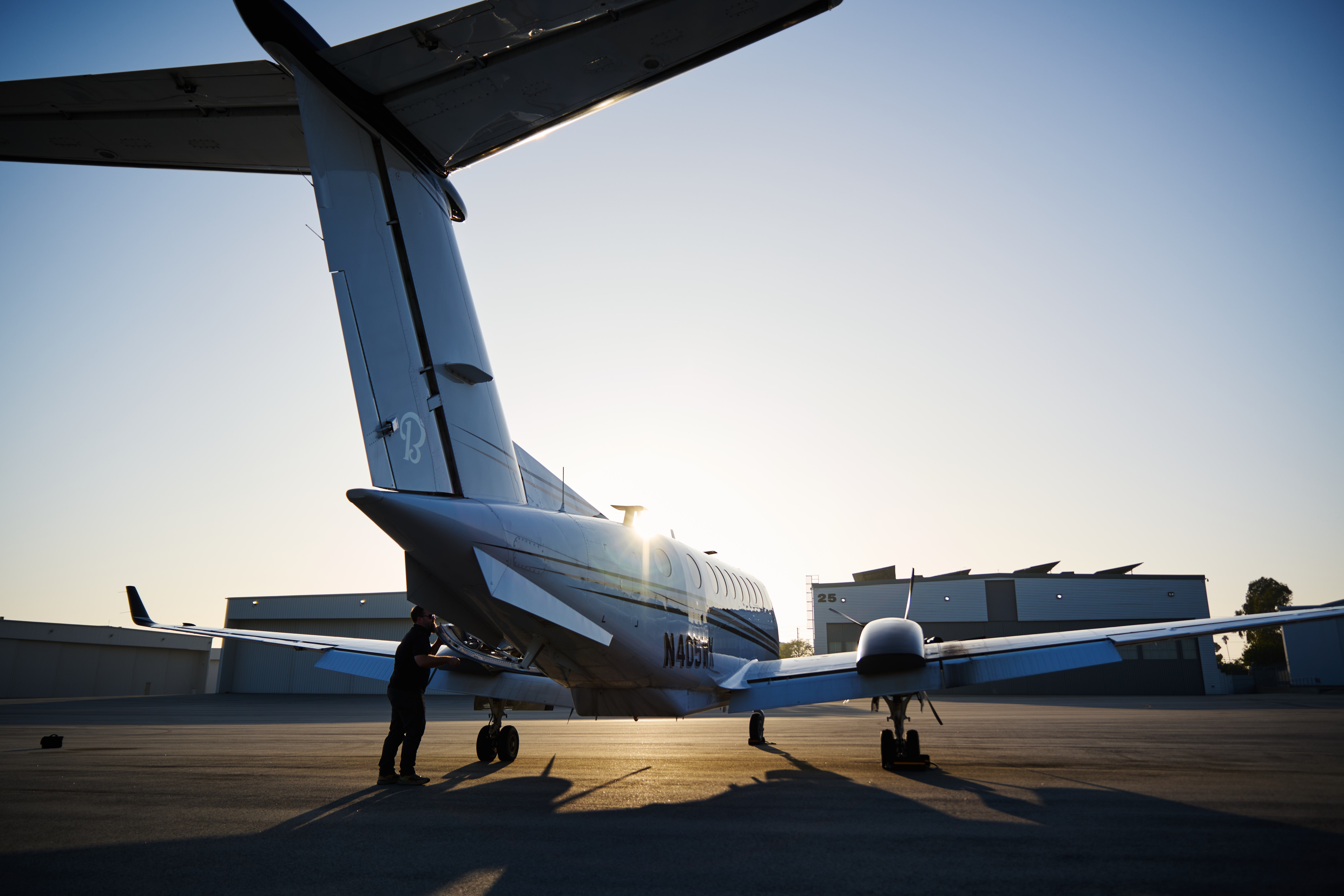
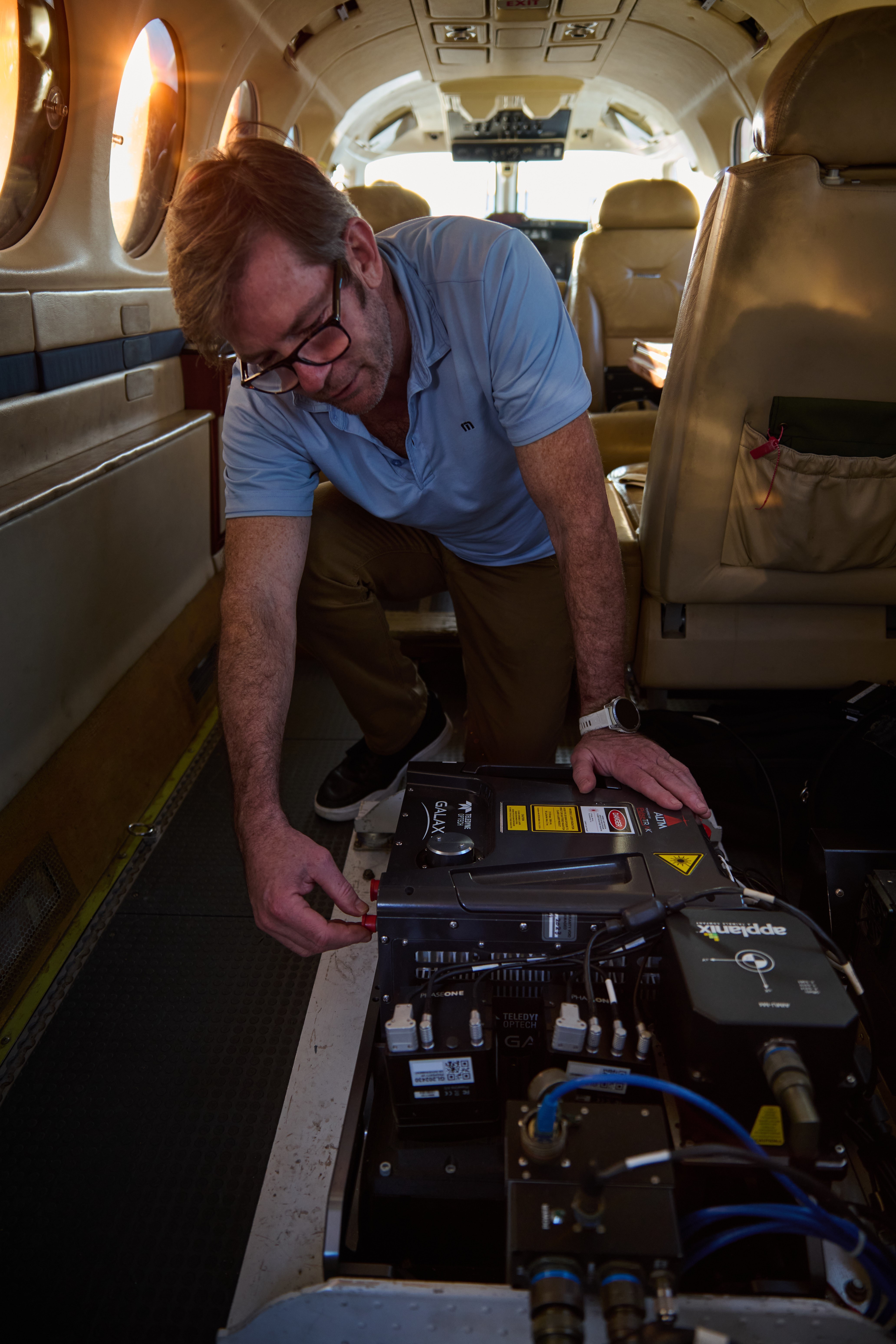
Their crew is deployed here under contract with the Army Geospatial Center, to collect high-resolution aerial imagery and geospatial data in support of the U.S. Army Corps of Engineers' debris removal mission, following the devastating Jan. 2025 Los Angeles wildfires. They are operating a specially modified aircraft equipped with a “BuckEye” sensor system capable of highly detailed scans over vast areas.
As recovery moves forward, USACE continues deploying a wide array of cutting-edge capabilities to support the mission – expected to become the most massive debris cleanup in the Corps’ nearly 250-year history. VIEW ORIGINAL
LOS ANGELES, Calif. — As recovery moves forward following the devastating January 2025 Los Angeles wildfires, the U.S. Army Corps of Engineers has deployed a wide array of experts and cutting-edge capabilities to support the mission — expected to become the most massive debris cleanup in the Corps’ nearly 250-year history.
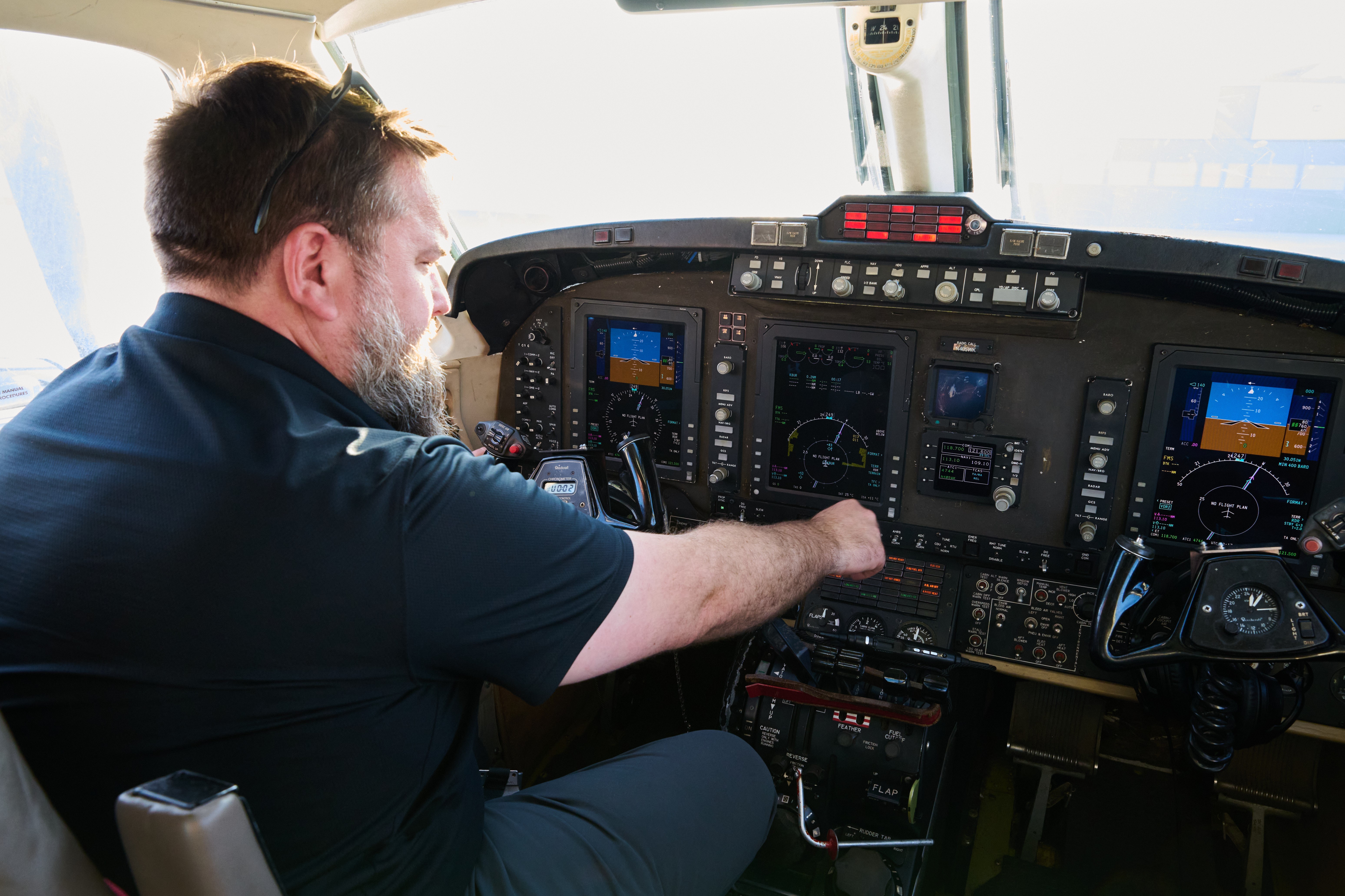
The latest high-tech asset to join this FEMA-assigned mission comes from the Army Geospatial Center, or AGC, whose contractor Leidos brought in a specialized airborne capability: a modified Beechcraft Super King Air 350 with a “BuckEye” sensor system capable of highly detailed scans over vast areas.
“We are bringing in the best — our best people, best technologies and best partners — to help us get after our mission of rapidly clearing debris and helping the people of Los Angeles recover and rebuild,” said. Maj. Gen. Jason Kelly, USACE deputy commanding general for Civil and Emergency Operations.
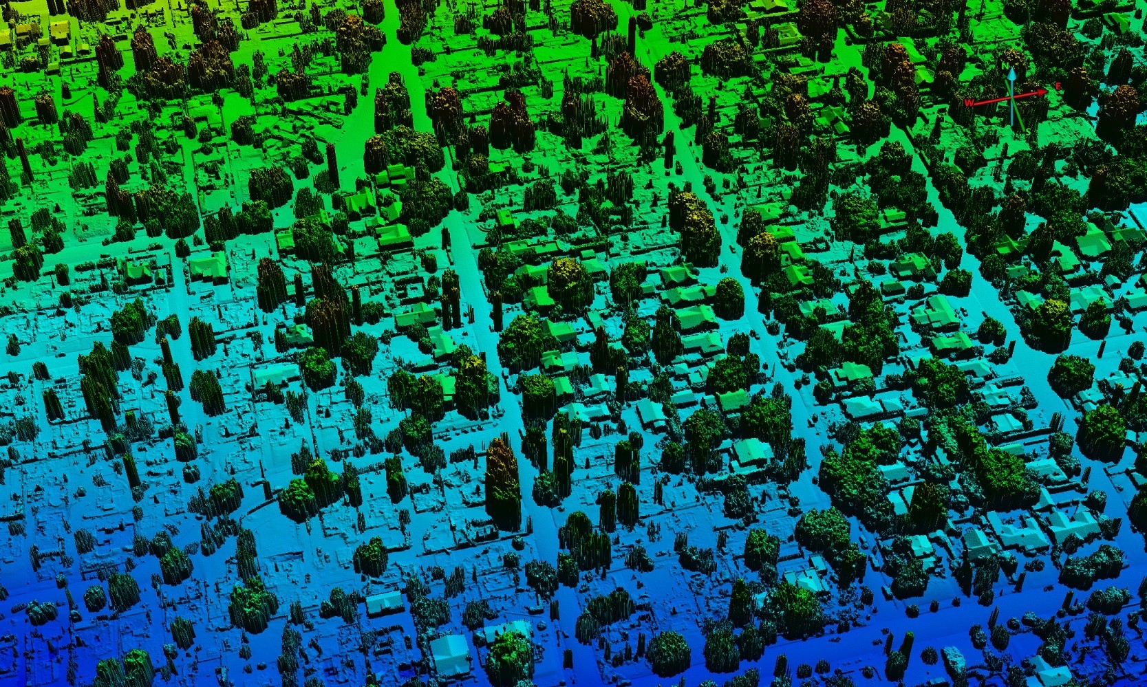
AGC’s BuckEye program enables three-dimensional renderings of wildfire-affected areas and estimates of total debris by volume — vital data that will help USACE to optimize plans for the safe and rapid removal of more than four million tons of fire-damaged debris.
As recovery moves forward, USACE continues deploying a wide array of cutting-edge capabilities to support this FEMA-assigned mission – expected to become the most massive debris cleanup in the Corps’ nearly 250-year history. VIEW ORIGINAL
Their crew is deployed here to collect high-resolution aerial imagery and geospatial data in support of the U.S. Army Corps of Engineers' debris removal mission, following the devastating Jan. 2025 Los Angeles wildfires. They are operating a specially modified Beechcraft Super King Air 350, equipped with a “BuckEye” sensor system capable of highly detailed scans over vast areas.
As recovery moves forward, USACE continues deploying a wide array of cutting-edge capabilities to support the mission – expected to become the most massive debris cleanup in the Corps’ nearly 250-year history. VIEW ORIGINAL
“This geospatial data is a vital difference-maker for our planners and teams on the ground, helping us optimize operations and accomplish our mission as quickly, effectively and safely as possible,” Kelly said.
AGC, headquartered in Virginia, provides geospatial-based information, capabilities and expertise to the U.S. Army and the nation as a direct-reporting center of USACE.
This BuckEye crew, which often deploys overseas to provide geospatial support to U.S. forces, allies and partners, rapidly mobilized and arrived at LA County’s Burbank Airport in only a week’s time — a quick turn considering the level of planning required for a mission so far from their standard base of operations and in such a high-traffic airspace.
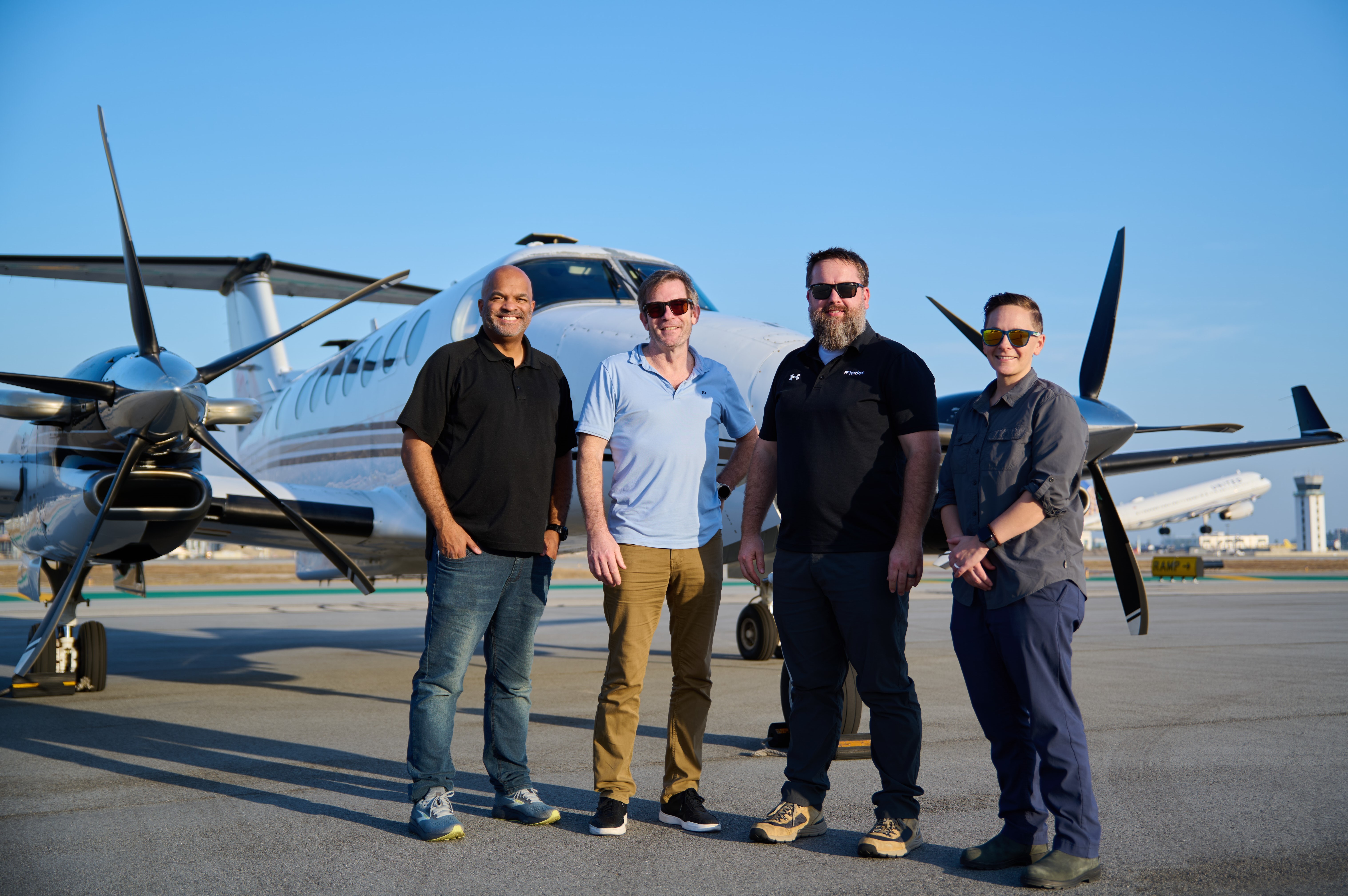
“The magnitude of the devastation here is just unlike anything else that’s happened here before,” said Ashley Brawner, senior director and deputy program manager for the High-Resolution 3-Dimensional Geospatial Information Program. “So, whatever small way we can help — we’re grateful to be part of the mission.”
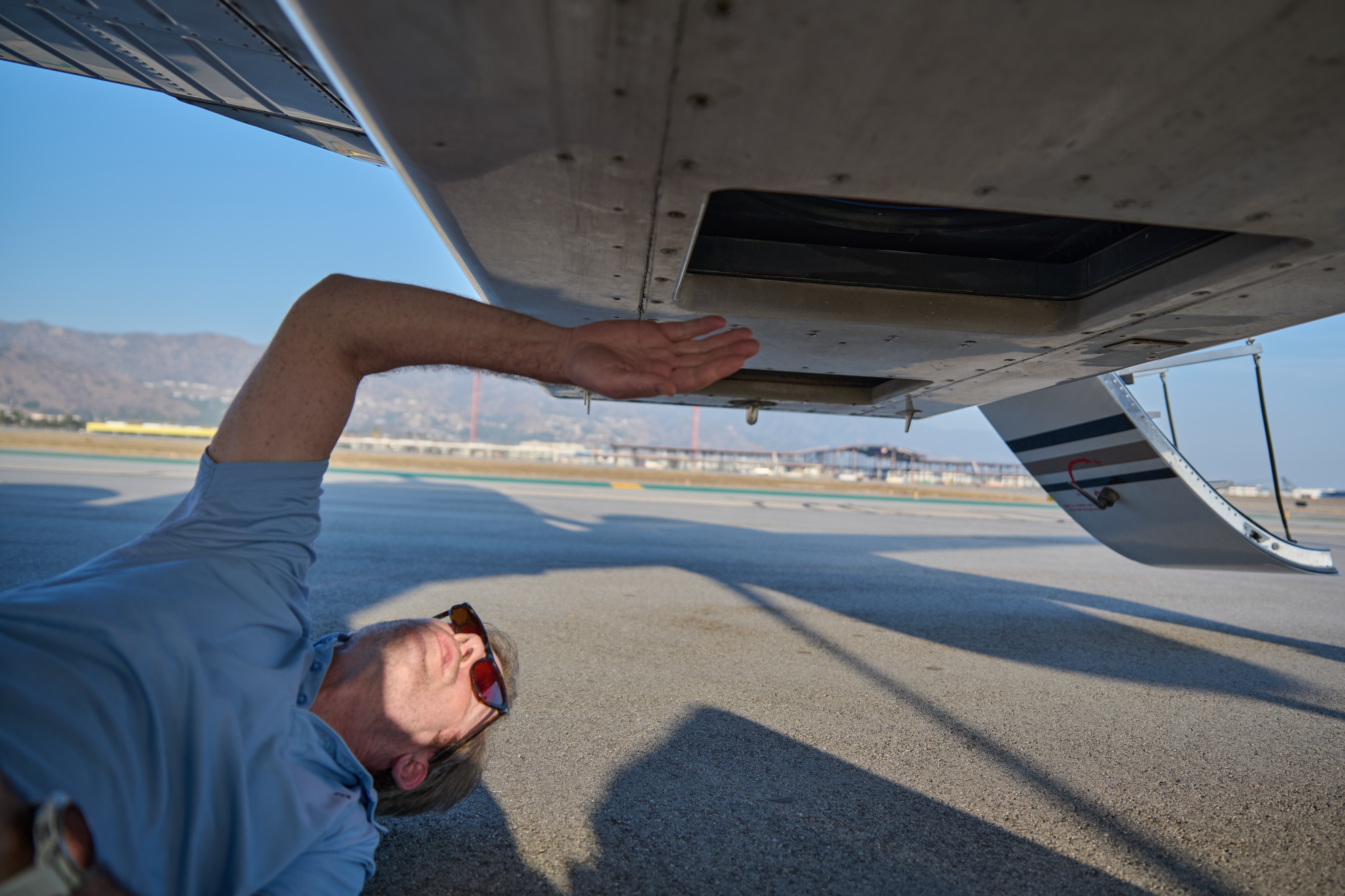
Their flight plan in LA has involved parallel rows of straight-line overflights above areas damaged by the Eaton and Palisades wildfires, flying at approximately 3,000 feet above ground level. The relatively low altitude allows them to capture close-in terrain details with BuckEye’s array of sensitive electro-optical cameras, infrared and light detection and ranging sensors peering through a window on the underside of the aircraft.
Their crew is deployed here under contract with AGC, to collect high-resolution aerial imagery and geospatial data in support of the U.S. Army Corps of Engineers' debris removal mission, following the devastating Jan. 2025 Los Angeles wildfires. They are operating a specially modified Beechcraft Super King Air 350, equipped with sensors capable of highly detailed scans over vast areas.
As recovery moves forward, USACE continues deploying a wide array of cutting-edge capabilities to support the mission – expected to become the most massive debris cleanup in the Corps’ nearly 250-year history. VIEW ORIGINAL
Their crew is deployed here under contract with the Army Geospatial Center, to collect high-resolution aerial imagery and geospatial data in support of the U.S. Army Corps of Engineers' debris removal mission, following the devastating Jan. 2025 Los Angeles wildfires. They are operating a specially modified Beechcraft Super King Air 350, equipped with sensors capable of highly detailed scans over vast areas.
As recovery moves forward, USACE continues deploying a wide array of cutting-edge capabilities to support the mission – expected to become the most massive debris cleanup in the Corps’ nearly 250-year history. VIEW ORIGINAL
The fidelity of the data they capture — down to mere centimeters of detail — allows them to generate vital terrain information, according to Mark Szypula, callsign “Shep,” a BuckEye sensor operator who previously served in the Navy.
Terabytes of data are then processed and provided back to USACE as color-graded 3D renderings and other volumetric information, which will help inform debris removal at multiple schools and an anticipated 10,000-plus residential properties.
“It just gives me a sense of pride to do our little part to help this devastated community get back on their feet and move forward,” said Shep.
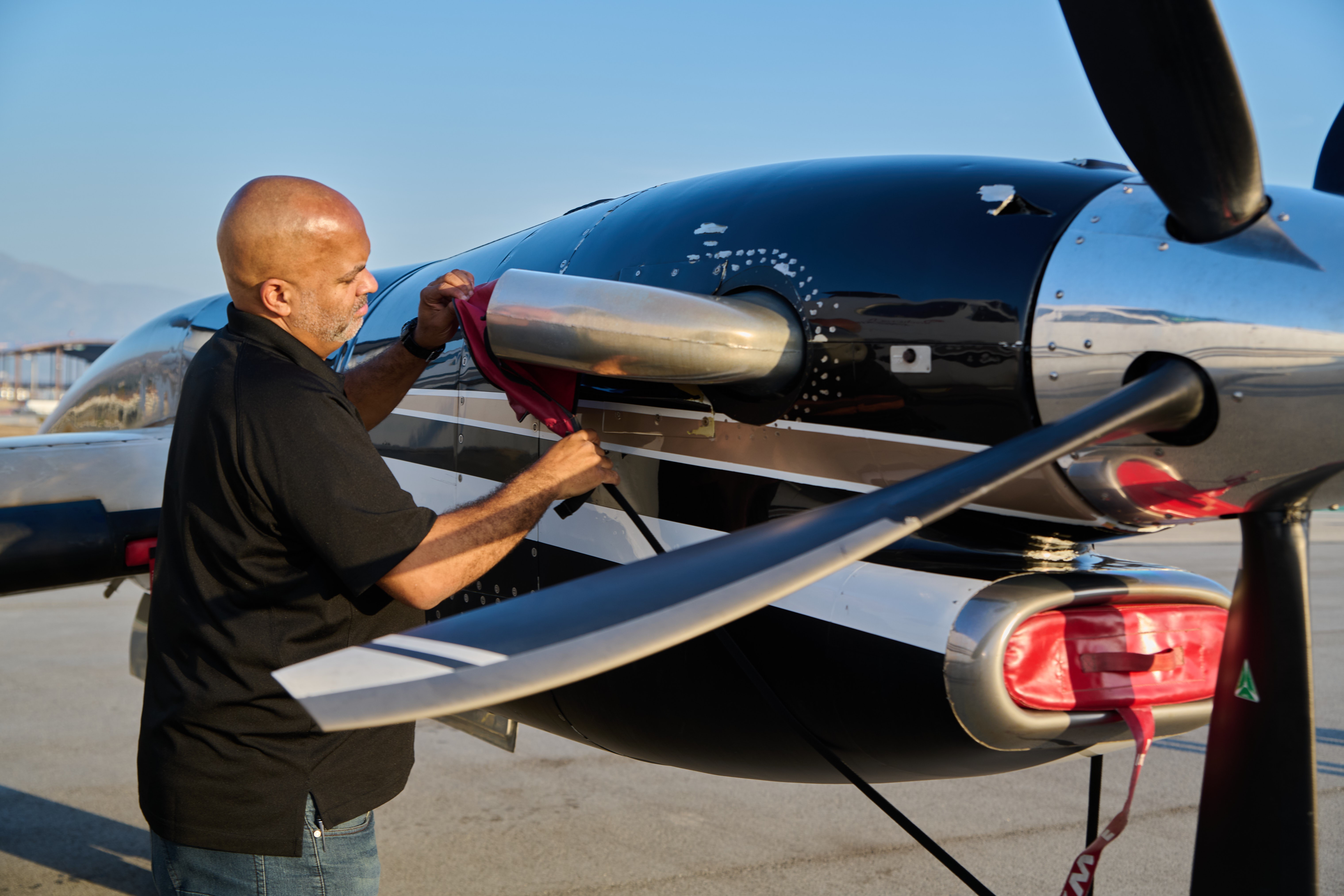
Together with Brawner and Shep, the BuckEye team here includes pilots Richard Pahnke and Reginald “Reggie” Williams, as well as aircraft maintainer Steve Lollar.
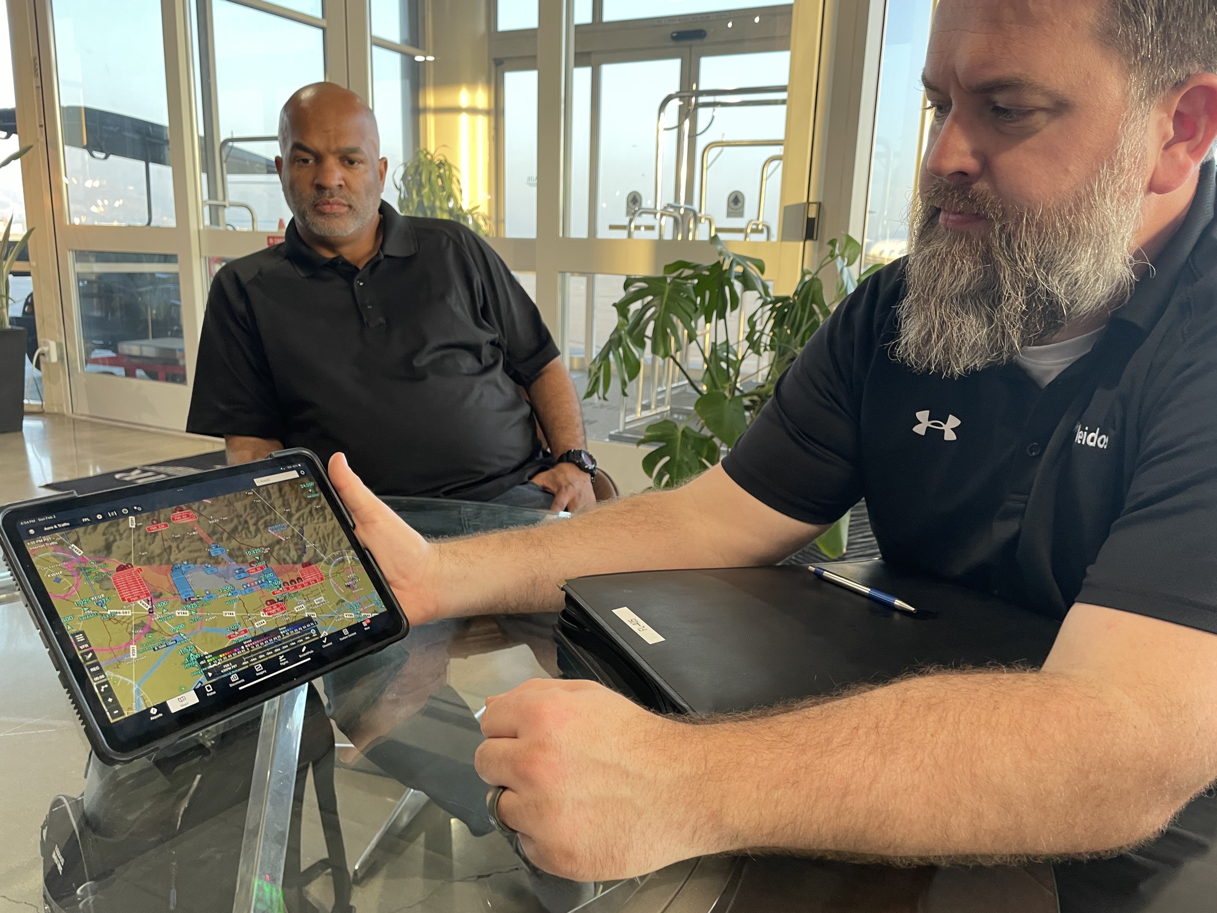
Their focus is first and foremost on safety, Pahnke noted. Their flights are planned around weather conditions and carefully coordinated within LA’s congested airspace. “We have to be hyper-focused on everything around us,” he said.
The crew expressed pride in their aircraft, its specialized systems and the wide range of missions they have conducted in support of AGC, USACE and the nation.
“It’s a work horse,” Brawner said of their Super King Air 350 twin-turboprop.
Their crew is deployed here under contract with AGC, to collect high-resolution aerial imagery and geospatial data in support of the U.S. Army Corps of Engineers' debris removal mission, following the devastating Jan. 2025 Los Angeles wildfires. They are operating a specially modified Beechcraft Super King Air 350, equipped with sensors capable of highly detailed scans over vast areas.
As recovery moves forward, USACE continues deploying a wide array of cutting-edge capabilities to support the mission – expected to become the most massive debris cleanup in the Corps’ nearly 250-year history. VIEW ORIGINAL
Pahnke noted the aircraft has logged millions of flight hours, and the crew has supported multiple missions both overseas and stateside. Last year, they provided USACE with specialized imagery of the collapsed Francis Scott Key Bridge in Baltimore, which helped guide the process of clearing the wreckage and reopening the federal shipping channel.
“Our focus has mostly been downrange (on overseas deployments), but we have done more and more CONUS work and would love to see that continue,” Shep said.
The crew was overall grateful for the opportunity to support this current mission in LA as part of a larger team.
“It’s just like with my military service, you’re involved and doing something to help,” said Williams, who served in the Air Force. “When Rich called me and said this was what we’re doing … I just jumped at the opportunity.”
“It’s an amazing partnership,” Brawner said. “We have supported AGC and the Corps of Engineers for 20 years … (and are) just very dedicated to the mission.”
Together with FEMA and other federal, state and local partners, USACE will continue to help LA’s wildfire-impacted communities recover as quickly as possible.
Visit the SoCal Wildfire Response 2025 DVIDS feature page for further news and imagery about overall federal and military support to recovery efforts.
For questions or further information about debris removal, visit the USACE website.
Social Sharing