Sacramento’s flood history dates back as far as the city itself.
The prospect of gold led to people flocking to California in search of wealth and prosperity during California’s Gold Rush. Founded in 1849, Sacramento was California’s first incorporated city. The city’s location at the confluence of two major rivers and its proximity between San Francisco and the gold fields made it an ideal trading center for miners. It also presented a threat its newly transplanted residents were unprepared for – flooding.
The Flood of 1850 welcomed Sacramento’s first residents and led to the construction of the city’s first levees. Nestled in the Central Valley between the Sierra Nevada to the east, the coastal range to the west, and the Sutter Buttes to the north, the Sacramento Valley would regularly become an inland sea, covered in water for as far as the eye could see.
“The geography of the Sacramento region means many communities sit at an elevation lower than the waterways that run next to them,” said Kristine Des Champs, chief of the Sacramento Basin Project Center for the U.S. Army Corps of Engineers Sacramento District. “Standing on the levee it can be easy to see why this work is so important.”
Today, more than half a million people live in Sacramento. While the promise of finding gold has dried up, the flood risk is as real as ever.
“Sacramento is considered one of the most at-risk regions in the nation for catastrophic flooding,” according to Des Champs.
The Sacramento District is underway on a series of projects designed to significantly reduce the flood risk for those who live and work in the region.
Infrastructure improvements from Folsom Dam, located approximately 30 miles east of Sacramento, to the American River’s confluence with the Sacramento River in Sacramento have been at the forefront of the district’s workload for more than two decades.
The 2017 addition of an auxiliary spillway offers Folsom Dam operators increased flexibility in managing reservoir levels but also means more water could potentially be released out of Folsom Lake should a storm scenario present the need. Of course, more water out of the lake means more water in the American River below the dam.
Levee improvements from Folsom to Sacramento will allow the river channel to convey up to 160,000 cubic feet of water per second, or cfs, a nearly 40 percent increase over the previously designated capacity of American River levees.
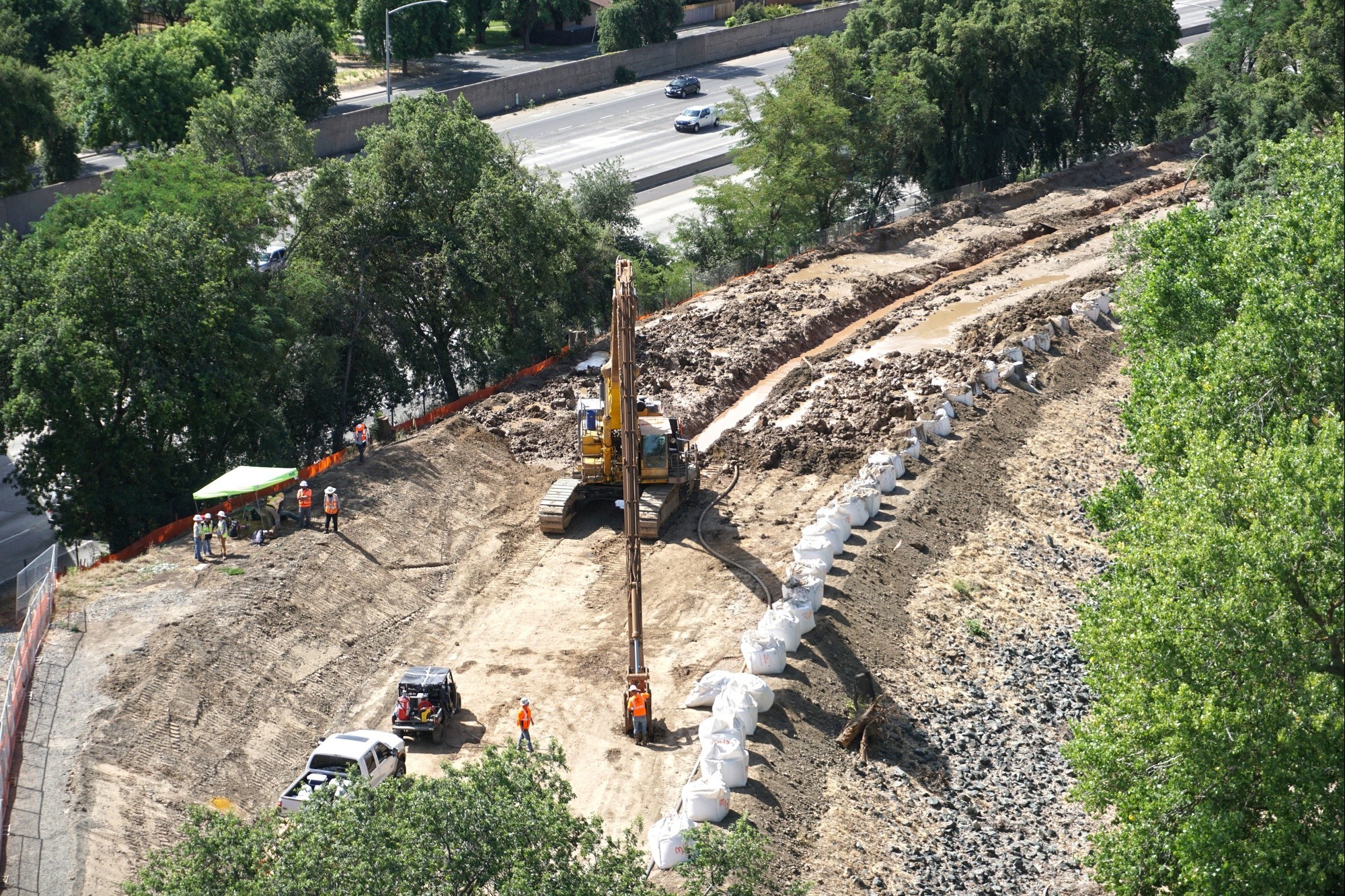
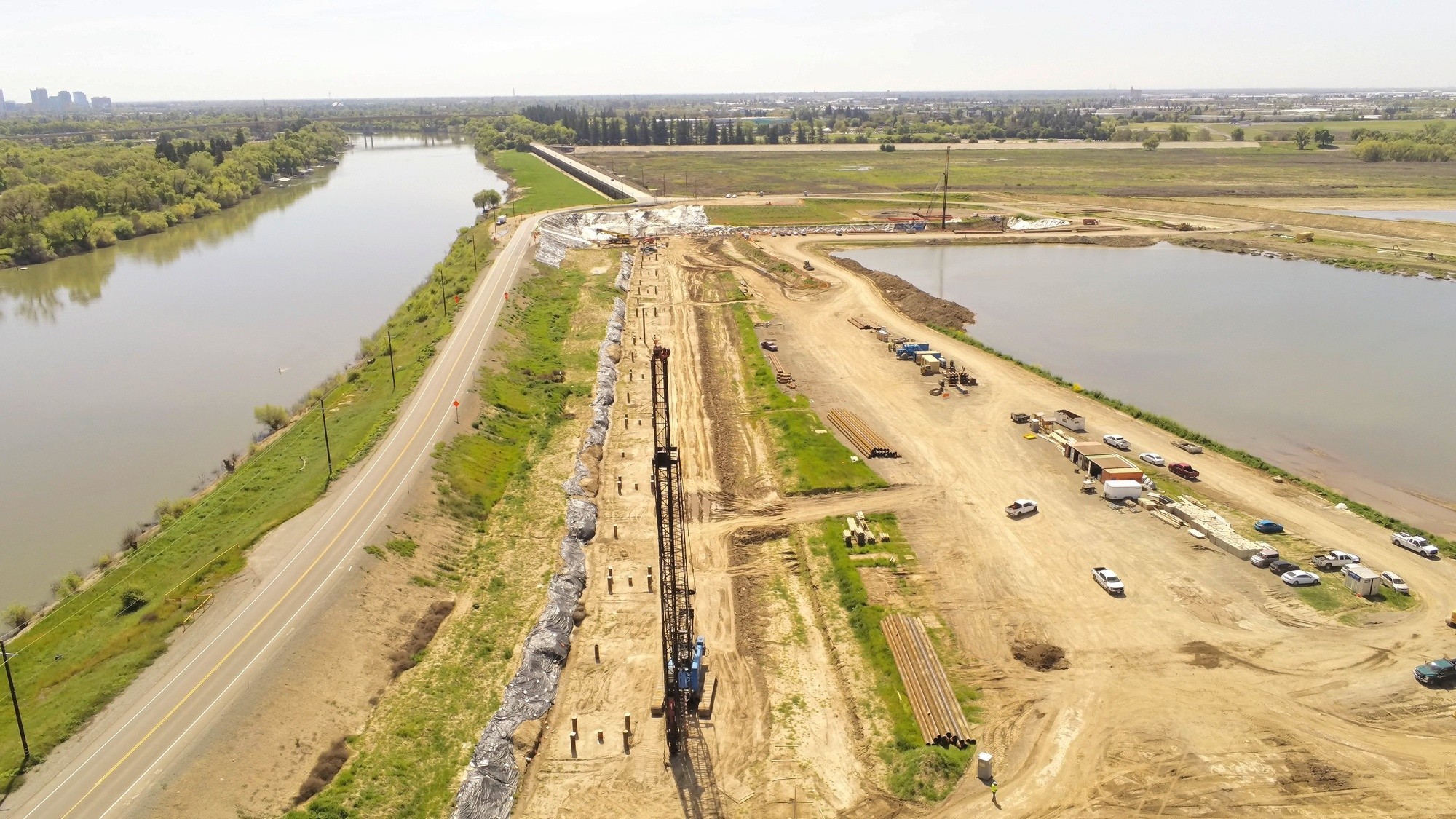
Installation of deep seepage walls, some extending more than 150 feet deep to help protect against seepage through or under the levee, are one way USACE and its partners have been improving Sacramento area levees.
Increased flows also mean greater potential for erosion.
Sacramento’s River Park neighborhood sits right where the American River would like to flow. A horseshoe-like bend, however, wraps the American River around the neighborhood. High velocity flows making a sudden change of direction have the potential to be devastating.
“Thousands of homes are located behind this levee,” said William Polk, senior project manager for the American River Common Features program. “A levee failure resulting from the high velocity flows of the American River would be catastrophic to people and property.”
The goal is to protect the riverbank by applying a layer of armor. By adding large boulders, referred to as rip rap, covered in soil and plantings, the levee doesn’t take the full brunt of the flows and can help keep water in the river channel and out of the community.
“We not only have a modern engineered levee but we’ve added more than 100 thousand tons of rock to help protect it from river flows,” said Polk.
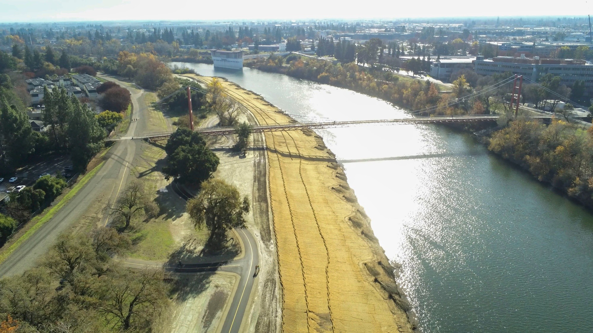
Most people won’t notice where flood risk reduction work was completed as carefully cultivated native vegetation restores the natural aesthetic over time. However, improvements at the Sacramento Weir, located along the Sacramento River just upstream of its confluence with the American River, will be clear for all to see.
The structure, which helps relieve the Sacramento River during high flow events, is getting its first significant upgrade in its 108-year history. Construction crews are expanding the facility to add a new 1,500-foot passive weir, that will help re-route water away from Sacramento-area communities and into the bypass when river levels rise.
All the work is designed to work as a system and will help the region achieve a 200-year level of protection, meaning there will be a one-in-200 chance of flooding in any given year.
“With nature, it’s not a matter of ‘if’ but rather ‘when’, so we’re doing what we can to reduce the flood risk for the next major storm event,” Des Champs said.
Social Sharing