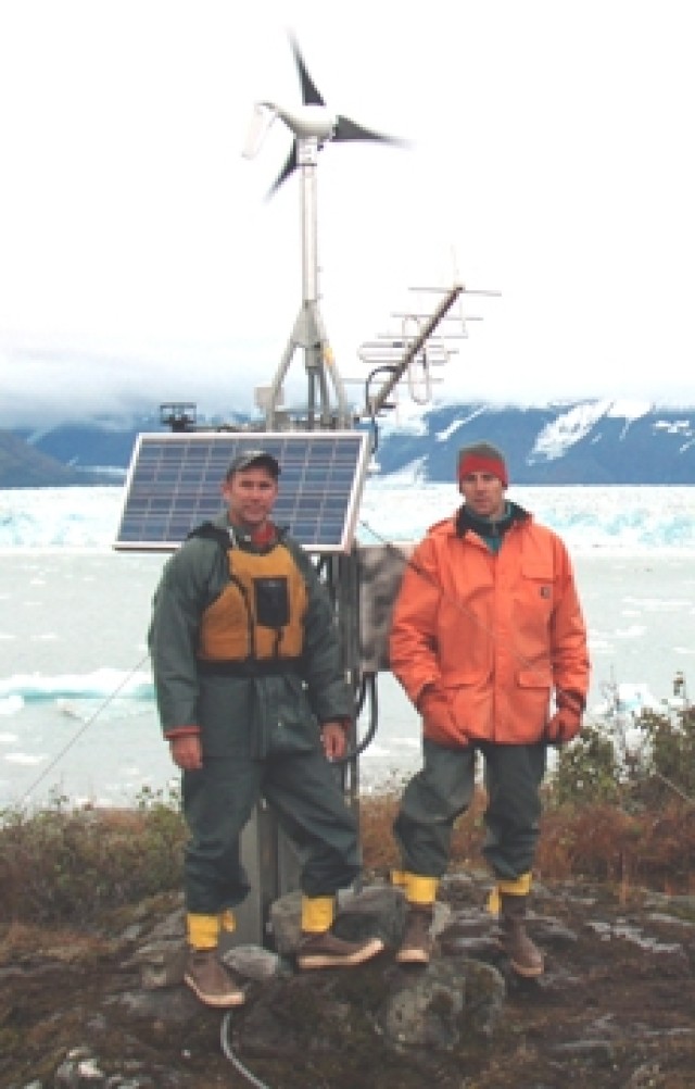
YUKATAT, Alaska (U.S. Army Corps of Engineers, April 18, 2007) -- Mr. Greg Hanlon and Mr. Dan Stenstream of the U.S. Army Corps of Engineers' New England District Reservoir Regulation Team traveled here as part of a large-scale engineering, scientific analysis, and data gathering study.
This study is intended to better understand the cumulative effects that the advance of Hubbard Glacier and the closure of Russell Fjord may have on the safety and well being of Yakutat.
Hubbard Glacier is the largest tidewater glacier in North America. It has been thickening and advancing toward the Gulf of Alaska since it was first mapped by the International Boundary Commission in 1895. This is in stark contrast with most glaciers that have thinned and retreated during the last century. This atypical behavior is an important example of the calving glacier cycle. Calving is when huge chucks of ice break off the forward edge of a glacier, forming icebergs.
If Hubbard Glacier continues to advance, it will close the seaward entrance to Russell Fjord and create the largest glacier-dammed lake in North America in historic times. The damming of Russell Fjord may ultimately inundate portions of Yukatat and cause salt water flooding of the Situk River, permanently destroying this rare and salmon/steelhead fishery, which is vital to the local economy. It may also produce serious erosion as a result of large volumes entering the river from Russell Fjord.
From its source on Mount Logan in the Yukon Territory, Hubbard Glacier stretches 76 miles to the sea north of Yakutat in Disenchantment Bay. It is the longest tidewater glacier in America, with an open calving face more than six miles wide. Before it reaches the sea, Hubbard is joined by the Valerie Glacier to the west, which, through forward surges of its own ice, has contributed to the advance of the ice flow that experts believe will eventually dam the Russell Fjord from waters of Disenchantment Bay.
The Hubbard Glacier ice margin has continued to advance for about a century. In 1986, the glacier temporarily closed the connection between Russell Fjord and Disenchantment Bay. By October of that year, the water level in the fjord had risen to 83 feet above sea level, causing a catastrophic failure of the ice dam. The result was an outburst flood of 3.7 million cubic feet per second, the largest outburst flood ever recorded.
In spring 2002, the glacier again approached Gilbert Point. It pushed a terminal moraine ahead of its face and closed the gap again in July. Moraine is rocky material that a glacier pushes along in front of it, like a giant bulldozer. On Aug. 14, the terminal moraine was washed away after rains raised the water level in Russell Fjord to 61 feet above sea level.
Hubbard continues to advance and retreat seasonally. The Army scientists and other government organizations continue to monitor its activity. As part of this study, data concerning the movement and other physical parameters of Hubbard Glacier are necessary to understand the stability of a long-term ice closure and for determining the potential outcomes of the continued advance at the Hubbard Glacier terminus.
A data collection system designed Army scientists using a high-precision automated laser range finder, was installed at Gilbert Point to monitor the advance and retreat cycles of the Hubbard Glacier terminus.
Since the terrain at the Gilbert Point range finder location does not provide adequate open sky for satellite transmissions, it was necessary to install an additional site on Haenke Island about two miles away in Disenchantment Bay. This location has proven to be a good location for satellite transmissions and for the climate sensors necessary for the project. This site transmits data to the satellite on an hourly basis.
Additionally, the Army Corps' Alaska District is initiating a full watershed study of the Hubbard Glacier and the Situk River watersheds. As part of this study, up to 25 monitoring stations will be installed to provide the data necessary for the study.


Social Sharing