
FORT DRUM, N.Y. (July 13, 2023) -- There are more outdoor recreational opportunities at Fort Drum than most people may realize.
But this article isn’t about hunting, trapping, camping, ATV riding, target shooting, wildlife photography, or geocaching. It isn’t about canoeing or kayaking (for that, see www.dvidshub.net/news/448869/fort-drum-natural-resources-branch-makes-kayaking-more-accessible-post), picnicking, biking or dog walking either.
It is about hiking.
Within the cantonment, there are miles-long stretches of hiking trails, well-groomed and easily accessible. The Commando Trail is my favorite. I’ve been logging 10-mile treks on it ever since the garrison commander stopped in the office one spring morning and said, “Mike, you should run the trails on post. They are awesome,” or something to that effect. What I was really hearing was, “Mike, you should jeopardize your race season by running on unfamiliar terrain where you might twist an ankle or worse.”
Long story short, I put my fear aside, gave it a try, and I’ve become obsessed with trail running.
Recently, I was told of a new hiking trail network that the Fort Drum Public Works’ Natural Resources Branch established. According to Jason Wagner, Fort Drum Natural Resources Branch chief: “This is a gorgeous place to get away from it all and get a feel for Adirondack wilderness hiking.”
When I asked him if I could run it, his response was, “Probably not.”
Challenge accepted.
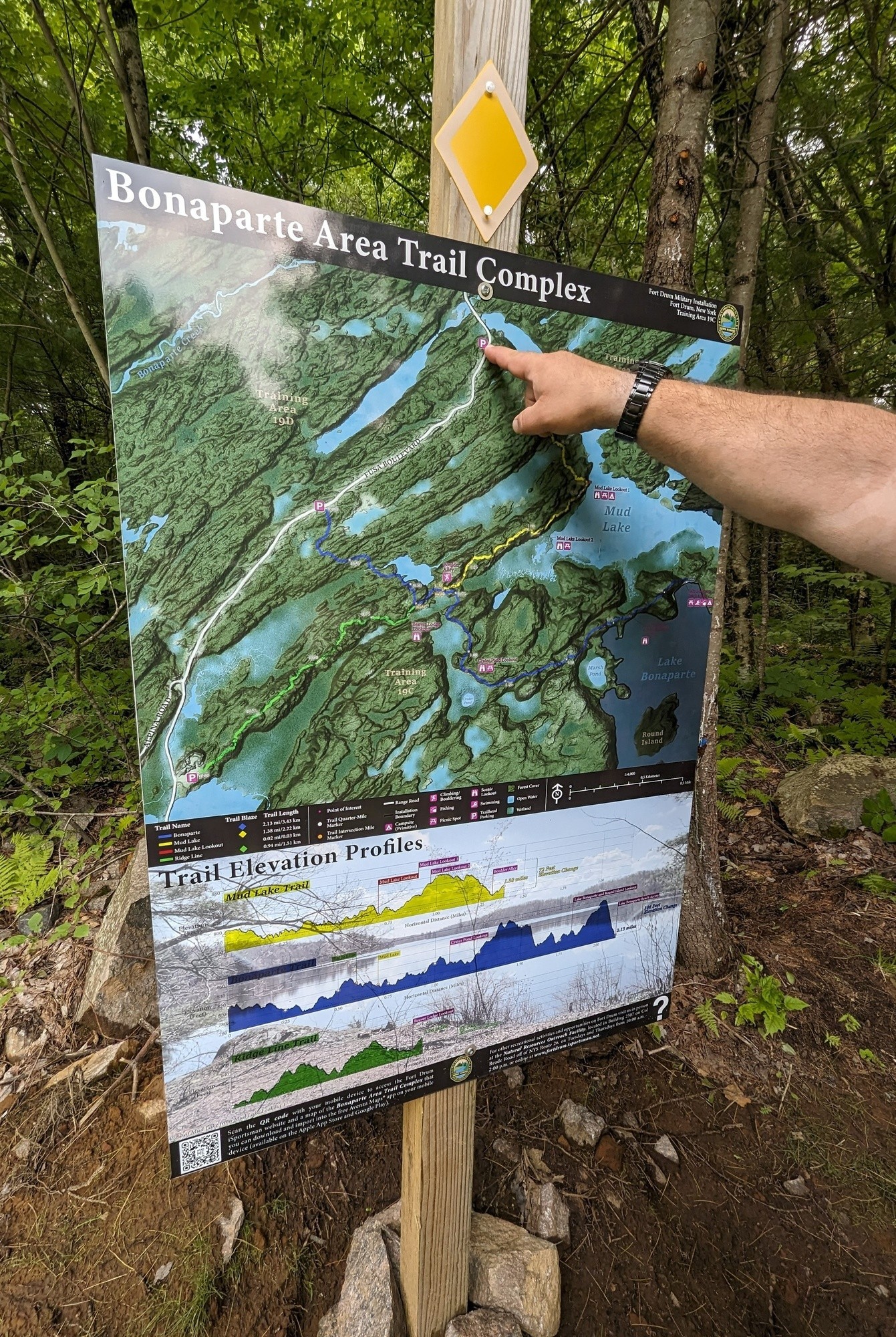
The Bonaparte Area Trail Complex is located within Training Area 19C, and it consists of three routes of varying distances – the longest being just over two miles (one way).
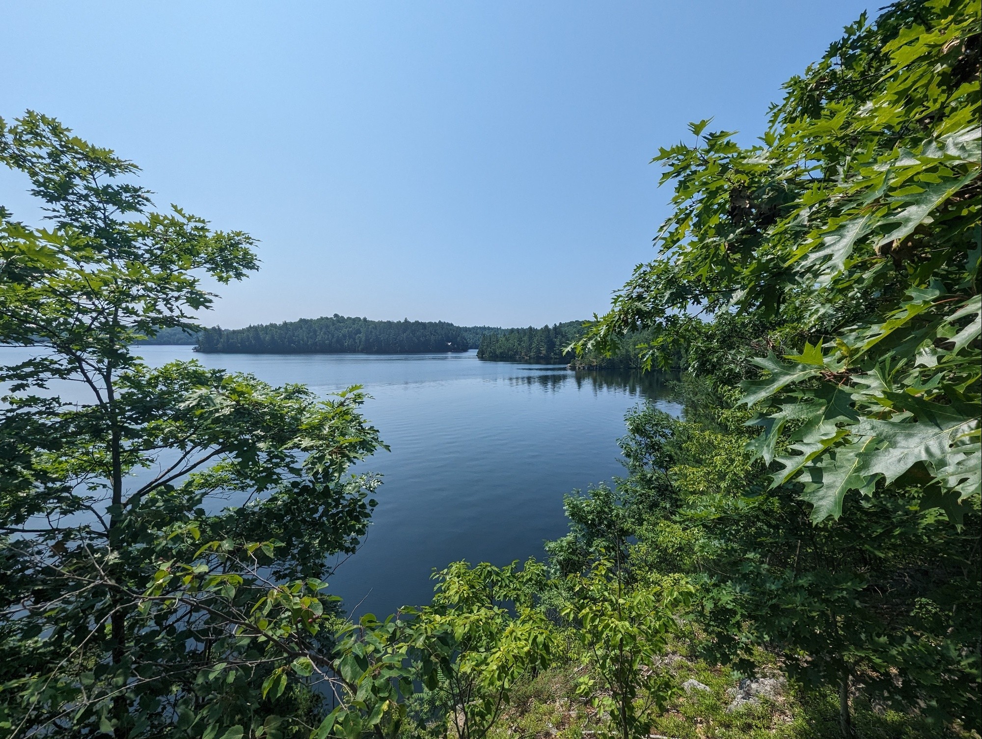
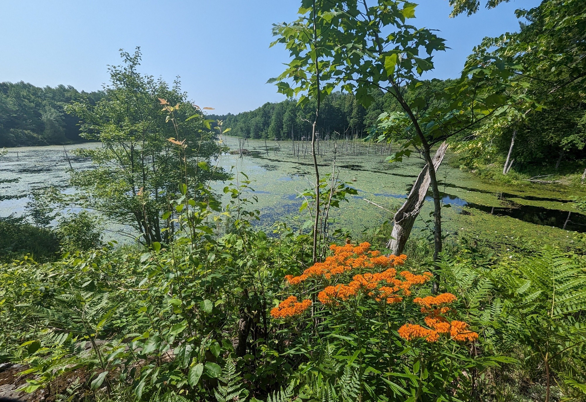
That’s the one I chose only because it ends at Sand Bay (Military Bay) and the water offers cool respite as reward for finishing.
I registered for the free recreational pass on the iSportsman website (https://fortdrum.isportsman.net) and the parking permit – both required for venturing into the training area. After I downloaded the trail map, I checked the status report to make sure the training area was open. From my online account, I selected the time and location for my hike, and I made a mental note to go back online and check myself out upon leaving the training area.
I did all this on my phone (except for printing the pass), and it took minutes to complete.
The drive from the cantonment to the range was about 15 minutes, and then the trek out to the trailhead almost 30 minutes (I was driving under the speed limit). I am not an outdoorsman, and I can barely read a map, but I managed to find my way without difficulty.
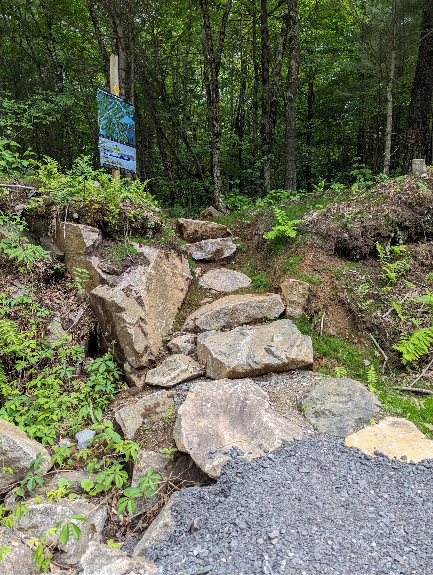
Once I stepped out of my car and onto the Bonaparte trail, I was accosted by flies. I was told that people who spend lots of time in the woods are used to the swarming menaces. I remain unconvinced.
As a novice hiker, what I found most reassuring were the trail markings, which are color-coded, depending on which trail you’re following. They are easily visible throughout the route, and at short enough distances so there’s never any fear of missing the next one ahead. This was exactly what Rodger Voss, Fort Drum forester, told me before my hike.
“You’re not going to get lost,” he said. “We’ve done a lot of work to the trail itself to clear paths for hikers. And you can always see the next marker from the marker you’re standing next to.”
Once I became comfortable with my ability to negotiate the terrain, I found myself running some short distances. At times, I didn’t have to look for the blue markings because the path naturally revealed itself and I could concentrate on pace more than navigation.
Having been told that there are bears in the training area, I took note of places I thought they may be resting (no sightings on the trail). I was startled by a deer (or vice versa), side stepped a few frogs, and at one point I thought I heard ducks growling in the nearby pond.
Wagner mentioned the topography in this area is quite unique and I must agree. It’s hard not to pause and just soak in the surroundings.
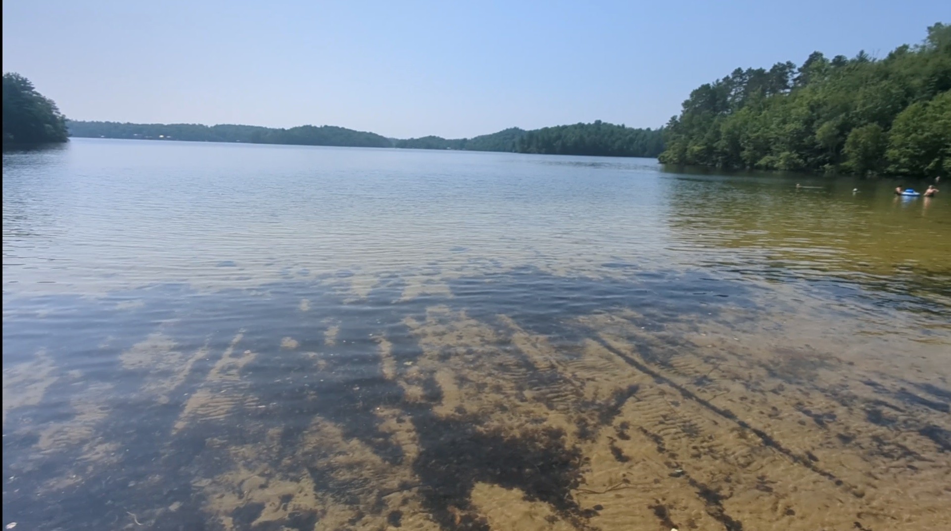
Reaching the endpoint, I emerged from the forest to the spectacular sight of Lake Bonaparte – surprising a married couple on a boat who were also about to take a swim. They didn’t know about the trails, and I happily gave them a quick recap of my first trek in the Fort Drum wilderness.
While dipping my feet into the water, I spoke about the wildlife I encountered, and the strange “Endor”-like noises I heard in the woods.
I’ll concur that these trails are not ideal for running. In fact, the trail complex was not initially intended for recreation either, but for training purposes.
According to Fort Drum Natural Resources Branch, 10th Mountain Division (LI) units have requested a trail system in the training area for years, and in lieu of that they would leave post to hike the New York State Trail Network.
“I wanted to build these trails so that Soldiers can get the same quality experience right here, where they go on a marked route and do all of their skills training,” Wagner said.
The trailblazing project began last fall, with Wagner and Voss spending their Thursdays literally putting in the groundwork on the routes. I can’t imagine the amount of work involved in establishing nearly five miles of trails through dense forestry.
“It was just woods,” Wagner said. “First we did an office assessment to make sure we weren’t running into a giant wetland or a wall of rock you couldn’t ascend.”
After this Geographic Information System (GIS) assessment, they went out to the training area to validate the routes.
“We laid it all out with flagging (marking the trail route), and then we came back through successively to cut the deadfall out of the way,” Voss said.
They trimmed away tree limbs that could be potential hazards and later used weed-whackers and leaf blowers to landscape the trails.
“Once the trails get used more, it’ll get beat down to where it becomes more visible,” Voss said. “Right now, it’s so new we just needed to get the leaf litter away, so it looks more like a trail.”
“Boots are the key,” Wagner said. “More people using it will make it better. If there is a ton of usage on these trails, I’ll go build more trails. I know what it cost me to build a mile of trail. I’ve got another 90,000 acres that we can put trails on if people want to use them.”
Wagner said the trails were his concept, but it was Voss who energized the project.
“It was his energy that made this a reality,” Wagner said. “There have been days he’s dragged me through the woods to keep it going. There were lots of others on the team that worked this, but Rodger was the driving force.”
“I think it’s pretty cool,” he added. “So even though the concept was originally for training Soldiers, I knew that it would still be a great recreational opportunity for everybody.”
“Once people find it, they’re going to love it,” Voss said.
I asked if it might be intimidating for the average community member to venture into the training area for the first time.
“The trails are marked so well both ways, you really have to work to get lost,” Wagner said.
For the uninitiated, he said that spending a little time on the iSportsman website should alleviate any concerns.
“All the regulations you need to know are right there. It walks you through everything that will keep you safe. That’s really what the access system is for – to keep recreationists and Soldiers apart.”
The Natural Resources Branch team had a booth during Mountainfest to explain how easy it is for community members to enjoy activities in the training areas.
“I get a lot of comments from people who think the training area is only for Soldiers. We prioritize training, but it’s also public land too. What the Army cares about is that we keep you safe. If no one’s training on it, you can recreate on it.”
Wagner grew up in nearby Champion where he had plenty of places to fish, hunt, and hike, but never on Fort Drum grounds.
“Then when I got a job here, I thought, ‘What did I miss out on for the last 18 years of my life?’ I should have been doing all those things here. Now it’s part of my life, and I’m out here all of the time. My mission is management for sustainable outdoors. The key, in my mind, is the more people you can get out in the natural environment, the more they like it, the more they understand it, and the more they want to take care of it.”
After a morning in the woods, I think I understand it a little better. And those ducks I thought were growling? It was coming from a heron rookery, a place for the birds to nest and apparently speak harshly to one another.
I’m looking forward to seeing what else I learn on my next hike.
What to know:
*All persons, including children of any age, entering the training area for any recreational activity must have a Fort Drum Recreational Access Pass.
*Access permits are free and available on the iSportsman website at https://fortdrum.isportsman.net. Click on the “First Time Permit” link and follow instructions.
*The Fort Drum Recreational Access Pass for every person in the vehicle must be clearly displayed with the access pass numbers facing up on the driver's side on the dashboard, windshield, or side window of the vehicle.
*Recreationists 18 or older must have a government-issued photo I.D. (e.g., military I.D., driver's license) on their person while engaged in any recreational activity on the installation.
*Before entering the Training Area, recreationists must check in with Fort Drum's Range Control. This is done most easily through the iSportsman website via a computer or smart phone. An interactive map and list will show the areas open for recreation the following day. If you don't have a computer or smart phone, you can check in by calling the Sportsman's Hotline at 1-855-267-9770 and following the prompts. The hotline is updated at approximately 3 p.m.
*Check-out is required at the end of the day, no later than two hours after sunset.
Social Sharing