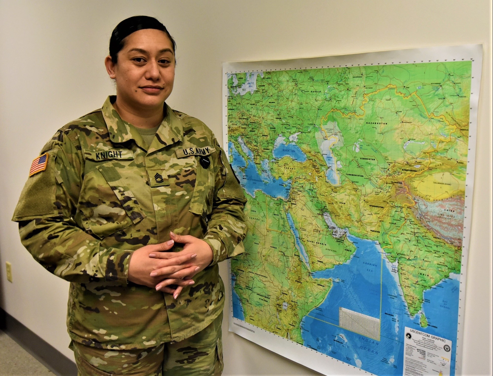
ROCK ISLAND ARSENAL, Ill. — Sgt. 1st Class Lisa Tavai Knight is the only person throughout the U.S. Army Sustainment Command doing what she does. In fact, she is the only uniformed person in the U.S. Army Materiel Command performing this job as well.
So, what does Sgt. 1st Class Knight do? She is a senior geospatial engineer — she provides maps and other materials that are critical to ASC and AMC support in exercises and operations worldwide.
“I never thought I would be doing what I do now. I enlisted in the Army on a whim and 13 years later, I create and design maps and geographic products that are a vital part of the planning and decision-making process,” said Knight, who works in the Intelligence Support Element, G2 (Intelligence and Security).
“I chose this career path because I could gain skills that would help me transition to civilian sector because in my mind, I wasn’t going to stay in more than the initial four years.”
Knight’s duties include providing timely and accurate terrain analysis products in order to support ASC’s overall mission from command to staff to support elements, and aiding personnel to visualize and understand their specific area of operations better.
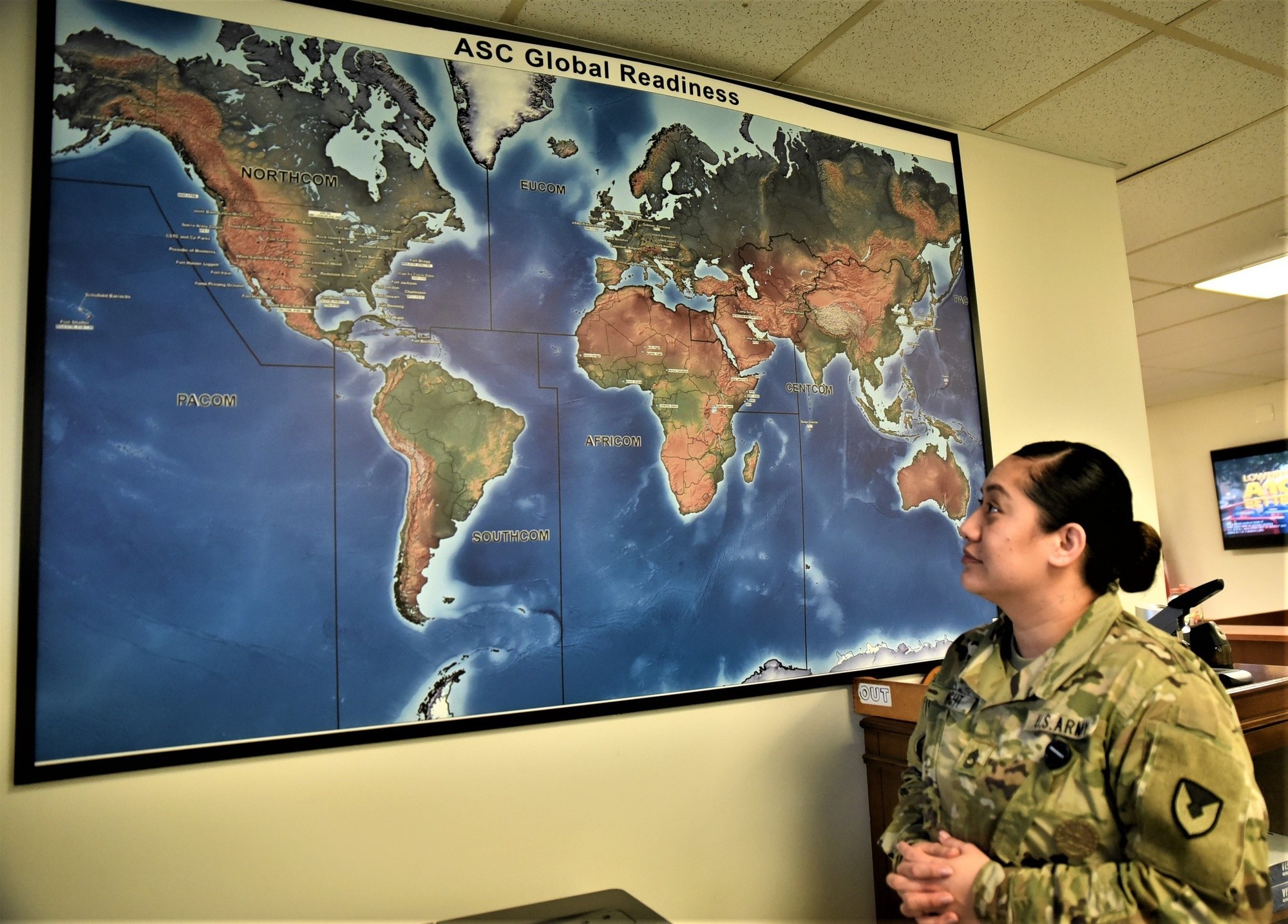
Geospatial products are highly sought after in both the military and civilian sector, Knight explained. They are ideal for planning and analyzing anything from seabed to space, such as intelligence, logistics, marketing, gaming/warfare, politics, weather, pandemics, environmental hazards, agriculture and more.
These duties support ASC’s Line of Efforts 2.0: Installation Logistics Support and 3.0: Army Prepositioned Stocks Management.
“Throughout history and now more than ever, the Army needs geospatial support to understand and exploit all aspects of terrain, which is critical to mission success for all levels and phases of multi-domain operations — air, land, sea, space and cyber,” she said. “Maps and graphics have always helped paint a clearer picture to the commander when it comes to the military decision-making process, specifically during mission analysis.”

What Knight does for the Army is fascinating, but so is her background.
She was born in American Samoa and her family moved to Waimanalo, Hawaii, when she was 4 years old. Knight considers Hawaii her home and Samoa her ancestral roots.
“As a child I had a horrible sense of direction, but I was very creative and loved art. I was in the gifted and talented art program for three years in elementary school. I’ve always enjoyed making things, drawing, painting when I was younger,” she said. “I think it’s funny how I didn’t ever know what I wanted to do as a young girl; joining the Army really helped me to capitalize on strengths and skills I didn’t realize I had.
“The real reason I decided to join the Army is because I woke up one day, looked at my life at 19 years old, second oldest of four siblings, working endless hours to help my mom with bills just to come up short and realized I didn’t want that for me or for her. I wasted time growing up, didn’t plan for my life and was headed down the same path everyone around me was on, so I went to the recruiter’s office.”
After basic training, Knight went to advanced individual training for 18 weeks to become a geospatial engineer.
Prior to her arrival at ASC headquarters, she was the noncommissioned officer in charge instructor at the Geospatial Engineering Course at the Technical Engineer Skills Division at Fort Leonard Wood, Missouri. This course involves teaching how to create tactical, operational, and strategic-level maps.
During her career, Knight has provided support to the Ulchi-Freedom Guardian exercise in South Korea in 2011 and in 2016-2017. She also provided geospatial intelligence support to Army and Marine elements in three different theaters in Afghanistan, Iraq and Kosovo.
Recently, Knight produced various maps that joined together displaying the Pacific Ocean and Asia for a rehearsal of concept drill Jan. 5 for the upcoming exercise Talisman Sabre 2023, which is slated to take place between the U.S. military, Australian Defense Forces and other countries July 22 to Aug. 4.
The overall map nearly covered the basketball court in the Navy Operational Support Center Rock Island.
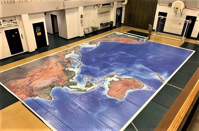
The ROC drill served to determine how the APS would be used to support the exercise.
Talisman Sabre is a biennial, multinational military exercise that focuses on crisis-action planning and contingency responses. The exercise is designed to test nations' ability to respond to regional contingencies, which has been held every two years since 2005.
“When the order came down, I thought, ‘challenge accepted.’ It took me about two days to create it and I am glad it served its purpose. Since then, I have created a European Command map — same size — and am currently working on a Central Command version of the same map as well,” she explained.
Overall, these maps for the ROC drill — three of them — totaled 45 feet by 30 feet. Additionally, there were seven 4-foot by 4-foot image maps that were placed over the big map, which were contracted out to be printed on special vinyl paper, Knight said.
As for the future, Knight said she is hoping to become a first sergeant and is also considering going the warrant officer career path. Upon eventual retirement from the Army, she hopes to put her skills to work for corporations like Verizon, Google and Amazon. And, enjoy being a wife, a mother to three children, traveling and watching her own children grow up and eventually becoming a grandmother.
“The best things in my life right now, I wouldn’t have if I didn’t make the decision to become a part of this great organization,” Knight said of the Army. “I don’t take anything for granted. I believe every single one of us has an important role to play, and I encourage all of us to put forth our best effort every day, and to remember that we are all invaluable.”
To learn more about careers in the Army, visit GoArmy.com.
Social Sharing