HONOLULU - The U.S. Army Corps of Engineers (USACE), Joint Airborne Lidar Bathymetry Technical Center of Expertise (JALBTCX), is performing airborne coastal mapping surveys along the shorelines of the Hawaiian Islands now through June as part of the USACE National Coastal Mapping Program (NCMP).
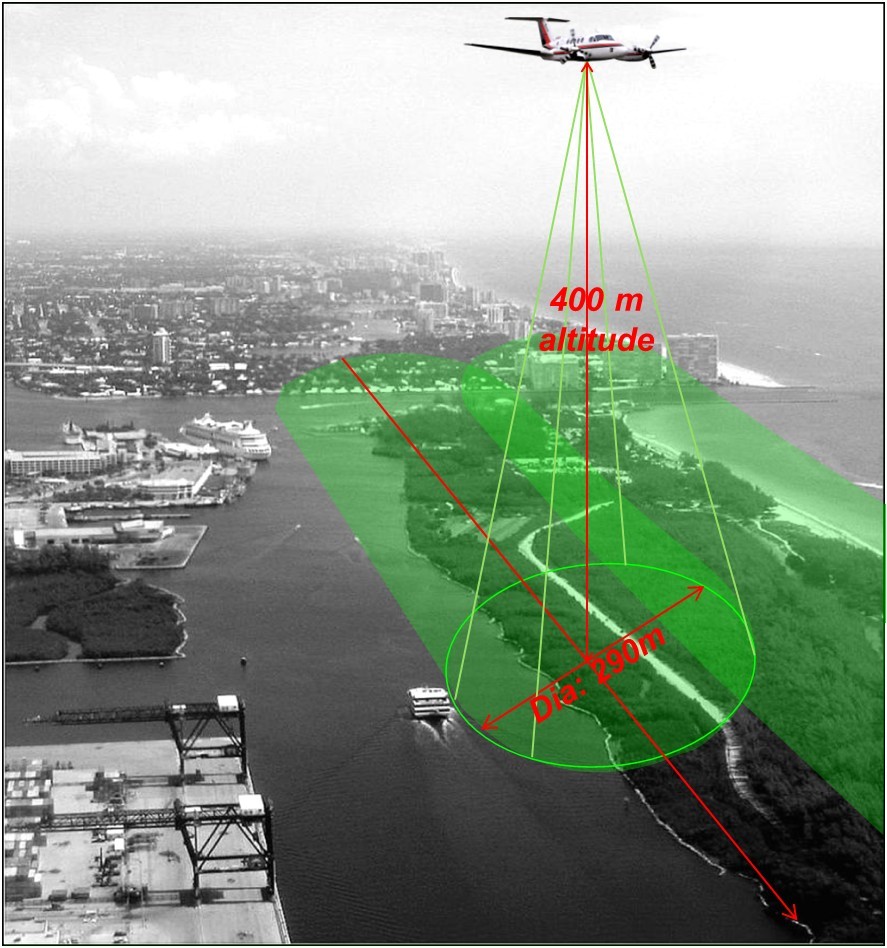
The surveys will be conducted using a contracted aircraft equipped with a USACE-owned Coastal Zone Mapping and Imaging Lidar (CZMIL) system. Lidar, which is short for “light detection and ranging,” uses light in the form of lasers to measure distance.
Residents near Oahu’s south-facing shores between Barber’s Point and Diamond Head are advised that broad beams of green light may be observed across the night sky and coastal terrain, between midnight and 5 a.m., April 28-30. The light will be emitted by the small aircraft equipped with the lidar. Brief exposure to the light is safe for the unprotected eye.
“The majority of data collection will take place during the day,” said Chris Macon, scientist with the JALBTCX. “The airspace along Oahu’s south shore is very busy, so we’re surveying this area at night to avoid interfering with air traffic from the Honolulu Airport.”
Activity will take place from offshore to approximately 500 meters inland from the shore at an altitude of approximately 1,300 feet AGL (above ground level).
The topographic data collected supports many USACE, state, academia, and private sector agency projects such as harbor dredging, sea level rise preparedness, and the evaluation of eroding shorelines.
NCMP surveys are conducted on a 10-year basis in the islands and along mainland coasts every 5 years and following hurricane events.
The Joint Airborne Lidar Technical Center of Expertise (JALBTCX) based out of Kiln, Mississippi is comprised of partners from USACE, the United States Naval Oceanographic Office (NAVO), the National Oceanic and Atmospheric Administration (NOAA), and the United States Geological Survey (USGS).
The U.S. Army Corps of Engineers is responsible for delivering vital engineering solutions, in collaboration with our partners, to secure the nation, energize our economy, and reduce disaster risk. As the nation’s lead engineering and public works agency, we deliver quality projects, on time and within budget, - safely - for the American people.
Social Sharing