Raging Arkansas River flows wiped out Riverview Park in Dardanelle, Arkansas and compromised the rock covered bank that protects the electrical switchyard at the Dardanelle Hydropower Plant during the 2019 spring flood.
If you lived in Dardanelle, or the state of Arkansas for that matter, you’ll remember this was no ordinary flood. Dardanelle is one of the state’s historic river towns, so it’s seen its share of floods, but 2019 was a high-water event like no other, and folks will be talking about it for decades to come.
The Arkansas River saw flows higher than any recorded in recent history in 2019. The damage done to parks, campgrounds, and vital infrastructure up and down the river was significant.
At their peak, flows were so high, Dardanelle Mayor Jimmy Witt asked the U.S. Army Corps of Engineers to deploy their sandbag filling machine to the city. The sandbags were used to keep river water from flowing through Downtown Dardanelle and causing costly damage that could have taken years to fix. Some of the sandbags were also used to keep the Highway 7 bridge between Dardanelle and Russellville open, avoiding lengthy delays and commutes.
Every step taken to protect the city was necessary considering 24 National Weather Service sites upriver from Dardanelle Dam broke their all-time May rainfall records.
While there was destruction all up and down the river, the loss of Riverview was particularly painful for the people of Dardanelle. Riverview is a Corps of Engineers Park that sits right below Dardanelle Dam on the powerhouse side. It’s a small park, but one that is well loved by locals, particularly fishermen. Its proximity to the river, and the iconic Dardanelle Rock make it a favorite of walkers and locals looking for a quiet spot to enjoy the river.
Tons of rock and debris covering one of the best and most convenient fishing spots on the river.
The land for the park was originally purchased by the federal government and used as a staging area during construction of the dam in the 1960’s. The land’s low elevation meant it was in the floodway and would certainly go underwater during times of high river flows. While this meant the area wasn’t suitable for permanent development, it could be used for recreation during times when flows were normal.
Designers decided to turn their construction staging area into a waterfront park that could survive being underwater with minimal damage during storms or floods.
While designed to flood, Riverview’s exposure to extremely damaging, repeated flooding started to take its toll on the park well before the 2019 high-water event. One of the challenges that Riverview faces is that the lower parking lot starts going underwater when flows reach 365,000 cubic feet per second. While that seems like a lot of water, it’s not an uncommon occurrence on the Arkansas. Just looking back a few years, the park was completely underwater in 1990, 2015, 2016, and again in 2019.
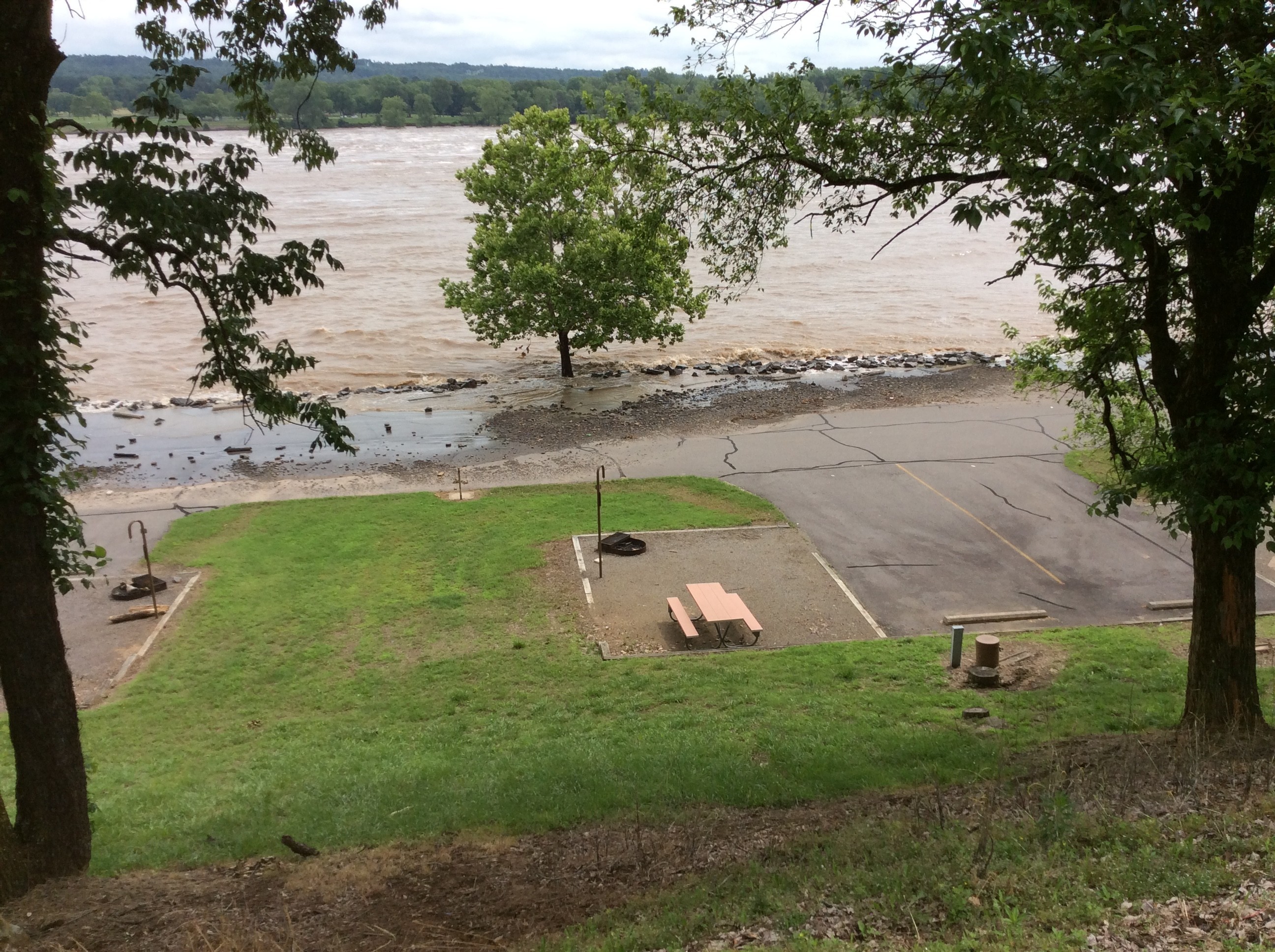
Riverview Park in 2015 as spring flood waters start to cover the lower parking area. Since 1990, Riverview has flooded four times.
During the 2019 flood, peak flows below Dardanelle Dam were clocked in at 565,000 c.f.s - almost double what it takes to flood the park. The water was so high, at one point it nearly engulfed the nearby switchyard, a linchpin in power production that supports the American electrical grid. Only luck and a timely intervention by the Tennessee Valley Authority and their heavy earth moving equipment saved the switchyard and prevented millions of Americans from experiencing months of power interruptions and higher electric bills.
Over the next several months as USACE and local citizens waited for the flood waters to recede, it became very apparent that Riverview would never be the same. Sustained high flows had washed away all the protective rock cover known as “rip rap” from the retaining wall that protected the switchyard, and erosion turned a once well-loved fishing area into a jagged bluff of sand and debris.
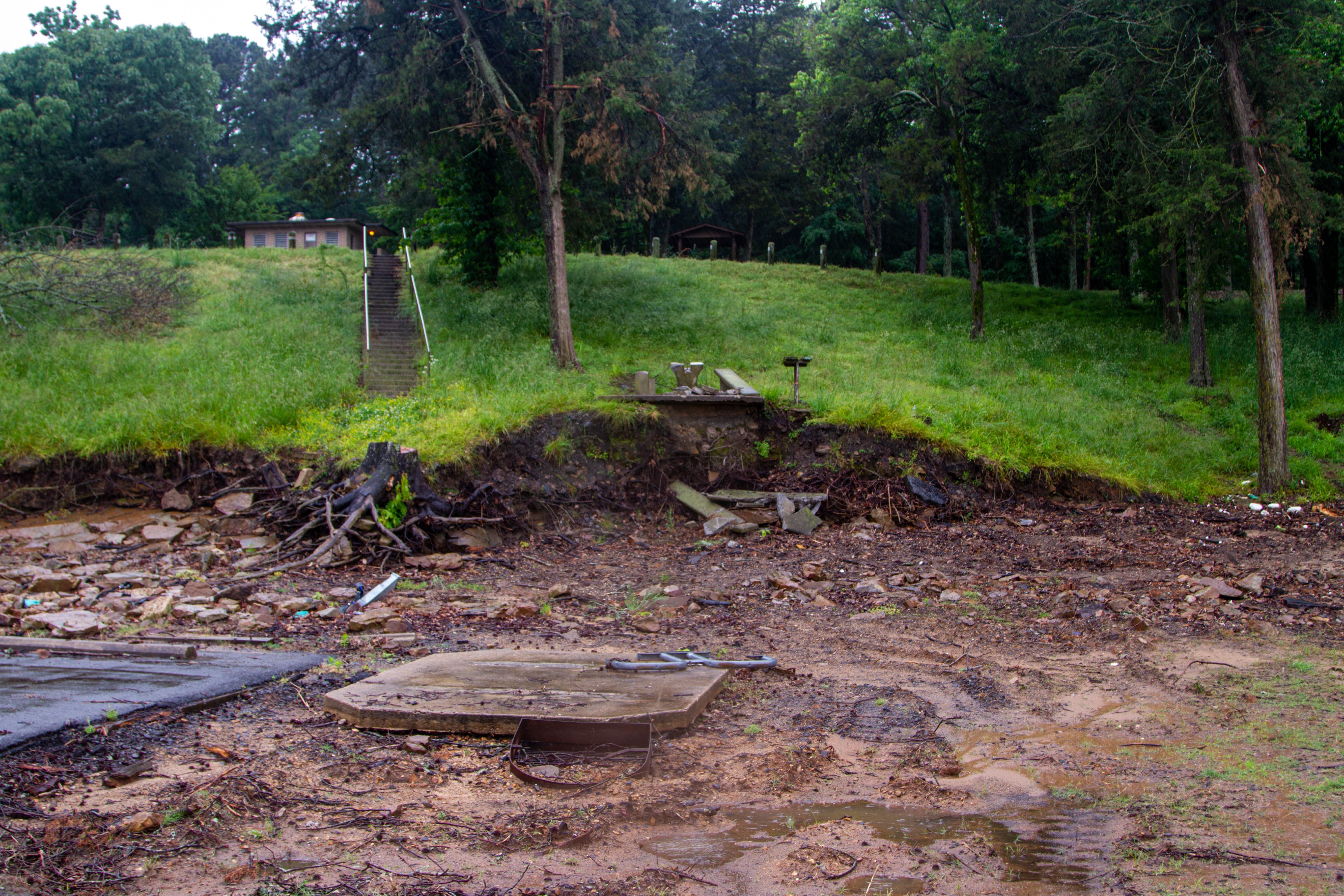
Riverview Park's camping and parking area shortly after the 2019 Arkansas River Flood.
From all appearances, Riverview was a total loss. The parking and camping areas had been buried under tons of sand and rock and there was significant erosion damage.
Yet as bad as Riverview was, it was only one location out of hundreds along the 445-mile-long McClellan-Kerr Arkansas River Navigation System that needed restoration and rehabilitation work following the flood.
All in all, USACE had a massive amount of work ahead of it, not only restoring parks and recreation areas, but also dredging out the navigation channel and rebuilding the dikes and levees that Arkansans depend on to protect farms and homes from flood waters.
Ultimately, we had to triage where money and workers were sent first. If a park was lightly damaged and very popular, we would focus efforts on it so that we could return it to service quickly and safely. Unfortunately, Riverview wasn't a well trafficked park, and the damage it saw was significant. These two facts together with the need to prioritize work securing the electrical switchyard put Riverview at the bottom of a very long list of work.
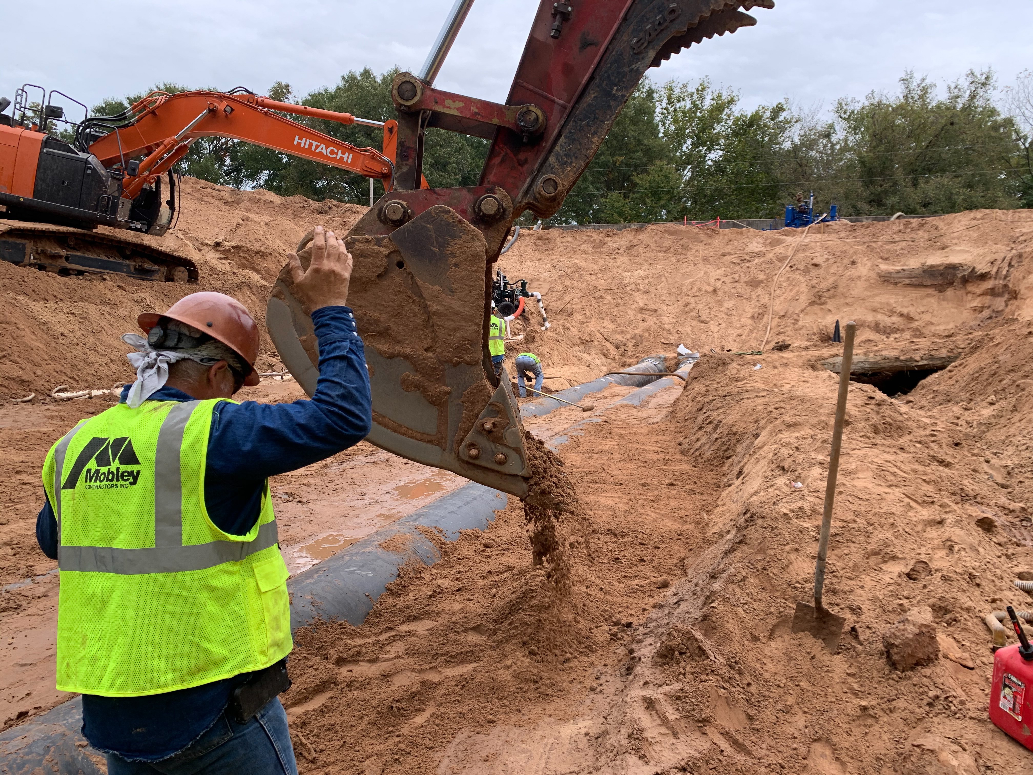
Workers rebuilding a damaged levee downstream of Riverview.
With all of that in mind, local USACE personnel at the Russellville Site Office were already hard at work looking for ways that they could restore Riverview. It was their dedication to the park, as well as the vocal support from local fans and Mayor Witt that helped keep the flame for Riverview Park’s rebirth burning bright. With some luck, and some dry weather, it was hoped that we could get the park back online and speed the return of recreators and fishermen to Dardanelle.
Unfortunately, mother nature wasn’t done with the river or Riverview Park.
Even after the 2019 flood, waters continued to run high for months, and the rebuilding process was constantly being slowed due to wet conditions driven by frequent, soaking rains. USACE saw its contract crews idled as the ground was simply too wet to work, or the river level was too high. These delays created a series of failures that affected the contracting and work scheduling that was necessary to restore vital infrastructure all along the river. Jobs weren’t starting on time, or if they did, they couldn’t finish on time as high water and poor conditions persisted well beyond the 2019 flood. For every step forward, contractors and workers would often find themselves taking several steps back as they had to stop work on one project to respond to an emergency somewhere else. Then, in 2020, a new and deadly threat to progress emerged - COVID-19.
This long and difficult march from spring 2019 to 2021 has been an eventful one. We’ve seen more flooding, though nothing as bad as 2019. We’ve seen a worldwide pandemic throw economies worldwide into disarray. Throughout all of it - Riverview Park has remained closed.
Visitors to Riverview Park are going to continue to see this for some months to come, but there's good news for the future.
But nothing lasts forever, and today Riverview Park’s future is still a bright one. From the end of the floods until today, USACE has been chipping away at the work necessary to begin the rebuilding of Riverview. The first and most important step of stabilizing the bank below the switchyard is almost done. After this work is complete, we’ll be able to start focusing more on the park itself.
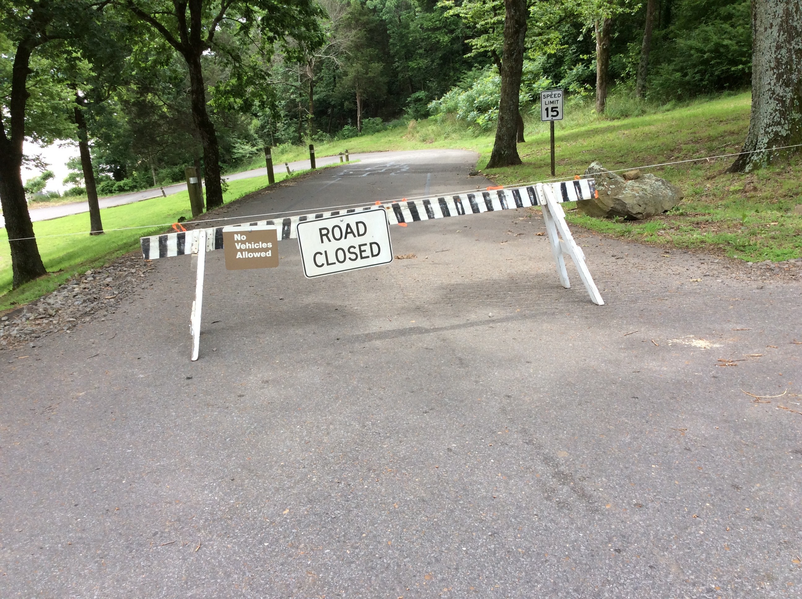
Until then, the gate to the park remains closed. This closure will be necessary for the safety of the construction crews and visitors as there will be heavy equipment and loaded trucks hauling in the area.
Riverview Park will reopen, but it will be different than many of us remember. For starters, the park will be a day use area only, with covered picnic sites replacing the campsites.
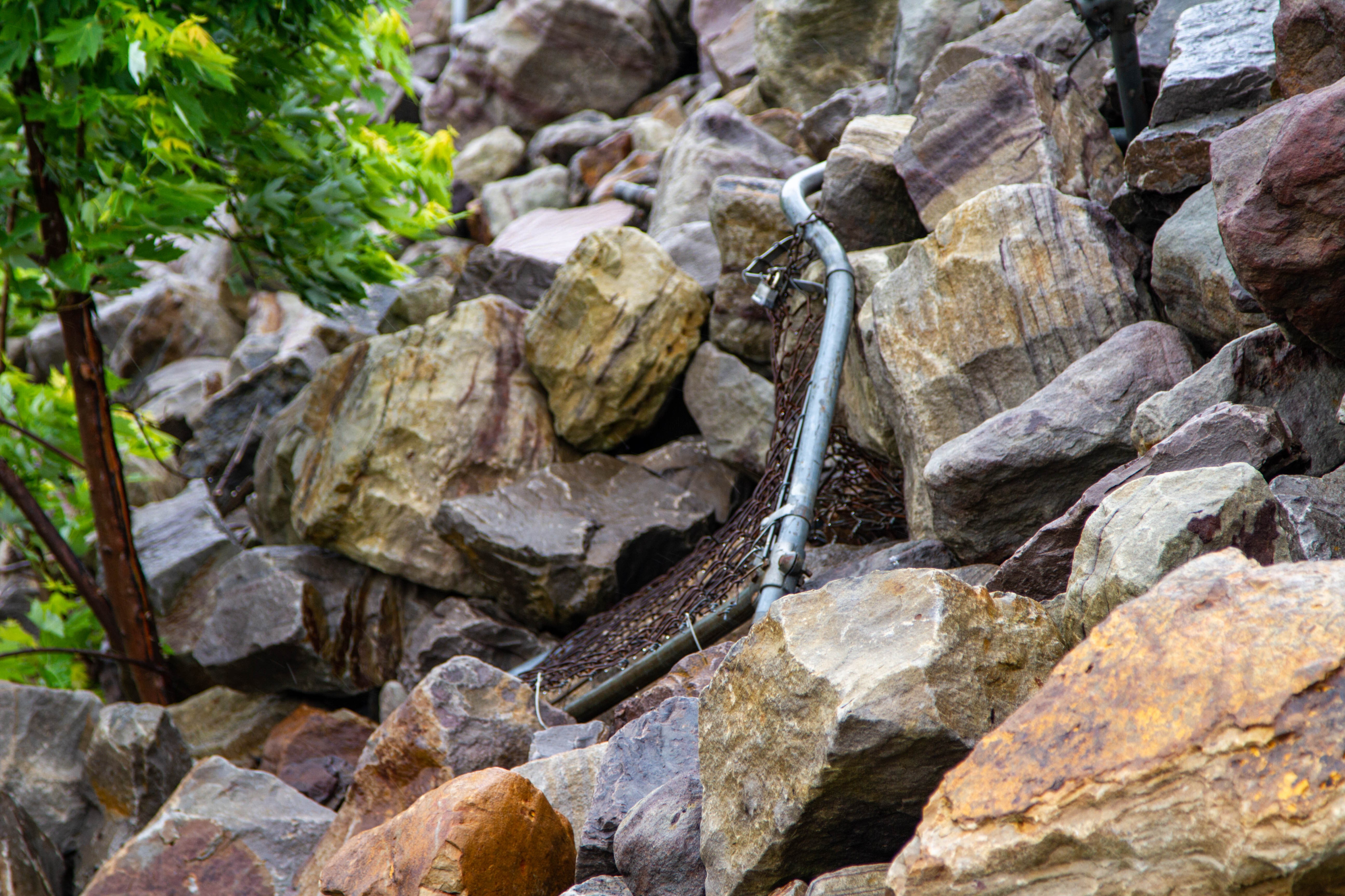
The next, most visible change is the new protective embankment built below the switchyard. This is a very steep, and currently very unstable wall of rock that provides an erosion-resistant barrier for the embankment. It's good news for the switchyard, but bad news for recreators who have lost access to a prime fishing spot previously known as "the slab".
The slab wasn't an actual designated fishing platform, but more of a flat spot that was easy to get to and fish from. After the flood, the slab was buried under tons of river sand and debris. Subsequent repairs to the embankment and erosion abatement along the shoreline made the approach steeper and more difficult to walk on.
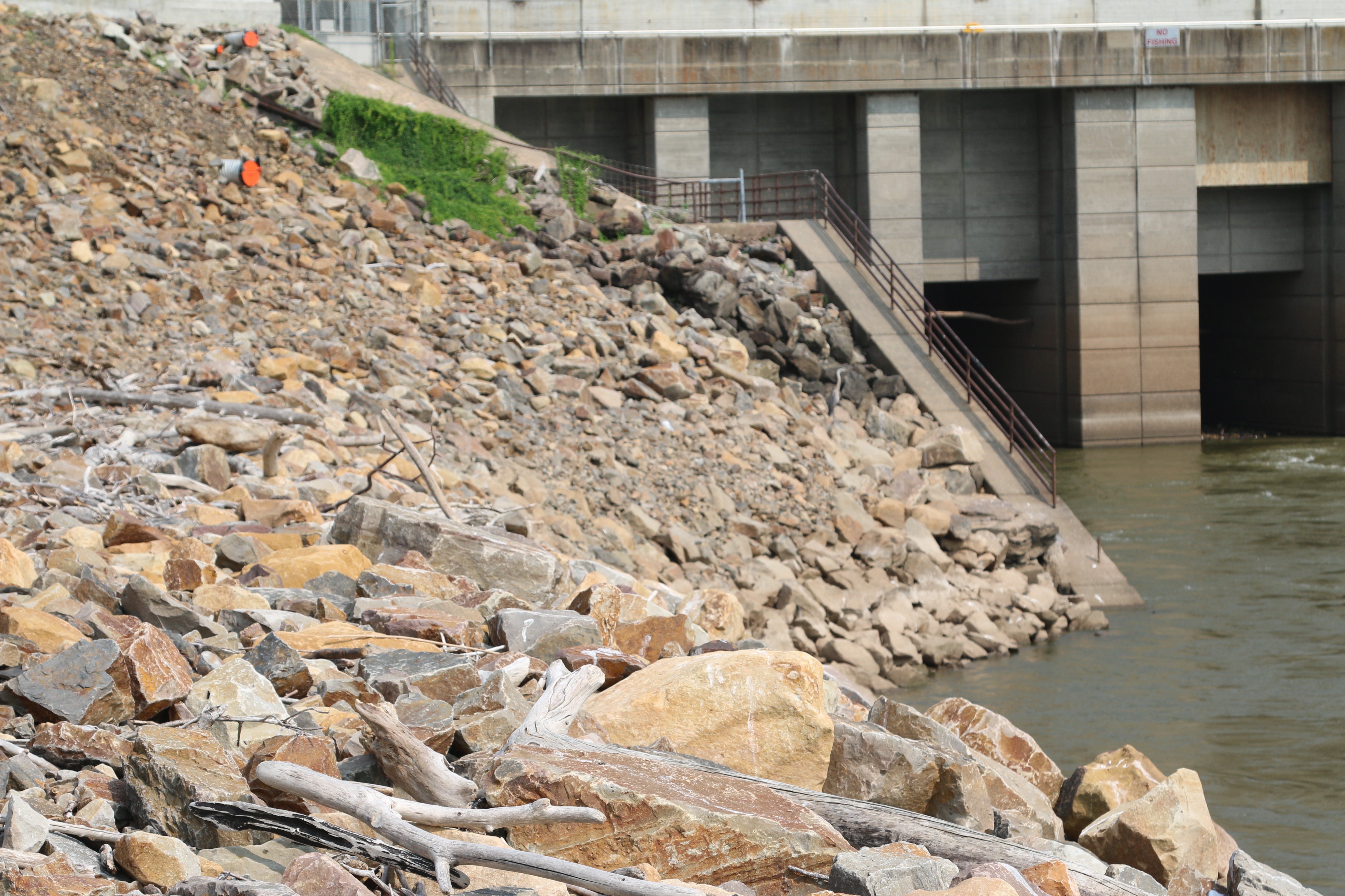
The new protective embankment has buried a favorite fishing location. USACE personnel are looking for ways to improve the situation and return fishermen to one of their favorite and most convenient locations on the river.
USACE hopes to improve the fishing situation as part of improvements and repairs to park. How and what this will look like is still being looked at and planned, but local officials hope to create a new platform for fishermen, with easier access, and no steep, unstable rock embankments to negotiate.
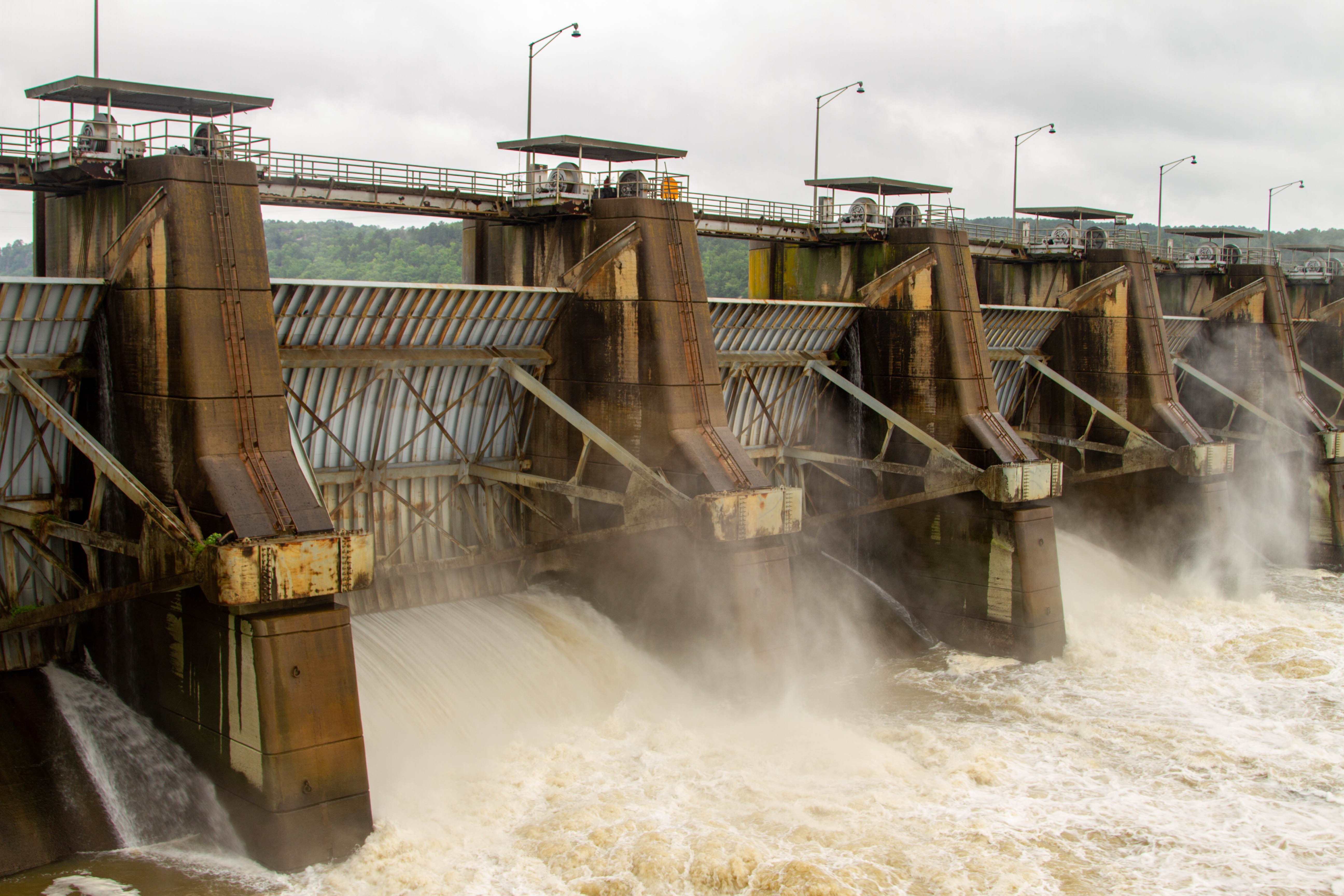
While this is good news for the future, there is one piece of bad news that is likely to take a lot of the shine off the plan. It's a change to how close fishermen are going to be able to get to the hydropower outlets. In the past, snag fishermen liked to stand between the switchyard and the river and cast into the turbulent waters from the outlets. This was a prime fishing spot and fishermen from all over the state and beyond would visit to "snag" from the dam.
Unfortunately, this won't be possible in the future. We know this is a disappointment, but there are good reasons behind it. First and foremost, it’s just not safe. Unlucky snag fishermen frequently get their lines tangled in our switchyard. This poses a threat to fishermen, the switchyard, and the power grid. The transformers in the switchyard alone cost more than $5 million to replace and we’ve seen them tangled in fishing line, lead weights, and those big treble hooks the snaggers use more than once.
Beyond having power transformers looking like Christmas trees decorated by a fishing club, another reason remains. That of the safety and security of the dam itself. Whether we like it or not, the dam, the powerhouse, and the switchyard are all pieces of critical civil infrastructure. Since September 11, 2001, access and proximity to USACE operated dams and powerhouses has been significantly curtailed. Most locks and dams simply do not tolerate the public getting as close to their structures as fishermen in Dardanelle are used to.
While the dams on the MKARNS create some amazing recreation opportunities, their primary missions remain centered around providing year-round navigation and hydropower solutions for all Americans.
For this reason, and the fact that we’ve thus far avoided any significant injury or mishap, we’re going to need to accept that fishing between the switchyard, dam and river is not something we can allow to continue.
We understand that fishing is important to visitors in the area however, the safety of our employees, the powerhouse and fishermen remain the priority.
Fishing will make a return to Riverview and should our local park managers get their way (and the funding they need) it will be far more comfortable and far safer than what has been available in years before. But snagging from the dam, quite literally snagging - on - the dam can’t continue in the same way.
As always, we welcome your thoughts and suggestions about ways to improve the park, or ways that we might be able to preserve or improve the snag fishing at the dam. There’s plenty of time for us to look at solutions and collaborate with the folks in Dardanelle. It’s been a long time coming and we appreciate the patience and support we’ve received.
We realize that not everyone will be happy with the future we have planned for Riverview Park. The changes and repairs have been a long time coming, and not all the news is good. While many of the changes are positive and will support the park's continued service to the people of Arkansas, the loss felt by snag fishermen and the community that supports them are but one of many compromises we’ve had to make in supporting recreation along the MKARNS since the 2019 floods.
In the meantime, campers and fishermen are encouraged to enjoy the many USACE parks in the area. There are 24 USACE parks between Ozark and Morrilton, Arkansas. The recreation areas combined have 357 campsites, 149 picnic areas, 24 public launch ramps, 14 playgrounds, 4 swimming areas, 4 trails, and 3 marinas. Additionally, there are numerous other parks, managed by the state and our federal partners like the Holla Bend National Wildlife Refuge all within easy driving distance of Dardanelle.
That said, we believe there’s a lot to look forward to in the future. Riverview will be restored and fishermen will have an easy in-town spot to return to. We remain committed to Dardanelle and Yell County and look forward to seeing visitors return to Riverview in the future.
Social Sharing