VIEW ORIGINAL
FORT POLK, La. — What lies below the surface of the water is important for Soldiers to know for safety and training purposes.
Using the right equipment to get the information they need is a priority.
That’s why Soldiers from the 46th Engineer Battalion were at Engineer Lake — within the Joint Readiness Training Center training area — April 29 testing equipment used to delve the depths and gather data to discover what they need to know about the lake.
1st Lt. Heath Coles, 46th Engineer Battalion engineer plans officer, said depending on the type of training, different areas of Engineer Lake or other bodies of water could be scanned by using water-based sonar equipment.
“For example, we might need to map a small, shallow part of the lake to concentrate on bridge-building training. It all depends on the mission set,” he said. “An underwater scan can also help with permanent construction of a dock, pier or pumping station.”
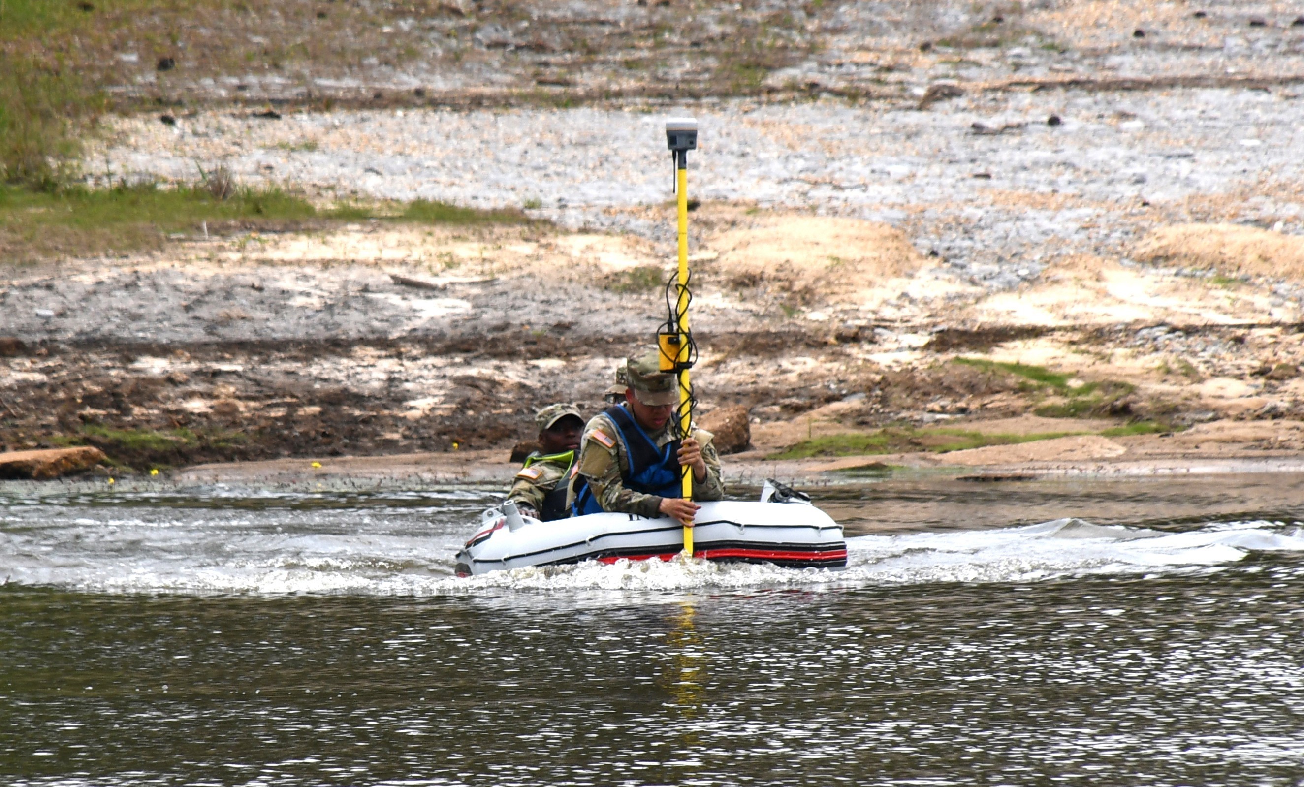
The survey and design equipment used to scan below the surface of the lake, as well as the steepness of its edges, included scanners, GPS locaters and sonar equipment specifically made for mapping bodies of water. The equipment was provided by Navigation Electronics Inc. out of Lafayette, La.
Coles said the 46th Eng Bn doesn’t currently have this type of equipment or the capability to scan a body of water like they are doing at Engineer Lake.
“This is something new. It’s a test run of the equipment and its functionality. If it’s successful, we hope to purchase our own equipment to increase our capabilities for future missions,” he said.
The equipment is allowing the 46th Eng Bn Soldiers to do a sonar survey of Engineer Lake to discover water depth, the angle and slope of the banks and if there are objects sitting on the bottom of the lake that need to be removed.
“This equipment will enable us to do things like wet-gap (river or lake)crossings and put in hasty bridges with bridging units, so we can get large scale equipment, like tanks, across a body of water during rotations. It’s good training,” said Coles. “It’s also essential to have this kind of equipment to do helocasting — dropping Soldiers out of helicopters and into the water — but we have to know what’s down there first and if the water is even deep enough to do that kind of training. We can also use it to help Soldiers train for things like the best Sapper and Ranger competitions.”
Staff Sgt. Reed Vascocu, 46th Engineer Battalion survey and design noncommissioned officer in charge, said the way water depth fluctuates at JRTC and Fort Polk, this kind of equipment could save the Army to do a survey anytime there is a need to know what’s going on beneath the surface of a body of water.
“In terms of a helocast, we could tell rotational units the water depth at Engineer Lake is currently at about 7 feet. That’s pretty dangerous if you want to drop someone in from 30 feet.
You probably wouldn’t want to do that. It’s all about gathering information and maintaining training safely,” he said.
Coles said his team recently went to the Army Corps of Engineers, New Orleans district, to look at how they use some of the same water sonar equipment, their tactics and procedures.
“They already have this equipment. They use a pedal kayak to do their mapping. The equipment is attached to the kayak and a Soldier peddles where he needs to map with the sonar. His hands are free to use the equipment. One Soldier on the water can get all the information needed with the support of Soldiers on the bank,” he said.
Coles said they borrowed a small boat to test the equipment at Engineer Lake.
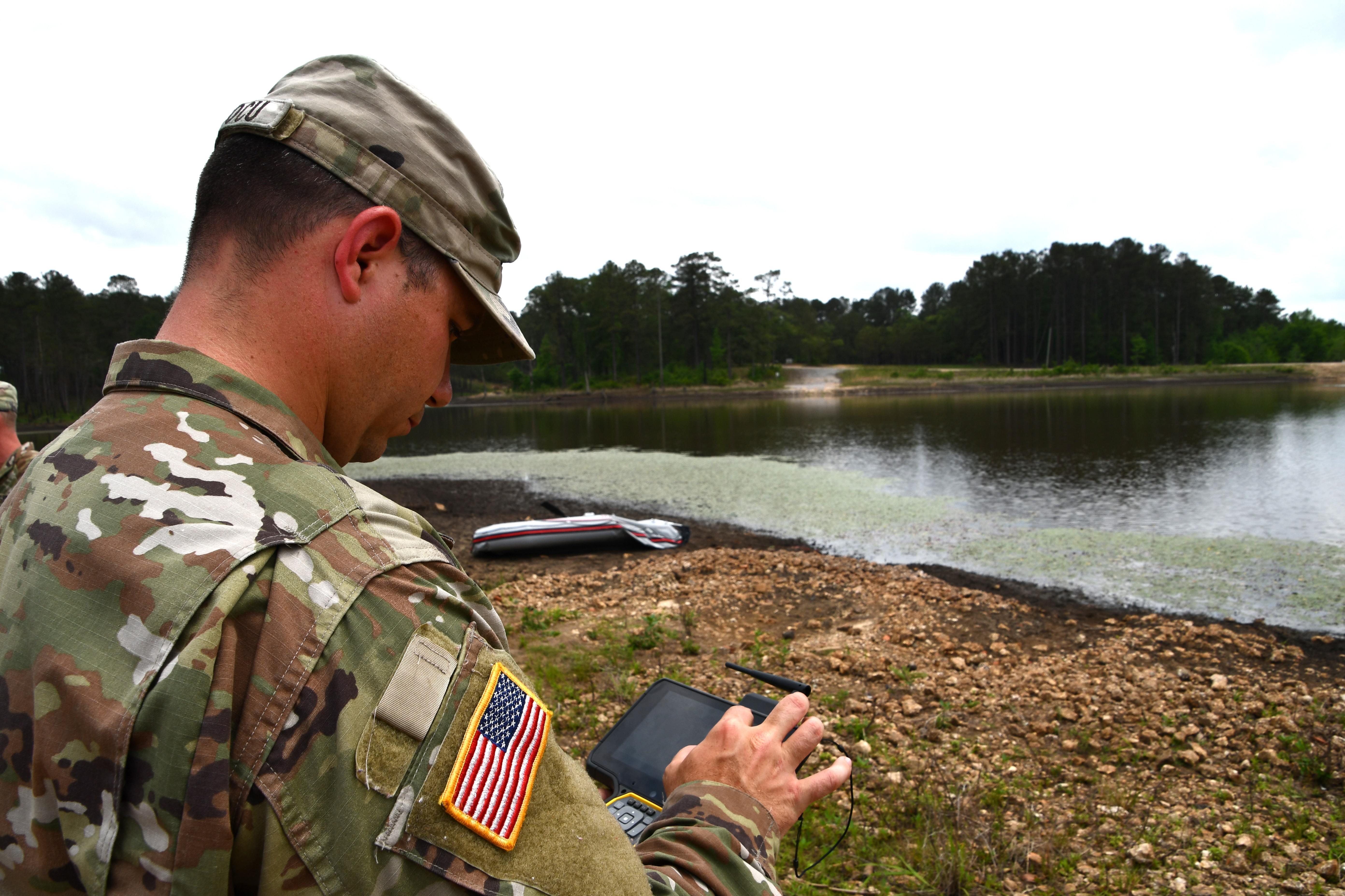
“Obviously, we don’t have an attachment apparatus, so we have a Soldier holding on to the sonar mike. He is shooting sonar down in the water. Another Soldier is holding on to the TSC7 controller — which is getting all the data from the sonar — and a third is driving the boat where it needs to go,” he said
Vascocu said they are using the equipment to work on building a 3-D visual based on the sonar information being gathered at Engineer Lake.
“Everything you see on the GPS scanner is from the zig zags we took on the boat as it moved back and forth across the lake. We will then take the information we got and download it to produce a 3-D model underneath the water. That way, we can tell if different training situations are suitable,” he said. “Being able to use this equipment is a great asset to us and shows how important it could be in gathering data on all the other lakes and bodies of water found on Fort Polk.”
Social Sharing