


HELENA, Mont. -- The Montana Army National Guard Remediation Team leads cleanup projects to restore legacy training sites throughout the state. These sites have been contaminated with munitions or munitions constituents and may include unexploded ordnance that did not detonate and are still capable of exploding decades later.
“MTARNG has historically used local training areas to train its Soldiers, but sometimes these areas were not cleaned up completely after use, especially rounds that entered subsurface soil,” said Montana National Guard Remediation Specialist, Virgil Kaiser. “These sites can pose a risk to people who recreate on public lands or build on private lands that were former training areas. So current land use is a key risk factor when setting remediation targets.”
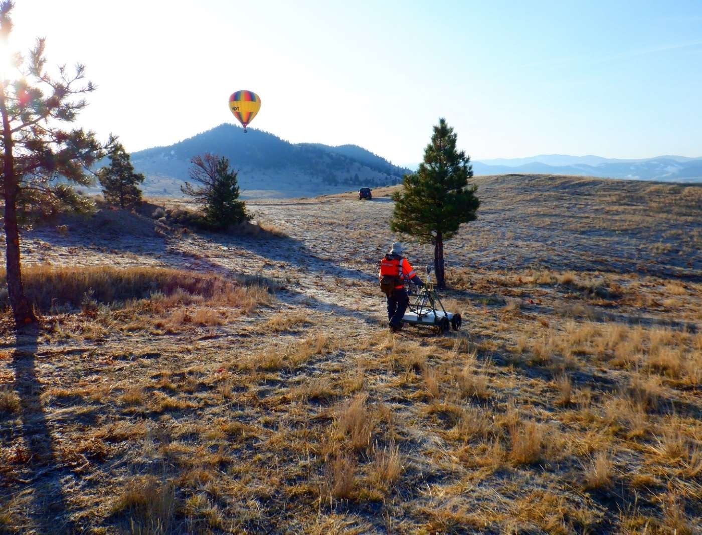
MTARNG is using advanced geophysics to detect UXO located below ground with increased accuracy, helping eliminate the guesswork in excavation while reducing remediation times and costs. Advanced geophysics equipment confirms the shape of anomalies with digital data, which helps the project crews positively identify the anomalies that are UXO, and eliminate fragmentation, metallic rocks and non-UXO anomalies from their digs. The number of anomalies can be reduced by 80 percent using this technology.
“While this technology has a cost, it ultimately slashes the time spent at a project site, reduces the number of anomalies to investigate, and reduces the potential time residents are evacuated during UXO excavation,” said Kaiser. “The team estimates that at just one of the five sites being targeted for cleanup now, advanced geophysics technology has saved $80,000 over the conventional excavation alternative.”
When funding became available in 2018, five UXO remediation sites in Montana proceeded with cleanup with oversight from the US Army Corps of Engineers: Scratchgravel Hills Artillery Range, Livingston Target Range, Dawson County Local Training Range, Lost Horse Rifle Range and Frying Pan Basin. During these cleanup actions, the MTARNG worked to establish relationships with stakeholders, including state regulators and public and private land owners with whom they negotiate for land access. MTARNG ensures their interests are being met by overseeing contractors hired by USACE to write cleanup plans and reports and perform remediation field work.
Encompassing 41.34 acres near Helena, and previously used for training from the 1950s until 1984, Scratchgravel Hills Artillery Range has publicly accessible trails owned by the Bureau of Land Management. Previous investigations identified mortar and high explosive items, which could pose harm to the public. Surface and subsurface munitions are being detected using advanced geophysics as required by the 2018 proposed plan for cleanup.
A dramatic improvement was seen by using advanced geophysics instead of conventional restoration actions at Livingston Target Range Munitions Response Site, 28 acres near the town of Livingston that supported munitions training in the 1930s. The team is the face-to-face liaison between USACE and landowners who were reluctant to grant access to the land.
During the remediation process for the 10.4 acre, privately owned, Dawson County Local Training Area Munitions Response Site, it was determined that lead could be a soil and water hazard and grenades used for training from 1950 to 1998 could pose a UXO hazard. Future cleanup will include removal of surface fragments and legacy berms contaminated with lead and recovery of grenade material to a depth of 18 inches below ground surface.
Cleanup efforts are slated for the near future at Lost Horse Rifle Range munitions response site, 4.5 acres of privately owned land that is primarily used as pasture land today with a home immediately south of the former target area. This site was used from the end of WWII until the 1970s as a small arms target range. The primary goal is removal of lead contamination by excavating and properly disposing of the target berm.
Remedial Investigation activities were completed in 2018 and a feasibility study is now being initiated to develop and analyze remedial alternatives at the Helena North Hills, a site that consists of privately owned open ranch land and state-owned land that is at times open to public use. The Helena North Hills site is located immediately adjacent to another site that underwent extensive UXO remediation. Live fire training with tanks, mortars, and towed artillery was conducted in this area from approximately 1948 to the mid-1950s.
The expanded use of advanced geophysics technology will help protect human health and the environment, while saving time and funding. In addition, by employing this equipment at multiple MTARNG sites, it will facilitate validation and nationwide use on UXO sites undergoing remediation.
Social Sharing