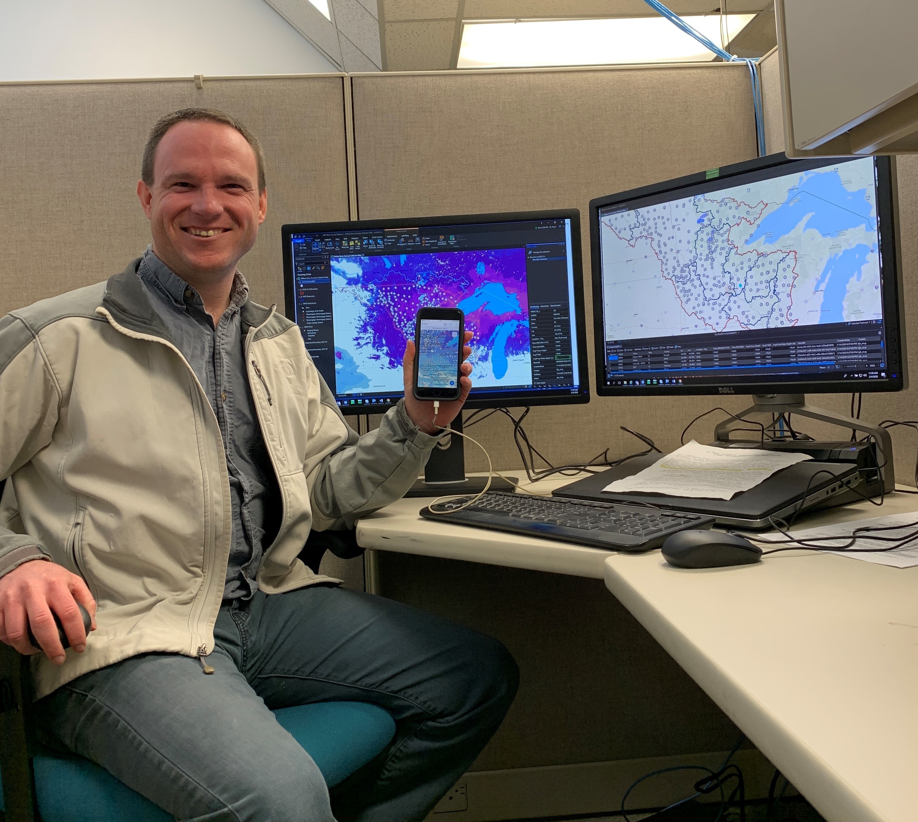
application that will allow the district water management team and river regulators to see data from snow surveys real-time. VIEW ORIGINAL
ST. PAUL, Minn. - The St. Paul District began conducting its annual snow surveys in February, but with a twist. We now have an app for that. Jesse
Scott, hydrologic technician, has been working to digitize snow survey data collection through a mobile application called Collector for GIS.
Scott said the mobile application contains the same information as the old paper forms, but now the data can be sent to the district’s water management team and river regulators real-time. Scott, along with Bill Odell, hydrologic technician, are testing out the application this year.
“This new system allows for more collaboration with our federal partners and state partners, allowing for much more efficient use of the data for weather forecasting,” said Scott.
The information entered on both the paper forms and this new mobile application includes estimated snowcover, snow depth and weight, snow water equivalent, a description of the snow and snow moisture. Odell said
the snow water equivalent is the amount of water in the snowpack or the amount of water that will be released when the snow melts. The information is shared with partner agencies like the National Weather Service to aid in their flood forecasts.
“It gives us an idea of what’s on the ground out there. There are other methods that the National Weather Service uses to give an estimate of what the snowpack or the snow depth or the snow water equivalent is, but we’ve given that boots on the ground verification,” said Odell.
Odell and Scott cover about 100 snow survey locations. Other project offices, such as Baldhill Dam and Lake Traverse, will cover approximately 200 additional snow survey locations around the district.
The process is to return to the same location as previous years. The mobile application can help surveyors get closer to the prior reference location with a compass and latitude/longitude coordinates.Geo-referenced photos can also be uploaded through the application.
Once surveyors return to the approximate survey location, they take five samples using a 0-30 in. snow tube. Odell said they have an extension that will go another 30 inches, but it’s rare they would need to use that. The samples are then emptied into plastic bags and weighed to calculate the snow water equivalent.
Social Sharing