1 / 10Show Caption +Hide Caption –
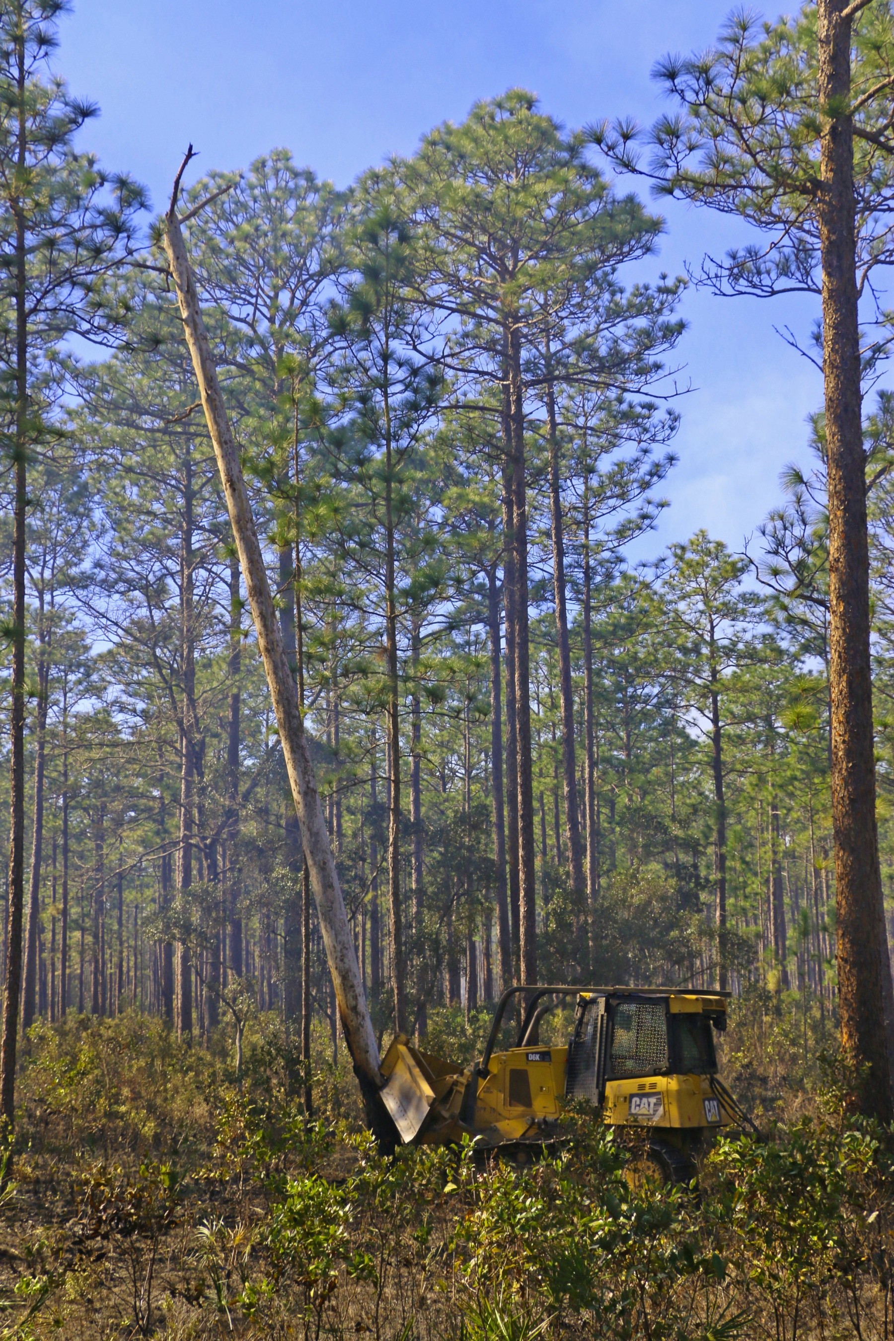
An equipment operator with Fort Stewart/Hunter Army Airfield Forestry Branch, uses a bulldozer to push a dead hardwood tree, also referred to as a snag, away from a road in the base’s training area, Feb. 3, 2020. Snags can cause fires to jump across roads if they should fall near roadways. FS/HAAF Forestry Branch conducts prescribed burns, also known as controlled burns, to reduce the risk and intensity of potential wildfires, improve training areas and endangered species’ habitats.
(Photo Credit: Staff Sgt. Todd Pouliot)VIEW ORIGINAL2 / 10Show Caption +Hide Caption –
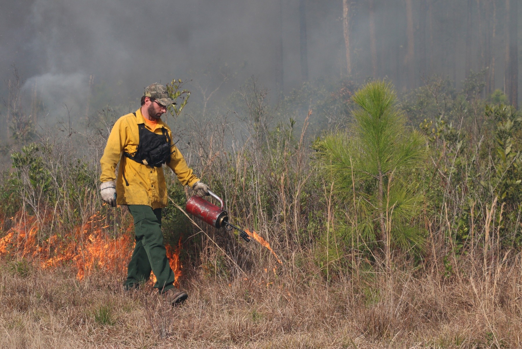
Randy Rhiner, an equipment operator with Fort Stewart’s Forestry Branch, ignites a baseline fire upwind in the base’s training area, Feb. 3, 2020. Upwind baseline fires will spread downwind until reaching areas that have been set ablaze through aerial ignition, small balls of incendiary substances dropped from a helicopter. FS Forestry Branch conducts prescribed burns, also known as controlled burns, to reduce the risk and intensity of potential wildfires, improve training areas and endangered species’ habitats.
(Photo Credit: Staff Sgt. Todd Pouliot)VIEW ORIGINAL3 / 10Show Caption +Hide Caption –
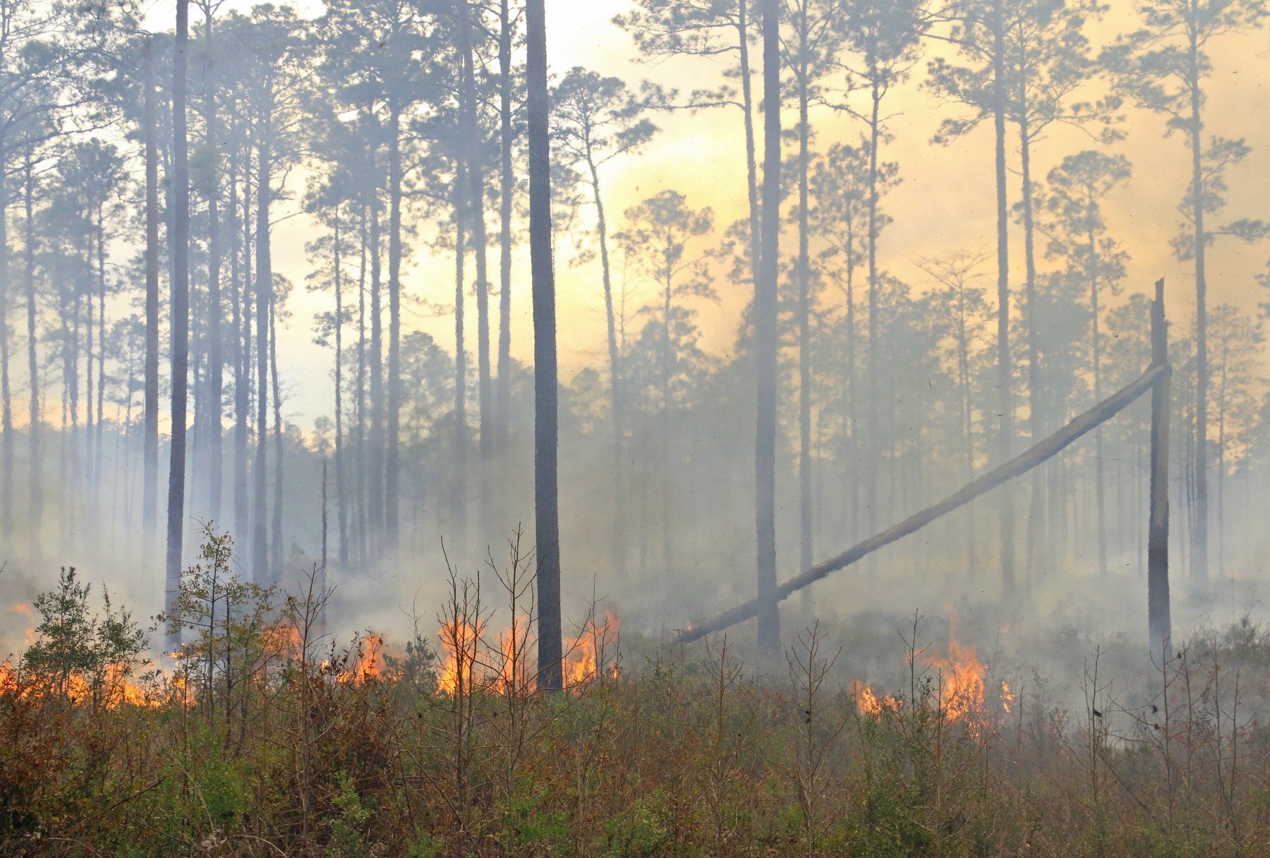
Smoke rises from a prescribed burn at a Fort Stewart/Hunter Army Airfield training area, Feb. 4, 2020. FS/HAAF Forestry Branch conducts prescribed burns, also known as controlled burns, to reduce the risk and intensity of potential wildfires, improve training areas and endangered species’ habitats.
(Photo Credit: Staff Sgt. Todd Pouliot)VIEW ORIGINAL4 / 10Show Caption +Hide Caption –
Nick Seanor, an equipment operator with Fort Stewart’s Forestry Branch, ignites a baseline fire upwind along a dirt road in the base’s training area, Feb. 4, 2020. Upwind baseline fires will spread downwind until reaching areas that have been set ablaze through aerial ignition, small balls of incendiary substances dropped from a helicopter. FS Forestry Branch conducts prescribed burns, also known as controlled burns, to reduce the risk and intensity of potential wildfires, improve training areas and endangered species’ habitats.
(Photo Credit: Staff Sgt. Todd Pouliot)VIEW ORIGINAL5 / 10Show Caption +Hide Caption –
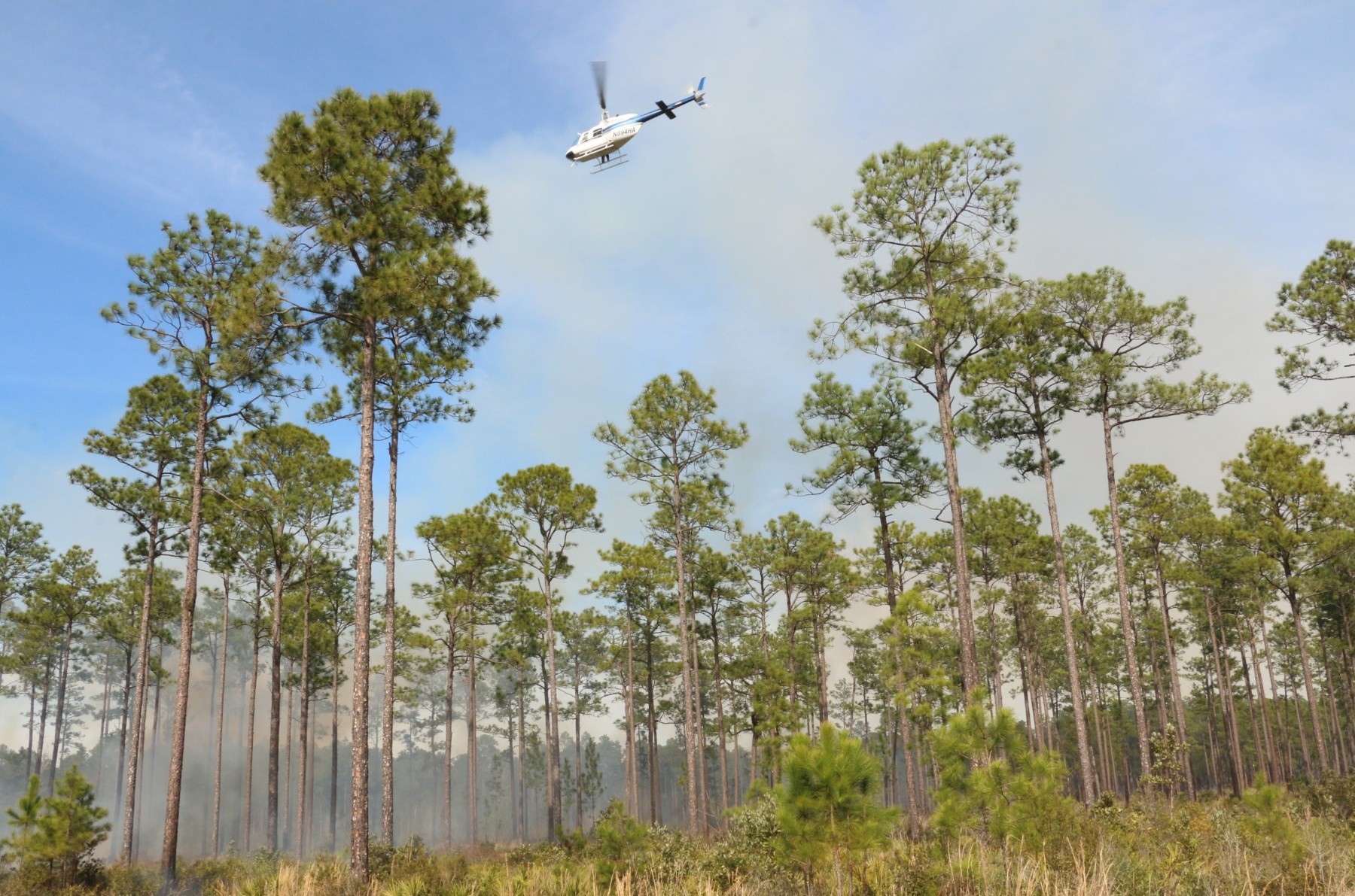
Jeffrey Wallace, a contracted pilot looks out over a prescribed burn in the Fort Stewart/Hunter Army Airfield training area, Feb. 4, 2020. FS/HAAF Forestry Branch uses aerial ignition, small balls of incendiary substances dropped from a helicopter, due to the size and rough terrain of its training areas. FS Forestry Branch conducts prescribed burns, also known as controlled burns, to reduce the risk and intensity of potential wildfires, improve training areas and endangered species’ habitats.
(Photo Credit: Staff Sgt. Todd Pouliot)VIEW ORIGINAL6 / 10Show Caption +Hide Caption –
Smoke rises from a prescribed burn at a Fort Stewart/Hunter Army Airfield training area, Feb. 4, 2020. FS/HAAF Forestry Branch conducts prescribed burns, also known as controlled burns, to reduce the risk and intensity of potential wildfires, improve training areas and endangered species’ habitats.
(Photo Credit: Staff Sgt. Todd Pouliot)VIEW ORIGINAL7 / 10Show Caption +Hide Caption –
A contracted commercial helicopter, piloted by Jeffrey Wallace, is used to drop small balls of incendiary substances to burn hardwood plants in the Fort Stewart/Hunter Army Airfield training area, Feb. 4, 2020. FS/HAAF Forestry Branch uses aerial ignition due to the size and rough terrain of its training areas. FS Forestry Branch conducts prescribed burns, also known as controlled burns, to reduce the risk and intensity of potential wildfires, improve training areas and endangered species’ habitats.
(Photo Credit: Staff Sgt. Todd Pouliot)VIEW ORIGINAL8 / 10Show Caption +Hide Caption –
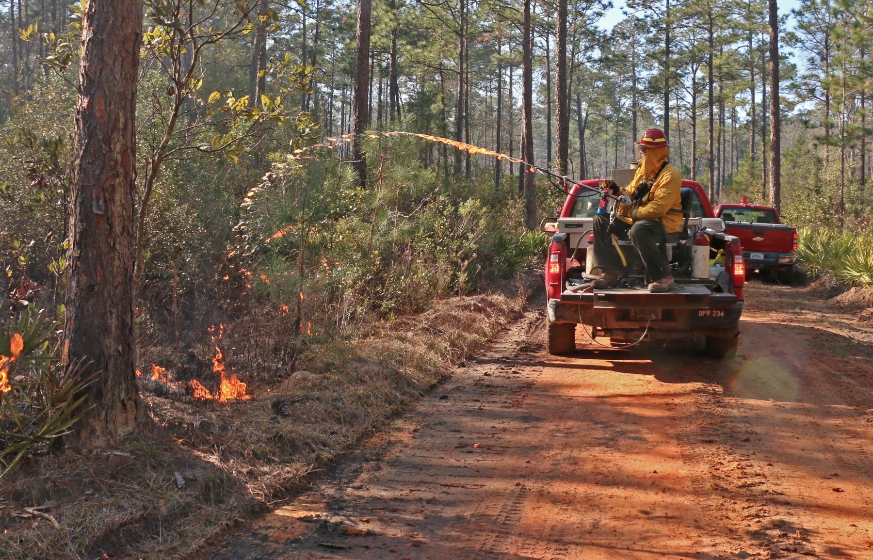
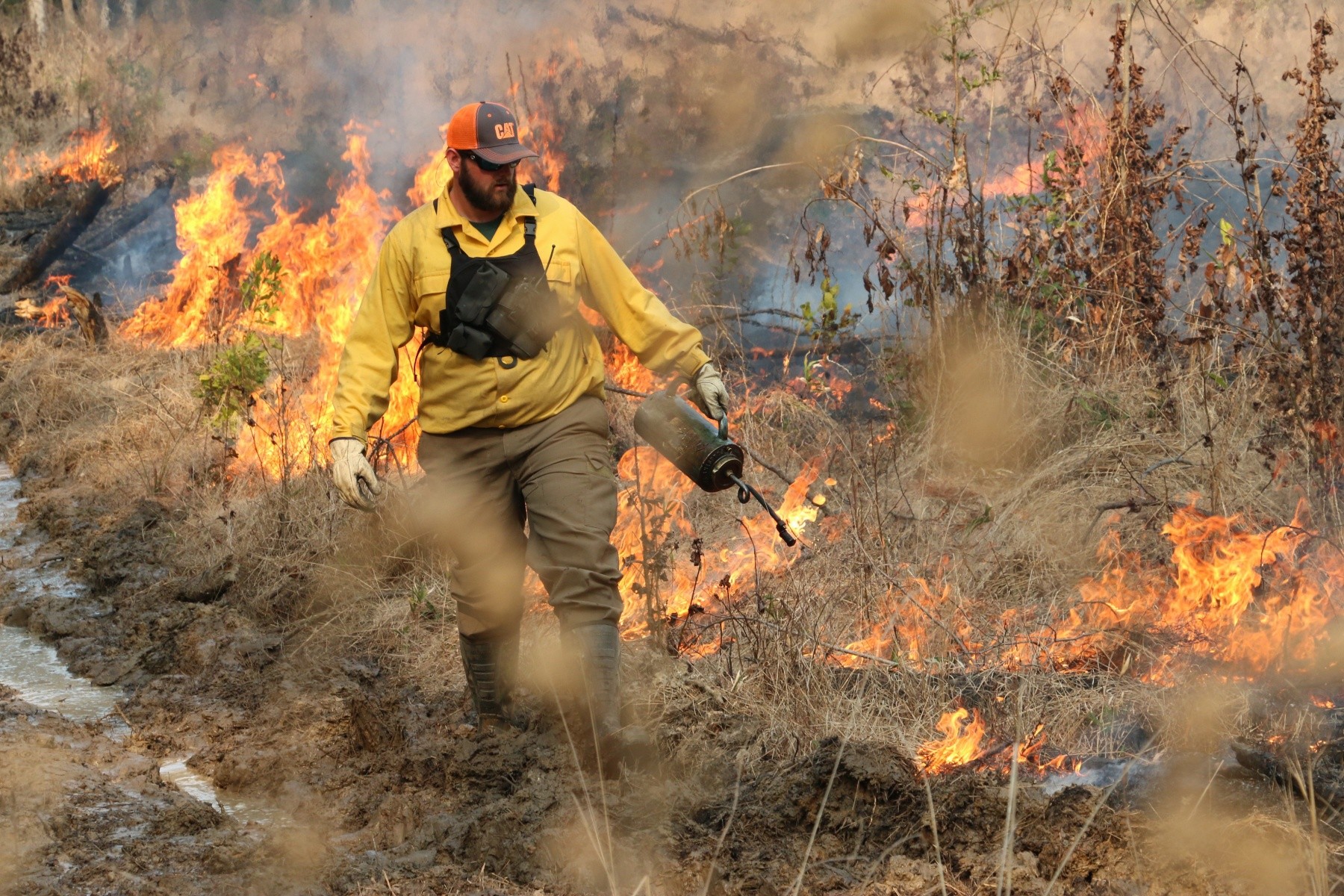
Charles Martin, an equipment operator with Fort Stewart’s Forestry Branch, ignites a baseline fire upwind along a dirt road in the base’s training area, Feb. 3, 2020. Upwind baseline fires will spread downwind until reaching areas that have been set ablaze through aerial ignition, small balls of incendiary substances dropped from a helicopter. FS Forestry Branch conducts prescribed burns, also known as controlled burns, to reduce the risk and intensity of potential wildfires, improve training areas and endangered species’ habitats.
(Photo Credit: Staff Sgt. Todd Pouliot)VIEW ORIGINAL9 / 10Show Caption +Hide Caption –
Smoke and flames rise from a prescribed burn at a Fort Stewart/Hunter Army Airfield training area, Feb. 4, 2020. FS/HAAF Forestry Branch conducts prescribed burns, also known as controlled burns, to reduce the risk and intensity of potential wildfires, improve training areas and endangered species’ habitats.
(Photo Credit: Staff Sgt. Todd Pouliot)VIEW ORIGINAL10 / 10Show Caption +Hide Caption –
Evan Strickland, an equipment operator with Fort Stewart’s Forestry Branch, ignites a baseline fire upwind along a dirt road in the base’s training area, Feb. 3, 2020. Upwind baseline fires will spread downwind until reaching areas that have been set ablaze through aerial ignition, small balls of incendiary substances dropped from a helicopter. FS Forestry Branch conducts prescribed burns, also known as controlled burns, to reduce the risk and intensity of potential wildfires, improve training areas and endangered species’ habitats.
(Photo Credit: Staff Sgt. Todd Pouliot)VIEW ORIGINAL
Seven months out of the year, large tracts of Fort Stewart training areas are intentionally set ablaze. The Fort Stewart/Hunter Army Airfield Forestry Branch works around the year to manage the largest forestry program in the Army - 139,000 acres of pine forest, 74,000 acres of forested wetlands, 58,300 acres of forest openings, and 9,600 acres of hardwood management areas. Management of these lands result in improved training areas for FS/HAAF Soldiers, improved wildlife habits, and a reduction of wildfire hazards.
From December 1 to March 30, Forestry Branch's burn season, the focus is on clearing out combustible plants from the training areas with prescribed burns, also known as controlled burns.
"We're putting fire on the ground under our terms," said Bryan Whitmore, fire management supervisor at FS/HAAF Forestry Branch. "For a wildfire, we don't have control over the weather conditions. However, with prescribed burns, we dictate the behavior of the fire."
A great deal of planning and coordination goes into conducting controlled burns to prevent smoke from blowing into populated areas, such as the Fort Stewart cantonment area, main roads, and nearby towns and cities.
Whitmore explained how fire planners start planning burns up to months in advance, coordinating with range control and wildlife branch to determine training usage and areas that must be avoided due to endangered habitats, significantly, that of the Red Cockaded Woodpecker. Most importantly, fire planners constantly monitor weather forecasts from the national weather service.
"Weather dictates when we're going to burn, where we're going to burn, and how we're going to burn," Whitmore said.
Ideal weather for burns, according to Whitmore, calls for clear skies and winds that will not push smoke into the cantonment area, major highways, or any training missions. Burns are typically conducted in the early afternoon when morning moisture has evaporated.
Most of the prescribed burns conducted by Fort Stewart Forestry Branch are executed using aerial ignition in which small ignitors are dropped from a contracted helicopter. This is due to the training areas' vast landscapes which require burning, and rough terrain, which includes large bogs and swamps.
Baseline fires are ignited upwind, either by hand using a drip torch, or a terra torch operated from the back of a truck. The wind will cause the baseline fires to move toward the fires ignited from the air. When the fires come together, they burn out as fuel eventually is completely consumed. Equipment operators are posted nearby to extinguish any residual fires.
The morning before an afternoon burn, burn bosses and the helicopter crew conduct a pre-burn briefing to plan what will happen during the day, and determine the best route for the helicopter to fly based upon expected smoke dispersion.
"We're responsible for all the resources on the ground," said Nick Seanor, a burn boss with FS/HAAF Forestry Branch. "We're also responsible for directing the helicopter from a ground perspective and making decisions based on conditions."
Not all plant growth in the training areas is desirable. In fact, other than fire-resistant Longleaf Pine, most plant growth in the training areas is potential fuel if a wildfire should ignite and spread. Large swaths of land are designated for prescribed burns to reduce the amount of fuel.
"An open, pine-dominated landscape is ideal for maneuver training, it promotes nesting of the Red Cockaded Woodpecker, and it significantly reduces the intensity of a wildfire if one should ignite," said Whitmore.
For more information about FS/HAAF Environmental Division, visit https://home.army.mil/stewart/index.php/about/Garrison/DPW/environmental


Social Sharing