


Despite thousands of artillery, tank and aviation rounds, flooding and other natural disasters that have occurred in the last 80-100 years, two houses in a rarely visited live-fire range area of Fort Knox still stand.
Just barely.
A small team of Fort Knox Environmental Management Division officials joined members of the post's Range Operations Section on a cold winter morning in early January to see for themselves what two of them had discovered the year prior using virtual mapping software and historical documents.
Cultural Resources Manager Dr. Criss Helmkamp and Compliance Branch archaeologist Niki Mills, with EMD, simultaneously were looking at a shared impact area of three live-fire qualification ranges and an aerial gunnery range when they discovered what looked like standing buildings.
"Every year, we select a number of previously identified sites to go back to and do further work to determine if they're eligible for the National Register; thus, they would warrant protection," said Helmkamp. "I was looking at sites around the installation, including some in the impact area. While I was doing that, Niki was working on our [Geographic Information System] records and validating the information for sites that we haven't been back to.
"Niki commented to me, 'I think I see buildings on this layer.'"
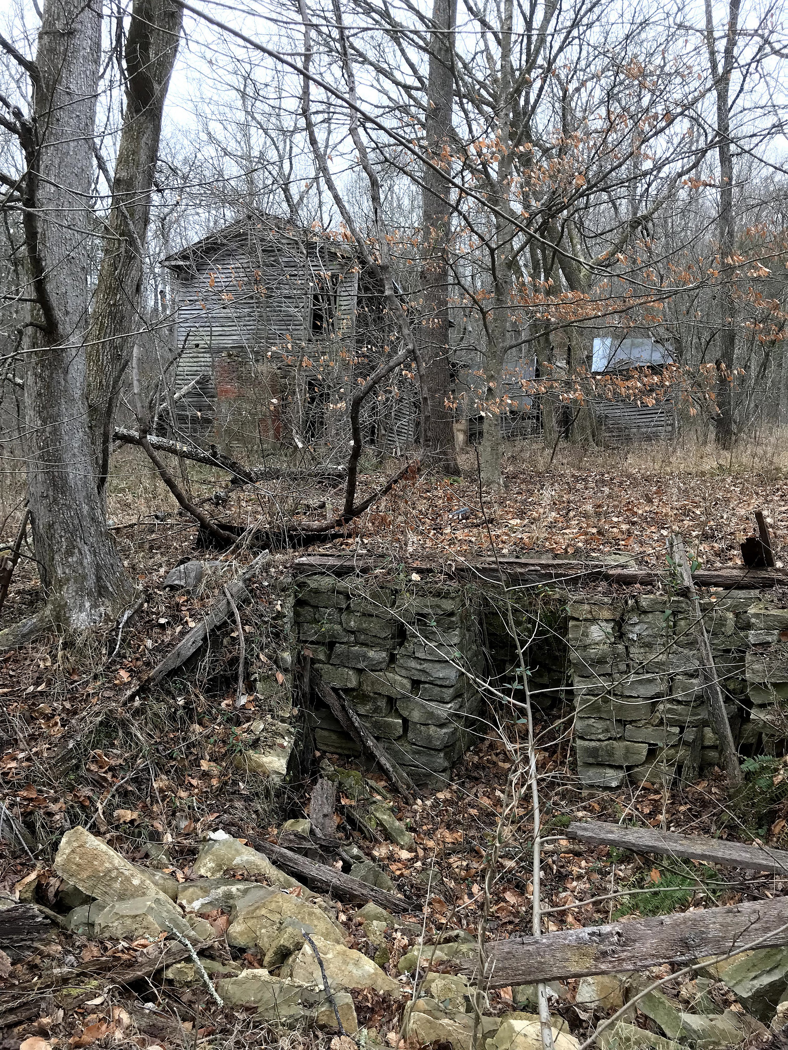
Known as Site 15BU404, the location is tucked within a wooded pocket that has a rugged mountainous range to the south and the Salt River to the north. Helmkamp said they were shocked when they realized there might actually be houses and barns still standing in the area.
"This just doesn't happen here," said Helmkamp. "These sites were purchased by the government in the early 1940s. They've been abandoned, and they're in the impact area; their chance of surviving is almost nil."
Using complex remote surveying methods known as Light Detection and Ranging, or LIDAR, Mills said she is able to measure distances of light and shadowy shapes and areas on a map to get a better understanding of what might be on the ground.
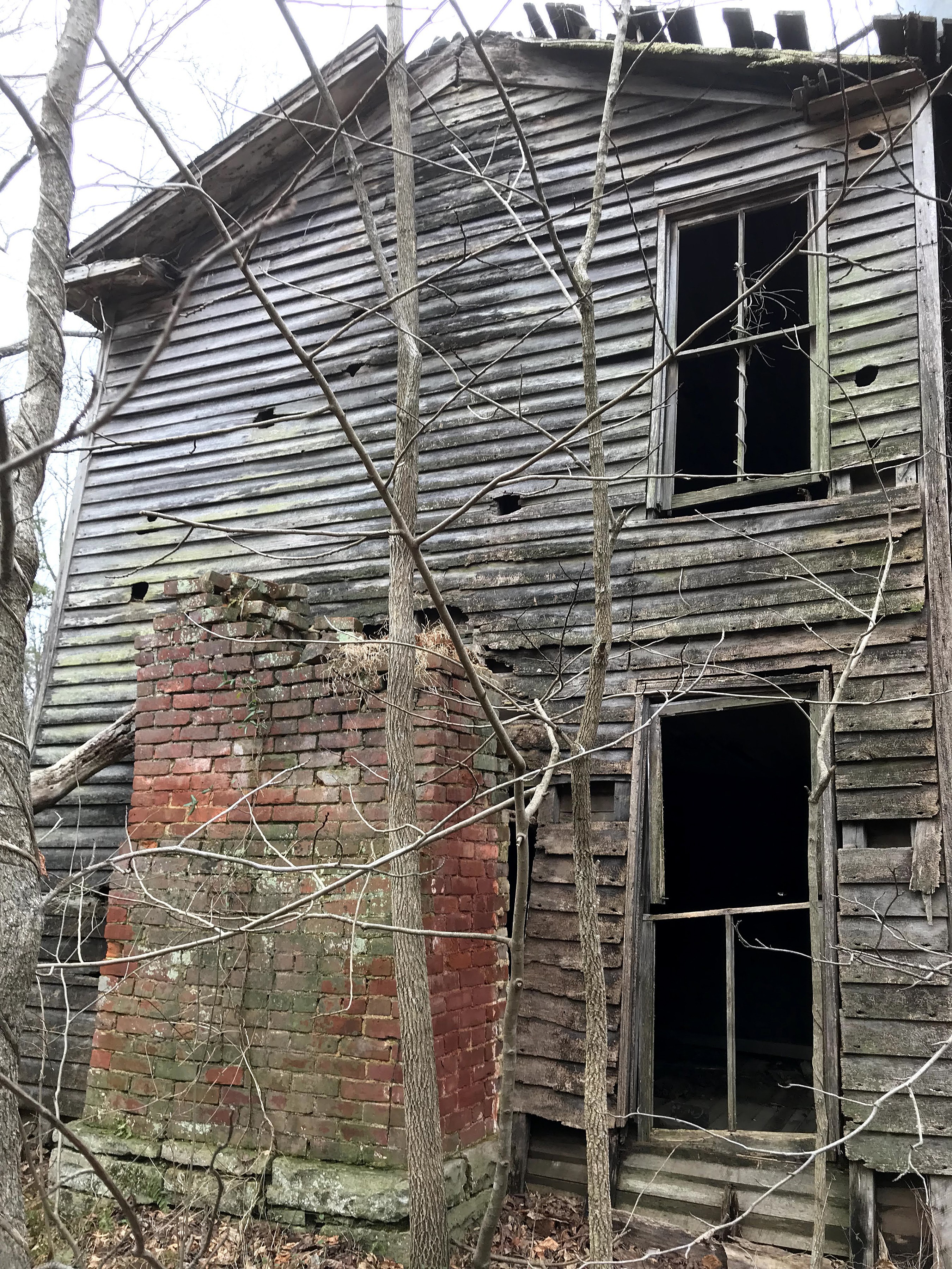
Still, Helmkamp said he would need to walk the ground to see for himself. When they did, they found an old two-story home, a flattened barn, what once was a root cellar, and a nearby one-story home at Site 15BU402 that Helmkamp suspects to have been a wedding gift for a son.
Mills said one sign of a home in the area were the distinct lines of farming rows. Helmkamp said the area necessitated the lines.
"This is a poorly drained area with rivers and all the creeks," said Helmkamp. "In order to have a viable base for crops they had to literally raise the strips of ground; they would furrow soil up into a raised platform. It's amazing how they stand out on the LIDAR."
Mills explained how effective LIDAR can be in identifying developed land.
"A lot of times you can even find property boundaries based on the field boundaries," said Mills.
Hundreds of area farms were acquired by the U.S. government in the early '40s in preparation for World War II, said Helmkamp. Common practice for the Army then was to demolish the houses in preparation for using the land to train and qualify Soldiers.
The few houses that escaped destruction would often get incinerated by range fires or destroyed by natural disasters. One disaster occurred in the 1980s, when the nearby town of Pitts Point caught fire, destroying every building in the town and a lot of woods nearby.
"To our knowledge, these are the only ones still standing," said Helmkamp. "These sites are in a unique area."
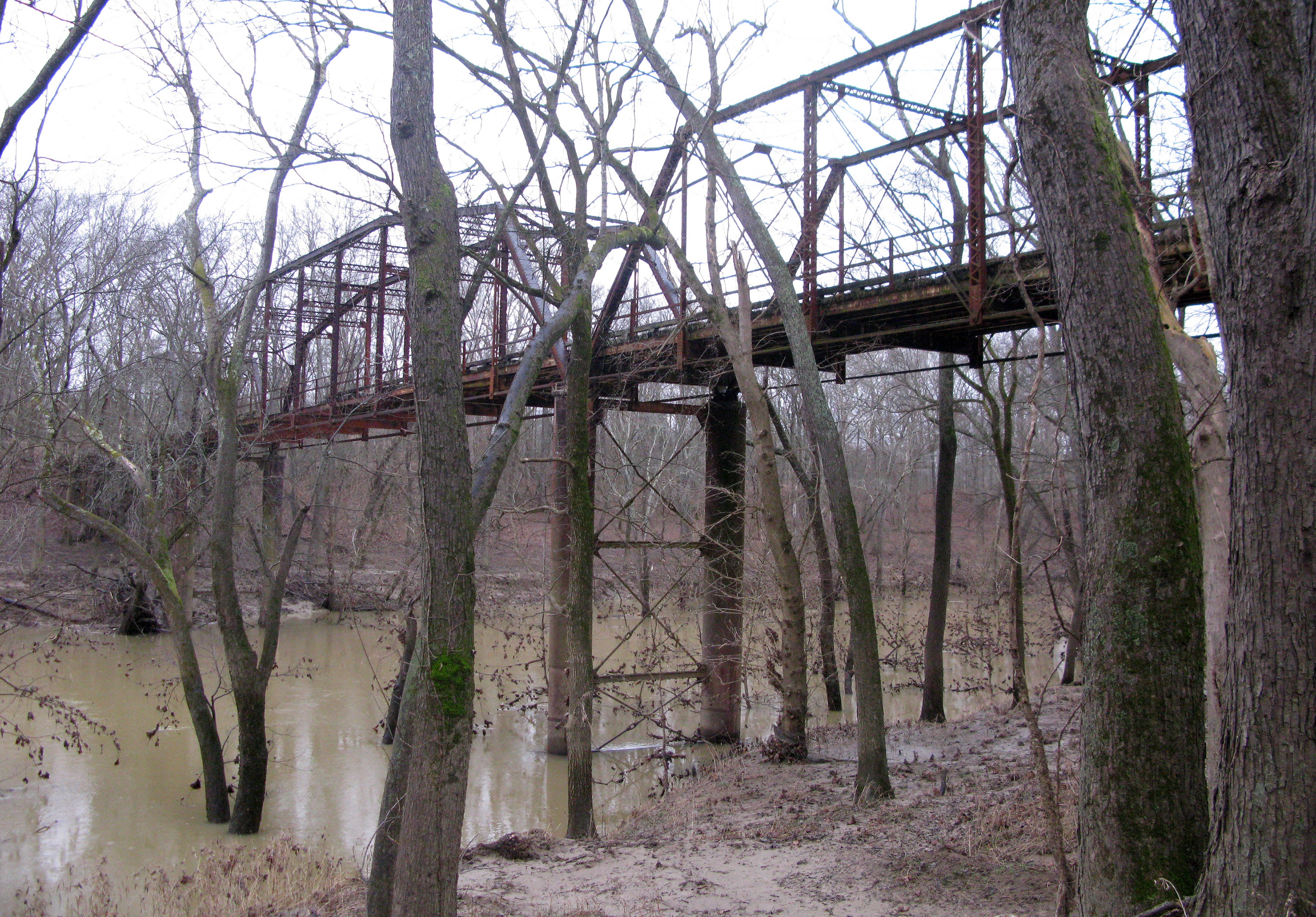
Based on the construction quality and size of the two-story house, a nearby ferry bridge that still stands, and features in and around the home, Helmkamp said the people who owned it would not have been considered poor.
"It was a grand place in its time," said Helmkamp. "For this area, that's about as nice as it gets."
Helmkamp said he and Mills rediscovered an archeological survey conducted by the University of Kentucky in 1979-80, in which they explored the area with ground guides and documented several buildings standing at that time. Once they saw the buildings using LIDAR, they dug into archived records and found the surveys.
"We hadn't really paid attention to the surveys because we knew we couldn't get in to do anymore work, and we didn't think anything was endangered," said Helmkamp. "The structures back then were in really good shape. Since then, a tree has fallen on the barn and the houses are beginning to crumble."
Mills noted that the barn was still standing as of 2006. In 2017, the area experienced severe flooding, which could have caused the tree to fall on the barn.
While there is no way for them to preserve the buildings because of dilapidation and their precarious location with unexploded ordnance dotting the land, Helmkamp said the site visit still provided them a lot of information.
"It's interesting to us as archaeologists to see how a site transforms just through natural processes," said Helmkamp. "We've learned a lot about what we see in the archeological record and being able to then see it in an above-ground site. This gives us insight into a prosperous community that was like an extended family, and how they expanded through time.
"It also gives us an idea what to look for next time."
Related Links:
Read more Fort Knox News here.
Social Sharing