WASHINGTON (Army News Service) -- Securing port entry is vital to moving supplies, weaponry and personnel inland from ship to shore.
But if the dock or pier is damaged from storm or sabotage, getting it quickly repaired can be dangerous work for Navy or Army divers, said Jonathan Marshall.
At locations around piers, water can be murky, and jagged obstacles underwater can pose a threat to divers, Marshall said. Also, he said, it's difficult in such conditions to get a good visual image of what lies beneath the water.
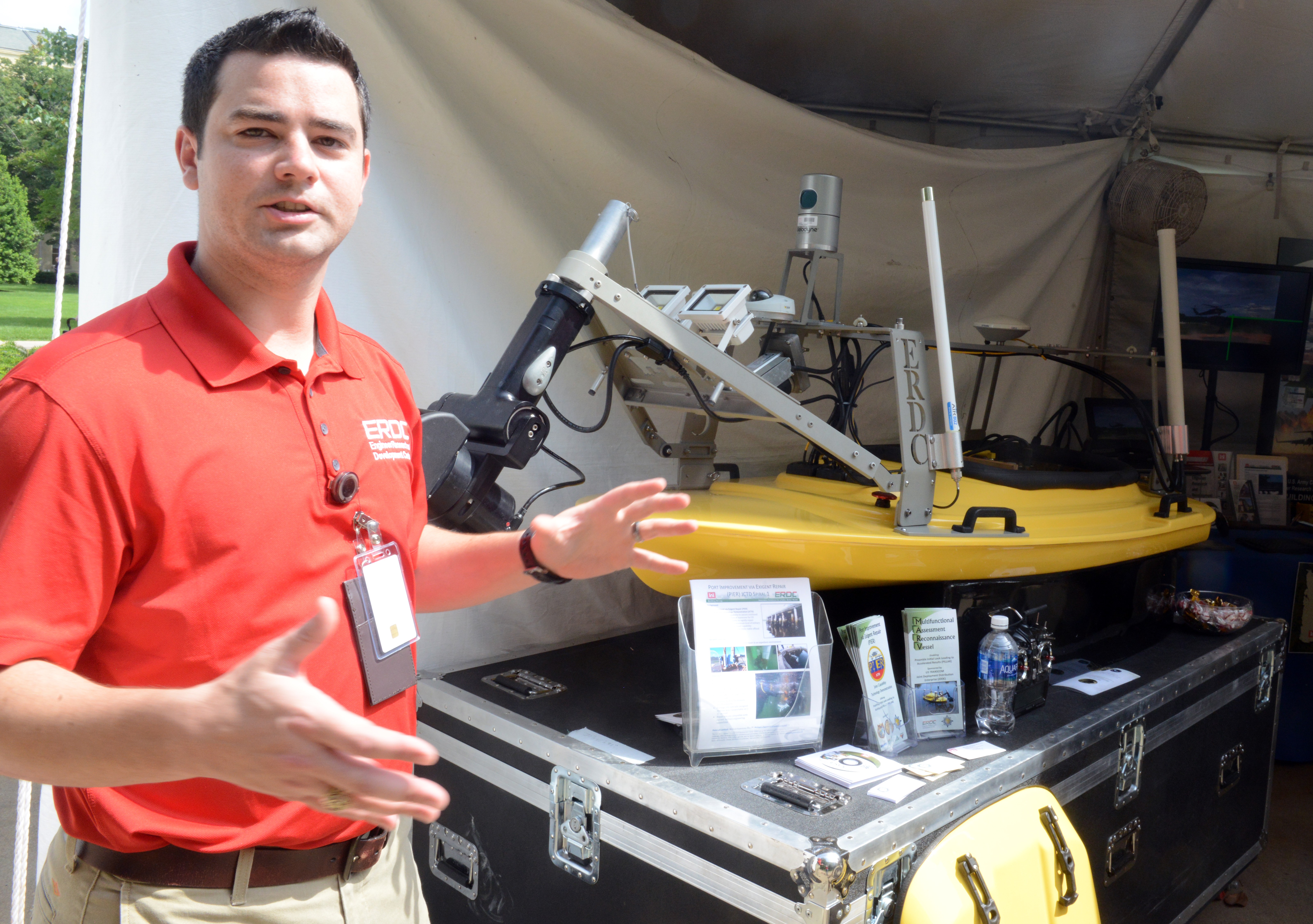
As a research engineer with the Coastal and Hydraulics Lab at the U.S. Army Engineer Research and Development Center in Vicksburg, Mississippi, Marshall spoke last month at the Pentagon's lab day.
Marshall said that the U.S. Transportation Command and U.S. Pacific Command asked ERDC to come up with a solution to the challenges involved with performing dock repair. PACOM's area of responsibility includes a vast maritime domain stretching across the Pacific to the Indian Ocean. The area is home to many allied nations, so access to ports there is vital, he said.
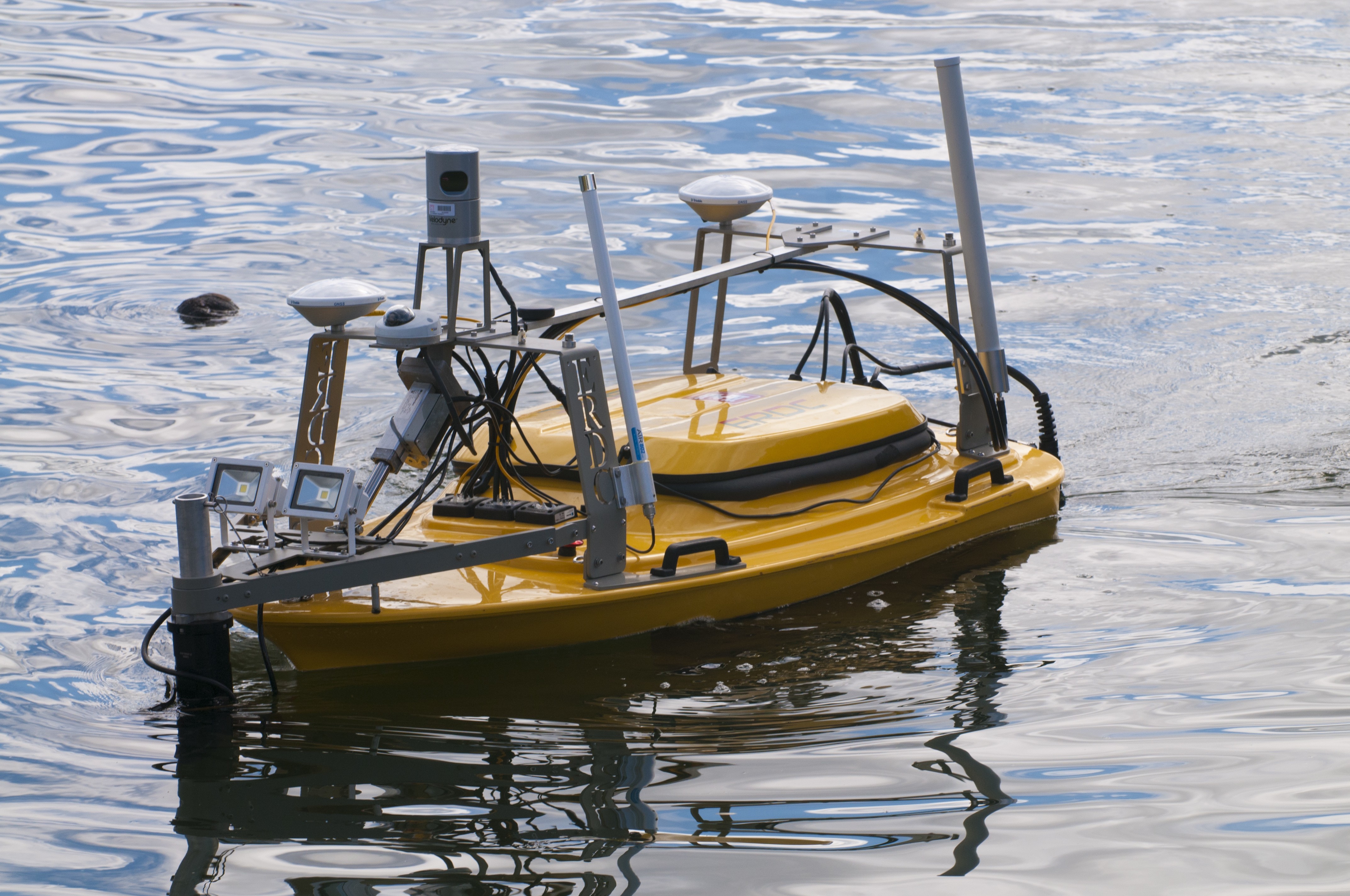
The lab came up with a solution -- an unmanned vessel called the Multifunctional Assessment Reconnaissance Vessel, or MARV, he said.
MARV is a six-foot-long, three-foot wide vessel designed to travel with a four-man team for rapid deployment and assessment of pile-supported marine structures, Marshall said. The MARV and its team are able to assess piers for structural damage or obstacles within 24 hours, a process that normally can take weeks.
The remotely-piloted MARV can be operated from as far away as one mile, scanning below the surface of the water as well as above, he said. Among other equipment onboard, the MARV is equipped with a Velodyne HDL-32E LIDAR, which beams out 32 laser pulses in multiple directions to measure distances.
These light pulses generate precise, three-dimensional data and software translates that information to a high-resolution graphic which can be seen on a computer screen, Marshall said.
Additionally, MARV comes with a Ricoh 12-megapixel multifunction camera for digital imagery.
A third method for generating imagery is a BlueView BV-5000 multi-beam sonar, he said. Sonar, short for sound navigation and ranging, is often used to map the ocean floor, because sound waves travel farther in the water than do radar or light waves
To accurately position the MARV, GPS is used, along with a Greensea inertial navigation system. This system uses an accelerometer and gyroscope to increase the accuracy of GPS to within two centimeters, Marshall said.
Currently, the MARV has had 18 months of rigorous testing by Army and Navy divers, much of it in the waters around Hawaii. While it's still too early to determine if the MARV system will become part of the Army and Navy toolkit, Marshall said the effort to move to more autonomous devices such as MARV could save lives by keeping service members from doing jobs in hazardous areas. It could also greatly reduce costs and speed up military operations.
(Follow David Vergun on Twitter: @vergunARNEWS)
Social Sharing