FORT BENNING, Ga., (Oct. 26, 2016) -- The Maneuver Battle Lab hosted the Technical Cooperation Program for a week of testing unmanned aircraft systems at the McKenna Urban Operations Complex Oct. 17-21.
Specialists from Canada, the United Kingdom and Australia also participated in the weeklong testing.
Keith Singleton, the chief of the unmanned systems team at the Maneuver Battle Lab explained that the Technical Cooperation Program allows for the English speaking countries to collaborate on UAS technology and mapping systems.
"This is a great opportunity for sharing ideas and cooperating between countries," said Singleton.
"We've had a great time," added René Desgagnés, Senior Software Engineer with Defence Research and Development Canada. "The (Battle Lab) has a lot to offer."
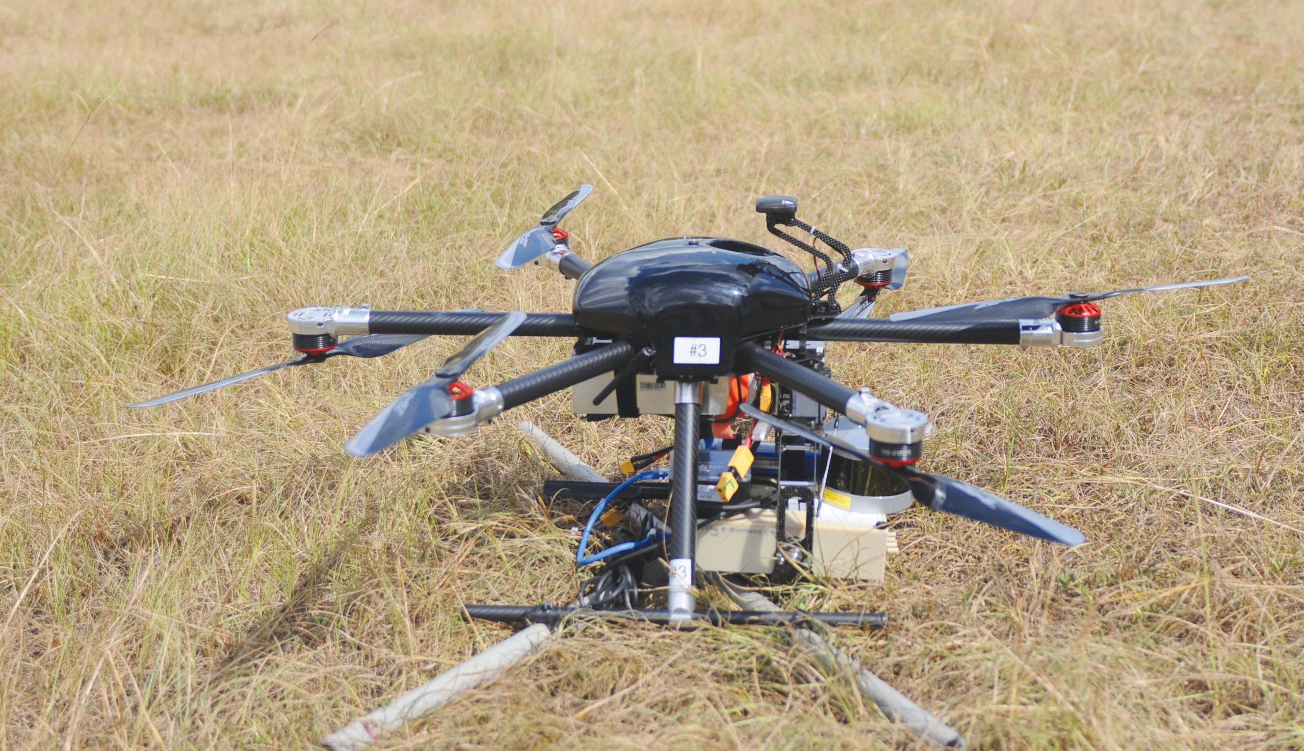
The teams participating in the program spent the week flying two UASs-one with six rotor blades and another with four-around the Urban Operations Complex in order to map the buildings.
"What we are doing is a mapping exercise," said Tim Condon, the Autonomy and Teaming team lead with Aviation and Missile Research, Development, and Engineering Center-Aviation Development Directorate. "We are flying these aircrafts with different payloads in and around the MOUT site to create different kinds of maps."
Condon explained that they created maps using a regular commercial camera, and one with a LIDAR sensor, which uses the light from a laser to measure ranges.
"What they are really looking at is testing the military utility of these small UASs in an urban environment," Condon added.
"The people who run TTCP decided they wanted to have a focused science effort. They have a bunch of them but one of them is the contested urban environment or CUE," said Simon Monckton, a Defense Scientist with DRDC.
"CUE has a whole bunch of different things going on but one of the things we recognized was the difficulty of getting maps of urban areas after the conflict has started or during it," said Monckton. "It is easier to get them beforehand when everything is pristine, but then everything falls apart."
Monckton explained that the idea was to find a way of mapping these contested urban environments using LIDAR and cameras, while flying as low as possible and getting high resolution visuals.
Monckton added that using a consumer camera has its advantages and disadvantages, as is also the case with using a LIDAR sensor.
"We are testing out different kinds of flights, trying to build up complexity and understand how hard it would be to fully automate these kinds of flights," said Monckton. "Right now they are not fully automated. The flights are planned ahead of time as a (computer) program."
Monckton explained that right now they are just collecting the data and that the United Kingdom is providing the software to bring the data together. He added that the camera data and the LIDAR data will be combined to fill in the gaps and get a clearer picture of the terrain.
"It's been very good (here)," said Monckton. "The facilities are great and the support has been fantastic."
Social Sharing