

This story originally ran in the August 17, 2011 issue of the Bavarian News.
OBERSTDORF, Germany -- Low hills planted with corn and barley cover most of Bavaria. But there still exists a storybook version of Europe just a few hours to the south in the snow-capped, high-soaring Alps.
Instead of navigating massive crowds at Neuschwanstein castle or paying the pricey summertime rate at mountaintop chalet hotels, there's a cheaper and more thrilling way to sink your teeth into Europe's largest mountain range.
The E-5 is a long-distance hiking path that leaves from southern Germany and continues almost 400 miles to the Italian coastal city of Verona. By far, the most popular segment of the trail is a 150 mile stretch that crosses the heart of the Alps from Oberstdorf (in Germany, just 50 miles from Garmisch-Partenkirchen) to Merano, Italy.
By taking 10 days to hike this leg of the trail, you'll travel through three countries and see the untapped, peaceful side of the Alps that most people miss.
Intimidated? Don't be. For starters, remember that Europe is densely populated. Unlike a backwoods trip in the mountains of the U.S., you won't need to carry a tent and sleeping bag, portable stove or weeks' worth of food and supplies.
Carrying nothing more than a couple changes of clothes, rain gear and sturdy boots, you can travel for weeks through the Alps at relatively little cost.
Cozy mountain houses, known in German as "Alpen Huette," dot the Alps. These "huts" are actually massive stone buildings with group bunks, private rooms and full-service restaurants.
When not sleeping in these remote huts high on mountain peaks, you'll also pass through civilization every day or two in the form of well-stocked Alpine villages complete with grocery stores, Internet, laundry and other creature comforts.
Starting in Oberstdorf, the path takes you up and over several mountain ridges. By the end of the second day, you will cross from Germany into Austria and onto the highest section of the trail.
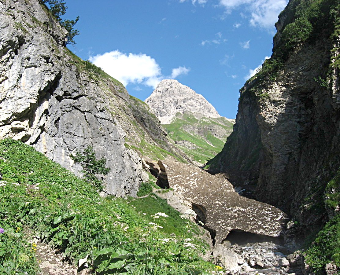
Traveling through Austria's fairly empty western panhandle, you may spend five hours in steep-sided canyon without seeing anyone, save for a few grazing cattle or darting wild ibex.
The highest point of the trail is the Pitztaler Jochl, in an Austrian branch of the mountains known as the Oetztal Alps. With the help of bolted steel cables, you climb above the tree line along a craggy trail nearly10,000 feet above sea level.
Even in the depths of summer, snow may fall at that elevation, but fear not. The huts will have roaring fires and will serve heaping plates of hot food.
Once you cross into Italy, you'll be on the home stretch and in the most pleasant part of the hike. Sun-baked hillsides, Mediterranean cuisine, top-notch coffee and a culture not entirely German nor Italian are just a few pleasures in this German-speaking corner of Italy.
To prepare:
To prepare for the trip, visit a German bookstore or search online for maps of the "Europaeischer Fernwanderweg E5." The map breaks down the stages of the hike into manageable distances of six and eight hours of walking per day. The map should be detailed and show elevation changes. Always carry a compass.
It's best to arrive in Oberstdorf by train so you walk in only one direction. At the end of the hike in Merano, Italy, you can easily catch a train back to Germany.
Budget time in a mountain village every few days to give your feet a chance to rest and to soak up the serene Alpine life.
As a hiker, you benefit from membership in the German Mountaineers club known as Deutscher Alpenverein (DAV), which cuts accommodation costs at the huts in half.
With DAV membership private rooms at huts run around €12 per person, per night, and beds in mass bunkrooms can be as cheap as €9 per person, per night. When staying in small villages, expect to pay around €25 per person, per night for rooms in cozy guesthouses that include breakfast.
Though accommodation is inexpensive, the only way food reaches the remote huts is by cable car, which drives up the price of meals. Though the restaurants aren't fine dining, they aren't dirt cheap either and costs can pile up if you eat every meal in a hut. You'll save money by visiting grocery stores or eating at restaurants in villages.
During the hike you'll see a more untouched Europe and rural life that rarely exists anymore. Farmers and woodcutters still wear lederhosen daily because the leather pants are the best clothing for the rugged work in the hills.
The hiking trail is almost entirely utilized by Germans and Austrians, and Americans are a rarity.
Though a trip along the E-5 isn't your typical European vacation, a hiker who would be interested in spending two weeks in rustic mountain hamlets and summiting jagged ridgelines probably isn't your typical vacationer, either.
Social Sharing