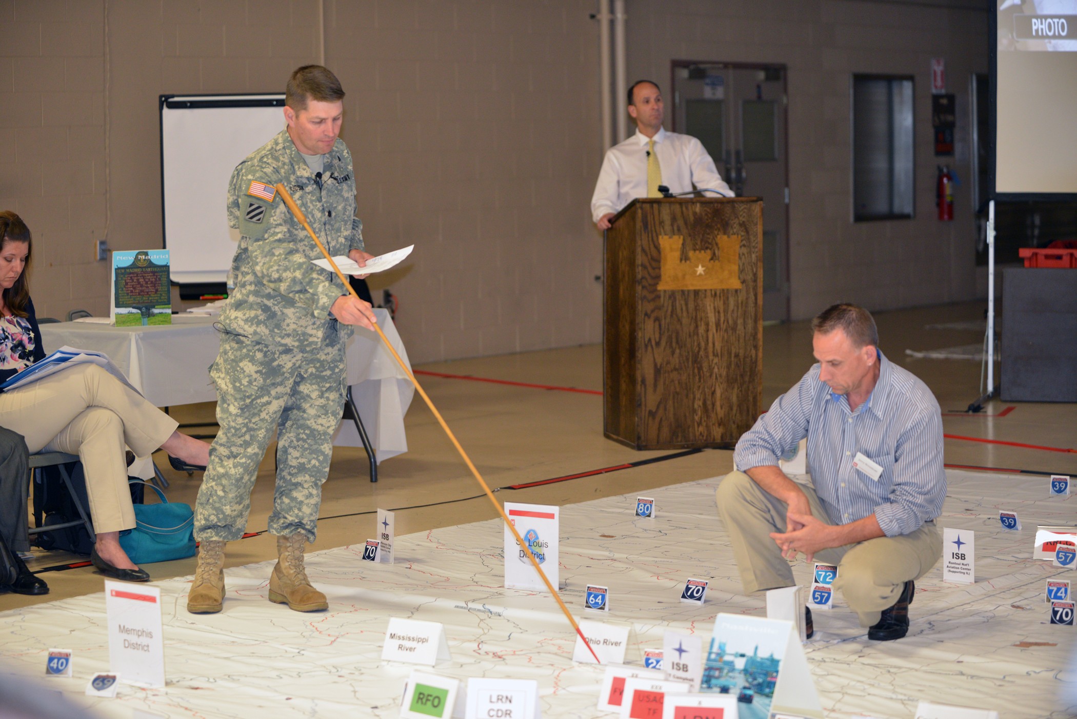
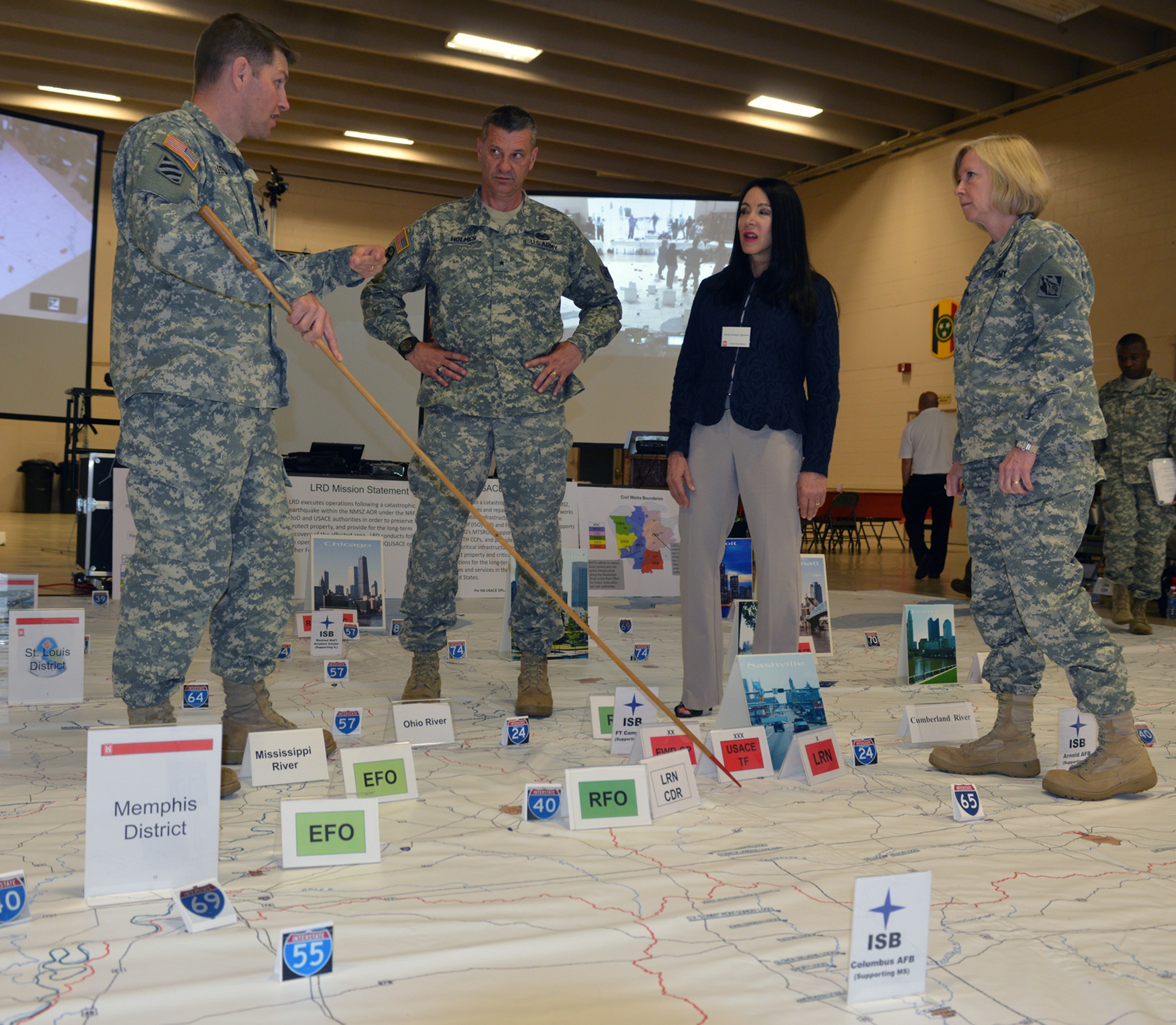
JACKSON, Tenn. (May 12, 2014) -- Emergency management officials moved pictures and signs, much like game pieces on a large board game, on a 24-by-24 foot floor map of the New Madrid seismic zone May 8, 2014 at the National Guard Armory in Jackson, Tenn. The exercise simulated an emergency response in the event of a major earthquake.
Led by the Great Lakes and Ohio River Division in Cincinnati, Ohio, the exercise provided disaster preparedness personnel and emergency managers an opportunity to rehearse their roles and response plans.
Brig. Gen. Margaret W. Burcham, Great Lakes and Ohio River Division commander, said that preparing for a catastrophic earthquake along the New Madrid fault is a priority of the Corps of Engineers and its many different federal, state and local partners in the region.
"When agencies share information and participate in exercises it puts us on the same page," said Burcham. "It is encouraging to know how much planning and work each agency has put into this exercise to share information and we appreciate that."
The New Madrid Seismic Zone experienced numerous large earthquakes in 1811, which wiped out the town of New Madrid, Mo., caused permanent changes in the course of the Mississippi River, caused large areas to sink, drained lakes and created new ones, and destroyed 150,000 acres of forest. Science suggests additional catastrophic seismic events become more likely as time passes.
In anticipation of future seismic activity, Corps representatives from the division, Chicago, Nashville, Detroit, Buffalo, Pittsburg, Huntington, and the Mississippi Valley and North Atlantic Divisions were present. As well as liaisons from the Army National Guard and Reserves, U.S. Geological Survey, Jackson-Madison County Emergency Management Agency, local emergency responders, and Tennessee Emergency Management Agency used the map and discussed each organization's capabilities, responsibilities and contributions.
Dr. Randall Jibson, a representative from the USGS in Golden, Colo., attended the exercise and briefed everyone on earthquake data potential hazards and presented facts in the likelihood of a earthquake with a magnitude of 7.0 or greater in the next 40 to 50 years.
"I think a picture of an earthquake in the mid-continent is capable of doing widespread damage and threaten Alabama, Tennessee, Kentucky, Arkansas, Illinois, Indiana, Mississippi, and Missouri.
By discussing the various issues raised during earthquake preparedness and response, discussion is intended to develop a common understanding of the capabilities, expectations and functions of participating organizations.
Lt. Col. John L. Hudson, U. S. Army Corps of Engineers Nashville District commander, explained the district's expected role in the aftermath of a major earthquake given its close proximity to the New Madrid Seismic Zone.
Hudson said being able to map out the emergency response is essential because emergency responders require quick access to affected areas using navigation on waterways and via roadways within the first 24-to-48 hours.
"It is important for us all to have a common picture of how the events will play out," Hudson said. "Exercises like this are great because it builds our support for each other and help react in a time of need and working together in this manner results in more effective and successful responses in the future that affects moving logistics, assets and developing a plan to respond to the disaster quickly."
With large cities like Memphis, St. Louis, and Nashville well within range of a large-scale New Madrid earthquake, understanding the science of earthquakes and the area's geologic history helps communities prepare for earthquake hazards and prevent them from becoming catastrophes.
Veteran disaster experts like Cecil Whaley, director of plans, mitigation and exercise for the Tennessee Emergency Management Team, and Marty Clements, director for the Jackson Madison County Emergency Management Agency, have been teaming up and attending meetings and briefings for years for potential disasters and emergency situations, and they recognize the value of training, earthquake preparation, and communication between statewide agencies.
"With more than 40 million people living and working in the region today, a major earthquake would cause widespread damage and disruption to our lives, so this exercise helps us emergency responders have communication between agencies and most of all, a plan," said Whaley.
Using the large map detailed with cities, districts, bridges, roads, navigable rivers, military installations, and interstates helped set the stage for the scenario and provide a graphic backdrop of a catastrophic earthquake.
"Based on history, it's good that we all paying attention, because there is pressure on the plates now," Clements said. "Look at all the events that are happening around the world. Sooner or later, it's going to come our time."
Officials say when it does, Jackson will be a major player, either as a crippled city needing aid from outside sources, or as a staging area to help Memphis recover from disaster.
Clements' worst fear is the scenario when chaos strikes, lives are on the line and first responders are stretched thin.
"Hurricanes are bad because of the winds, the water and flooding," Clements said. "And we've seen the (destruction caused by) winds in tornadoes. But the earthquake is the worst, because it does so much damage to so many things."
Ms. Karen Durham-Aguilera, U.S. Army Corps of Engineers director of Contingency Operations and Homeland Security, also contributed to ironing out the various processes involved with a coordinated response between the federal, state and local partners.
"I think the take away from this exercise is that when agencies communicate and work together, developing plans become much easier," said Aguilera.
Tom Howko, emergency management specialist and exercise coordinator for the Great Lakes and Ohio River Division, said the two-day event opened lines of communication and provided great information for everyone attending. He said the large-scaled map placed on the floor set a good stage for agencies to understand their boundaries and responsibilities.
"Our main objective here today is to communicate, develop future plans, and provide insight to other agencies of the Corps navigation, communication and response to the New Madrid Earthquake, which will save lives, prevent additional property damage, and restore navigation back so we can get the communities back to normal as quickly as possible," Howko said.
Hudson said the goal of the exercise is to improve overall preparedness to respond to a catastrophic earthquake occurring in the central United Sates through candid, solution-focused discussion. The goal of the exercise was simply to seek solutions that will lead to mutual success in future responses, he added.
The New Madrid Seismic Zone extends 150 miles southward from Cairo, Ill., to Marked Tree, Ark., dipping into Kentucky near Fulton and into Tennessee near Reelfoot Lake, extending southeast to Dyersburg. The zone crosses five state lines and crosses the Mississippi River in at least three places. It poses the greatest earthquake risk east of the Rocky Mountains, according to the Center for Earthquake Research and Information at the University of Memphis.
Jackson is about 70 miles southeast of the Reelfoot Lake area where a magnitude 8.0 or greater earthquake occurred on Feb. 7, 1812. That was the third and strongest quake in a series that began Dec. 16, 1811.
"We have to make sure we are ready and do everything possible to make sure we are ready to respond," said Hudson. "Meeting a liaison from each agency and understanding the capabilities of each will allow us to work together more effectively, and efficiently to accomplish maybe one the largest missions the U.S. will have ever seen," said Hudson.
(The public can obtain news, updates and information from the U.S. Army Corps of Engineers Nashville District on the district's website at www.lrn.usace.army.mil, on Facebook at http://www.facebook.com/nashvillecorps and on Twitter at http://www.twitter.com/nashvillecorps.)
Social Sharing