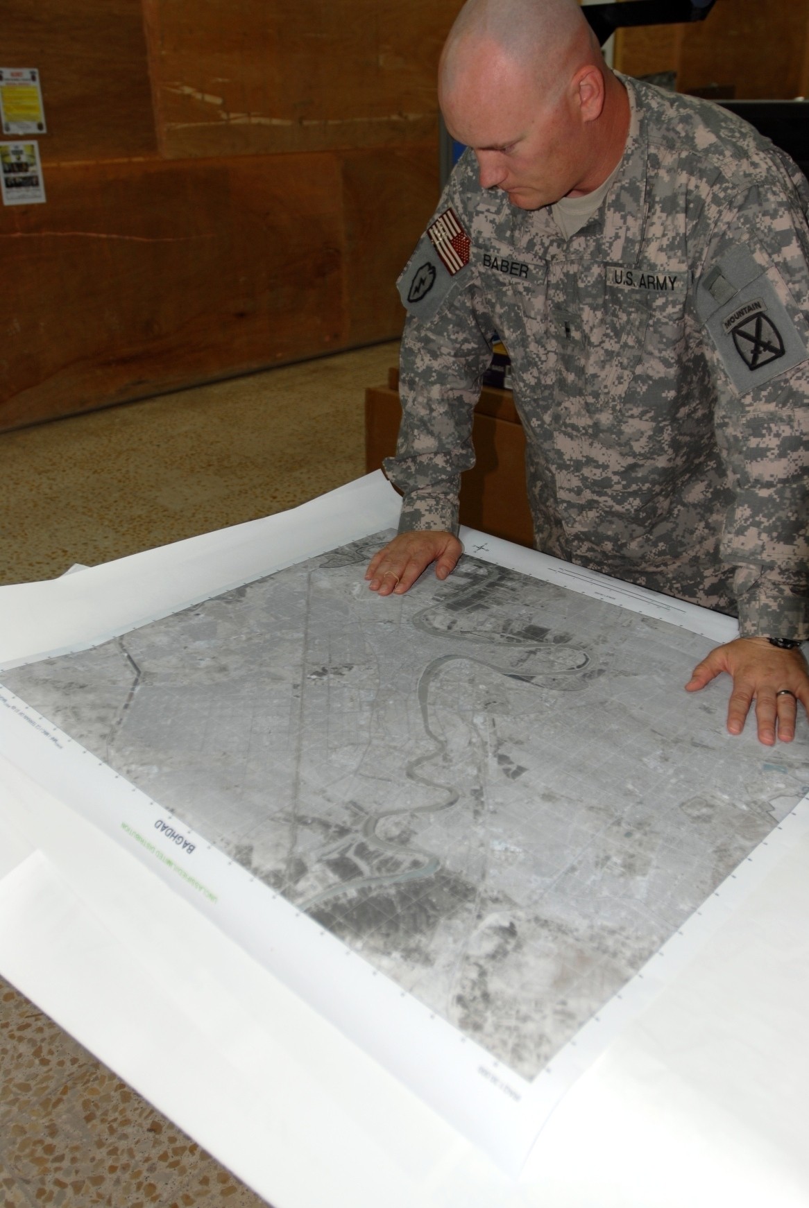
CAMP VICTORY, Iraq (Army News Service, Aug. 18, 2008) -- When it comes to mapping out mission success in the Multi-National Division - Center area of operations, there's only one place to begin - the topographic section.
"We provide geospatial support and information, as well as tailor-made products to support mission planning," said Warrant Officer 1 Mike Baber, MND-C geospatial information and services officer-in-charge. "We support all the brigades in MND-C."
Baber and his team quickly create maps based upon the demands and needs expressed to them. Depending on the degree of detail included, these maps can take anywhere from two hours to complete, up to a week-and-a-half.
"Commanders need to be able to plan missions, while being able to visualize the area of operations as well as possible," added Baber.
But it's not only MND-C units that have asked for maps. Baber's team has also made maps for the Iraqi Army since arriving in May.
"So far, we've disseminated more than 4,000 products," he added.
Topography is the study of the earth's surface features. To prepare themselves to make high-quality maps, Soldiers attend 17 weeks of Advanced Individual Training at Fort Belvoir, Va. Baber also personally teaches his Soldiers a few classes covering topics not taught in AIT, as well as making sure they all get some extra classes about satellite imagery.
These skills are very valuable for the civilian employers, making topographic specialists very marketable when they leave the service, especially if they have a security clearance, Baber said. Their knowledge of complicated equipment is in high demand.
The MND-C topography section uses digital topographical support system - light and digital topographical support system - deployable, two Army fielded systems, as well as global broadcast systems and computers custom built by Baber to execute their mission.
"The map data we use can be extremely large," Baber said. "We need a lot of processing power to render the information used in them."
All of the maps created are hand-made, built to the specifications requested.
"We don't manufacture regular maps - we make special products. We make maps for specific missions," he added.
A lot of the information they use in their maps is from Soldiers' experiences and observations in the area of operation, such as washed away bridges or route disruptions.
"We use things that a Soldier on the ground can see," Baber said. "Every map we make is basically made by these Soldiers based on what they report."
Baber and the other eight Soldiers on his team understand their importance in helping Iraqi Security Forces ensure continued stability in the country.
"We're helping the U.S. and Iraqis. They are planning their operations and carrying out their own missions. We can someday leave this country knowing the ISF has a firm grasp on what they have to do to be successful," he said.
Social Sharing