REDSTONE ARSENAL, Ala. -- One U.S. Army Space and Missile Defense Command/Army Forces Strategic Command team member is using technology developed by the command to help direct emergency responders during natural disasters.
Recently, Justin Novak, USASMDC/ARSTRAT Future Warfare Center Innovative Ventures Office, travelled across the nation from January through April to help different geographical locations prepare for emergencies using the Eagle Vision/ROVER Responsive Exploitation of Space Products for Tactical Use (EVR2EST), pronounced "Everest," system.
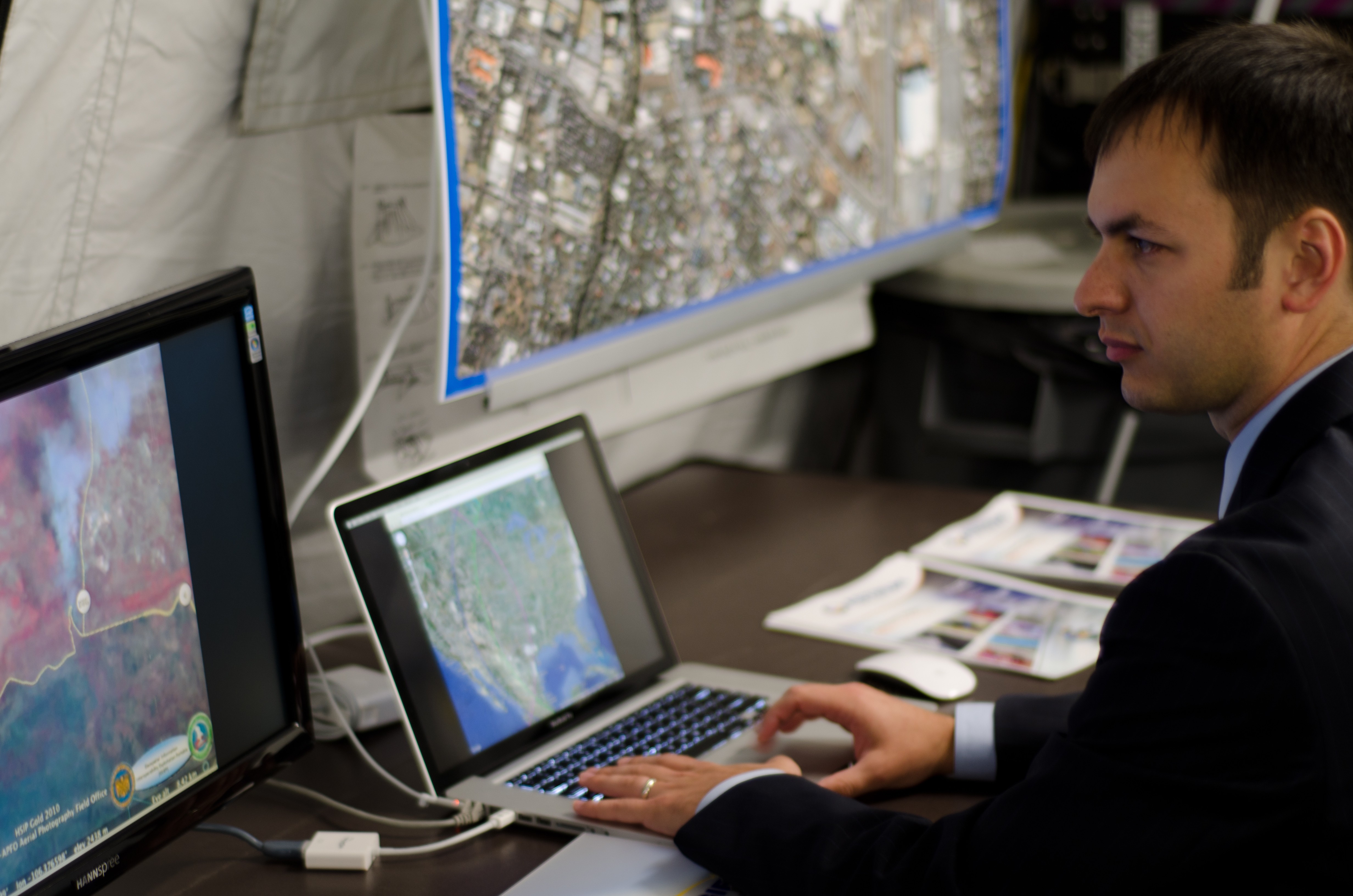
"We travelled to all the Eagle Vision ground stations from here at Redstone Arsenal, to ones near San Diego, Hawaii, Shaw Air Force Base, S.C., and Germany to help get them up and running," Novak said. "Eagle Vision provides commercial satellite imagery tasking and downlink capability to Warfighters and first responders. The Eagle Vision system was developed out of an Air Force program and they looked at different sensor programs and integrated them all together.
"At the sites, a lot of the people had misconceptions about the system," he added. "They all speculated on what EVR2ST could do and what it couldn't do. For the most part, after they saw what it could do, they were pleased and very happy their data could get out there to more users than they previously thought possible. They were overall excited to have a new capability in their quiver."
EVR2EST allows the rapid distribution of space-based imagery and radar products generated by Eagle Vision program deployable satellite ground stations. In conjunction with these systems, satellite imagery and radar products can be generated in mere hours after the satellite has collected the information allowing for timely and accurate operational support to troops in the field.
"Eagle Vision is a deployable commercial imagery ground station that can downlink imagery directly from a satellite," Novak said. "They do all of the imagery processing right there at the station. They have all of the hardware to take the images from the binary format and convert it into a usable product.
"They also have the commercial geo-processing software that takes it from the raw product and makes it into something usable they can send out to emergency responders," he added.
For civilian emergency personnel and first responders, EVR2EST is used to process, web-optimize and share information with federal, state and local emergency managers, as well as using the newly available imagery to refine damage paths. EVR2EST is used to disseminate Eagle Vision commercial satellite imagery to remote locations in a timely, bandwidth-efficient manner.
"It's rare that an engineer can work on a program from concept to reality," Novak said. "I am proud of the fact that I came up with the idea and I actually took it from a pie-in-the-sky idea, to building and demonstrating a prototype, then finding funding to build a system, then getting it fielded and hopefully have the longevity throughout the years. The system has also been submitted as a patent."
In the disaster relief and humanitarian assistance roles, EVR2EST supports civil authorities by rapidly providing critical space-based information to emergency personnel. Information is critical to disaster mitigation planning, search and rescue, and recovery. This allows for timely access to state and federal aid as well as clearer communications of need through better information gathered from space-based products.
With EVR2EST, SMDC has helped make space-based imagery and radar products available to Warfighters and first responders at the tactical level. The requirement for larger bandwidth networks has always been a concern and EVR2EST addresses this operational need, not by purchasing more costly bandwidth but, by optimizing the information on those networks and reducing the time and size requirements while maintaining the precision and fidelity of the information. This leads to enhanced situational awareness through timely, accurate and network-friendly information.
"As a fireman myself, I have a little different perspective than most people," Novak said. "It definitely helps out having that imagery and having that oversight for planners and emergency managers throughout the nation. To have that near-real-time information and then having the updates come in can be the difference between life and death."
Social Sharing