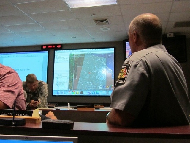
REDSTONE ARSENAL, Ala., May 16, 2011 -- In the aftermath of the recent tornado outbreak, two members of the command spent time with local, state and national authorities in efforts to save lives.
Justin Novak and Drew Ballance, both of U.S. Army Space and Missile Defense Command/Army Strategic Forces Command Future Warfare Center Innovative Ventures Office, processed commercial satellite imagery and provided updated tornado-damaged areas imagery to the Madison County Emergency Management Agency, Madison County Incident Command Post, Alabama State Emergency Management Agency, Federal Emergency Management Agency and other agencies using the Eagle Vision and Rover Responsive Exploitation of Space Products for Tactical Use, or EVR2EST, initiative.
EVR2EST is aFuture Warfare Center, or FWC, system developed for Air Force systems to disseminate Eagle Vision Commercial Satellite imagery to remote locations in a timely, bandwidth-efficient manner.
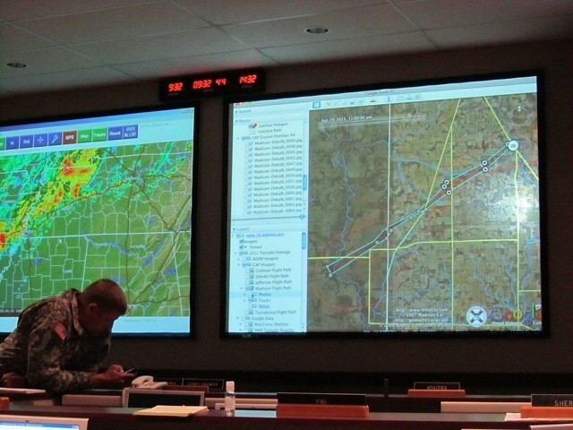
"Our mission was to support emergency agencies by providing aerial photos of grid searches to help first responders and workers clean up after the tornadoes," Novak said. "We used Virtual Alabama to help plot the path of the tornados and with that we could direct rescue crews to hard-hit areas and not have them either go to unaffected areas or to areas which already have units there."
From April 27 through May 2, 2011, Ballance and Novak facilitated the dissemination of tornado damage imagery, enabled data sharing and provided communication to various agencies, which saved time and manpower during the critical hours after the storms had passed.
They coordinated regional information awareness and assessments with subject matter experts in various areas of interest with the use of geographic information systems associated with Virtual Alabama.
Virtual Alabama is a program Novak aided the state of Alabama in developing since working at USASMDC/ARSTRAT. It was designed on the Google Earth enterprise, a geographical information systems visualization system, and provides access for federal, state and local authorities to public service data, most of which aides first responders and emergency workers during disasters.
Using other technologies created and developed at USASMDC/ARSTRAT, Novak and Ballance, under the leadership and guidance of Norven Goddard, USASMDC/ARSTRAT FWC Innovative Ventures Office director, provided space-based imagery and acted as a portal for high resolution aerial data distribution.
Ballance spoke about the command's hand in providing information and support to the community in its time of need and how lessons learned can help during future emergencies.
"We had great support for what we were doing and those who worked on the technology we used made our jobs easy," Ballance said. "It is amazing how people and technology came together during this emergency and with what we learned this time, next time we will be even more prepared to help."
Novak used a mobile data terminal mounted in a response vehicle to load Virtual Alabama and a cellular data modem and external antenna booster for data connectivity. He then used the terminals to map out a search grid and identify the areas that were already searched.
Based on reports from others, he was able to map out known damaged areas and project a likely tornado path. This eliminated a large search area to the south with little or no damage, saving valuable time and resources.
With the help of the Civil Air Patrol, Novak and Ballance were able to provide photographs of the tornado paths, which enabled rapid dissemination of Civil Air Patrol imagery to the Alabama Department of Homeland Security and Virtual Alabama.
Ballance prepped laptop computers and satellite data links from Quantum Research International's Tactical Emergency Management System, a regional communication platform developed through a Cooperative Research and Development Agreement with USASMDC/ARSTRAT-FWC. Based on the SMDC Future Operational Capability - Tactical Operations Center, this mobile asset is equipped with broad band satellite Internet, radio communications bridge and video server to provide an incident command post with connectivity and interoperability in a timely fashion.
"The state of Alabama bought these vehicles and their capabilities were immensely helpful by providing information between the command post and crews," Ballance said. "One of the great things they did was allow law enforcement officials the chance to see the news and learn of the damage throughout the state, which they had not seen yet."
"They were upset at first because of resources being diverted away from here and down to Tuscaloosa, and when they saw the news they understood," he explained.
Leveraging this resource, Novak was able to take the first post-incident Civil Air Patrol photos of Madison County, map them on Virtual Alabama and generate the first photographically verified map of the damage available.
He briefed this to the Madison County Sheriff command post day and night watch commanders and an emergency management officer from the Madison County Emergency Management Agency.
The Eagle Vision 4 deployable ground station, located in South Carolina, had downlinked several images of various areas in Alabama and Mississippi.
At the direction of the Eagle Vision operators, Novak used EVR2EST to process, web-optimize and share information with federal, state and local emergency managers, as well as using the newly available imagery to refine damage paths around Birmingham and other devastated areas.
"It was time on the ground that was saved as we helped operations run more efficiently," Novak said. "One lesson we learned is that in future emergencies, people who want to help need to do it in a coordinated manner and make sure they are going through the proper channels when they do it."
"People need to do this to ensure they are working in conjunction with local authorities who know where the problem areas are and can be of the greatest assistance to the community," he explained.
Using the Virtual Alabama program to display damaged areas affected by pre-incident aerial imagery and post-incident satellite and aerial imagery, Novak was able to spot check areas where critical infrastructure was known to be located.
He utilized the Geospatial Information Interoperability Exploitation - Portable, a National Guard Bureau system which was developed by the FWC that provides full motion video and a situational awareness platform to the National Guard and first responders.
Using the Civil Air Patrol flown imagery, which provided instant information awareness and assessment, Novak was then able to display a map of critical infrastructure, such as transmission and radio towers, from the Homeland Security Infrastructure Protection database.
"A lot of the running around that we did helped set the stage next time there is a catastrophe," Novak said. "So next time we will be a much pointier spear. It may have been a lot of work but it is times like this when we learn valuable lessons and can make things easier the next time."
As northern Alabama slowly started recovering and lives began returning to normalcy, Ballance talked about the week and the feeling of satisfaction in serving his community and being in a position where he could help those in need.
"We couldn't have done this without the help of the Civil Air Patrol and Virtual Alabama," Ballance said. "Putting those two resources together made our work a lot easier. As recovery was taking place, our mission was to help put people in place to do the most in the least amount of time. I am just glad I could help and hopefully do some good."
Related Links:
Families find shelter from storm at Redstone
U.S. Army Space & Missile Defense Command / Army Forces Strategic Command
Army.mil: Science and Tehnology News


Social Sharing