ZAGREB, Croatia - Officials from the U.S. Army Corps of Engineers and International Sava River Basin Commission hosted a three-day workshop here Sept. 6, aimed at presenting attendees information collected for the Sava River Hydraulic Model project and garnering feedback from participating countries.
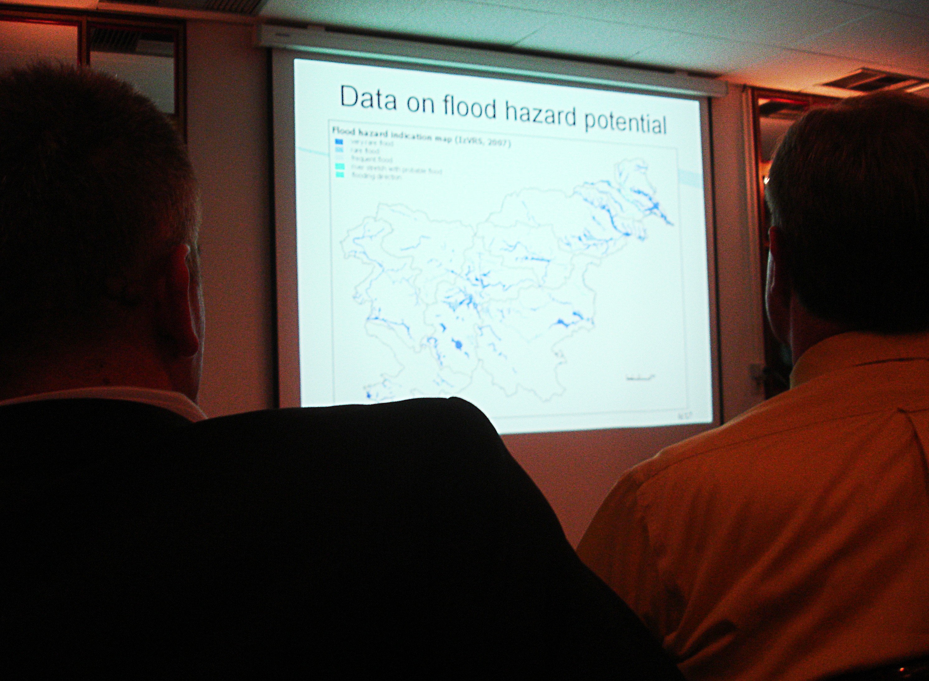
Representatives from Bosnia-Herzegovina, Serbia, Slovenia and Croatia attended the Sava River Flood Mapping Workshop to understand the data uncovered by the hydraulic model, a $100,000 project funded by the U.S. European Command's Civil Military Operations Program and carried out by USACE.
The four countries are all members of the Framework Agreement on the Sava River Basin, signed in 2002, which promotes regional cooperation throughout the basin on issues related to navigation, economic development, comprehensive water management and environmental protection, said Dejan Komatina, Ph.D., the executive secretary of the ISRBC.
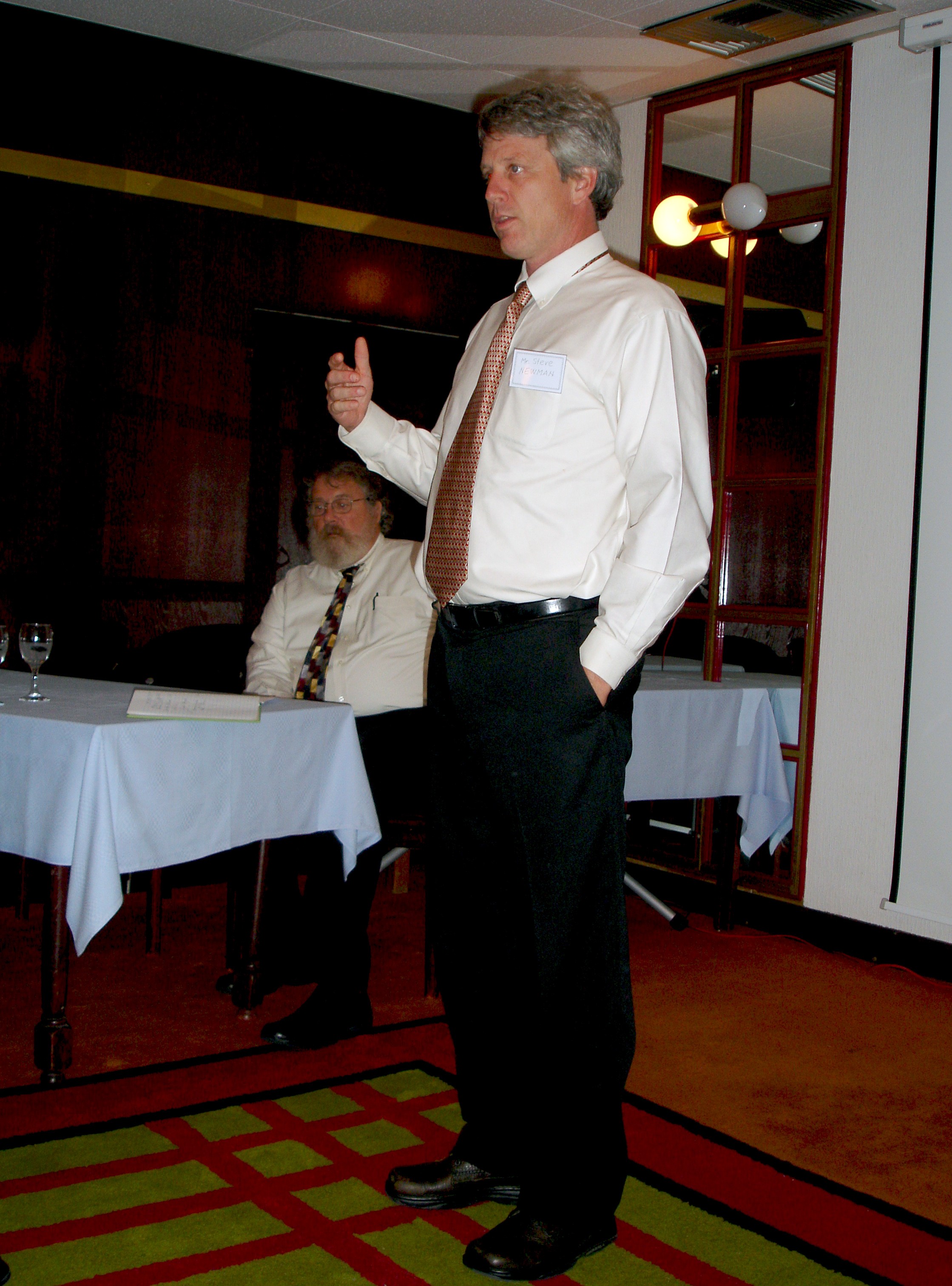
"It has been a great collaborative effort between the Sava River commission stakeholders and USACE to develop a model that will be used for efforts related to flood forecasting and warning systems, and comprehensive water resource management," said Steve Newman, a remote sensing scientist for the Cold Regions Research and Engineering Laboratory with the USACE Engineer Research and Development Center in Hanover, N.H., who presented at the conference.
The project, roughly 75 percent complete, is to develop a single hydraulic model of the Sava River and the major tributaries. Once complete, the hydraulic model will be shared between the nations and used to prepare flood mapping, support flood warning and forecasting systems, and analyze future flood protection projects, said Dr. Mark Jourdan, a research civil engineer for the Coastal and Hydraulics Laboratory at the ERDC in Vicksburg, Miss., who presented at the conference.
"We've been able to incorporate a lot of data, but the model is not done," he said. "This workshop gave us the opportunity to talk to the experts who have the local knowledge within each country to tell us what we need to know to make it better."
The workshop allowed participants the opportunity to share experiences in the development of flood maps with the USACE experts. And with the additional data collected, the team will be able to complete the final portion of the project and fix any shortfalls, said Jamie James, a hydraulic engineer from the USACE Nashville District's Water Resources Section, who also presented at the conference.
"We are aware of some of the deficits in the model so I appreciated those people who have taken the time to talk to us. It does us no good and it does them no good if the model is not useful or useable," he said. "Once we get to a point where can do no more to the model or run out of data we can use, we'll turn that over to the Sava Commission and the experts in each country will carry it forward from there."
The workshop represented the final step of this joint effort by the ISRBC (established in 2005) and USACE, supported by the partnering countries, Komatina said.
"We believe that this workshop provided a significant contribution to the achievement of the common goals in flood protection in the Sava River Basin," he said. "We look forward to continuing this cooperation. There are many issues we can work on together."
Komatina said he hopes the success of the project will lead to future projects that help the Sava Commission develop a flood alarm system.
"This is the start of a journey in which all of these countries are joined together," Jourdan said. "We really want this model to be utilized. I don't want to do this just for fun - I want to create something, to do something that makes a difference."
The Sava River is the third longest and the largest discharge of water to the Danube River contributing almost 25 percent and is an important asset to the Danube's biological and landscape diversity, according to the ISRBC website. The river runs from Slovenia to the Danube in Serbia.
The ISRBC was the first multilateral organization formed in the region after the Yugoslav Wars, according to U.S. Embassy Zagreb officials. The organization provides political and economic stability within the area through its support of international navigation, sustainable water resources management, and hazard risk reduction within the river basin, according to the ISRBC website.
Related Links:
USACE Engineer Research and Development Center
International Sava River Basin Commission
Social Sharing