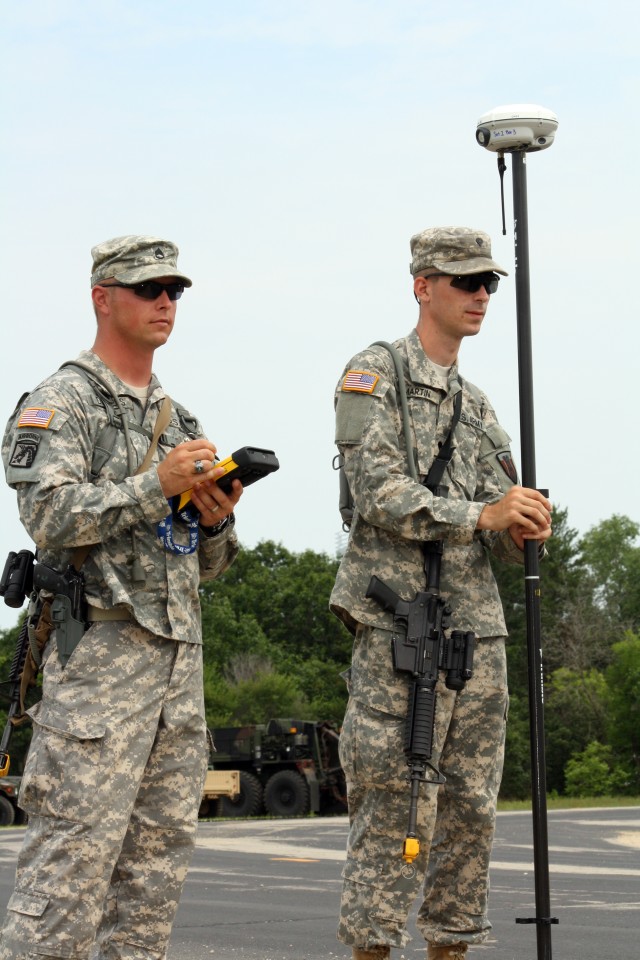
FORT McCOY, Wis. -- Pairs of Soldiers from the 176th Engineer Brigade walked along cantonment streets and fields and through the wooded areas on the training lanes at Fort McCoy - one Soldier carrying a pole with an oblong ball on the tip, the other Soldier with a hand-held device.
The Texas Army National Guard Soldiers were training to deploy in support of Operation Enduring Freedom. The technical engineer surveyors used new Global Positioning System (GPS) equipment to read information from an orbiting satellite and record it on the hand-held device. The data is loaded to a computer program and system, which, in turn, allows surveyors to calculate positions within one centimeter.
Robert Faircloth, a military-certified trainer with Trimble Navigation Limited, of Westminster, Colo., said the new equipment helps surveyors produce topographical maps in an efficient manner. "This new gear is a major upgrade from previous surveying equipment."
Older survey equipment required a line-of-sight to take measurements. The GPS version needs an open sky to read the satellites although it should be located at least slightly away from large natural or man-made structures.
"Trimble equipment works in all weather," Faircloth said. "It's not affected by clouds. This equipment is the latest and greatest for surveyors."
Faircloth spent five days at Fort McCoy instructing the 176th Soldiers.
Staff Sgt. Joseph Daniels, a surveyor with the 176th, said the use of the equipment is totally new. "We just received it since coming to Fort McCoy."
"This new equipment is important to our job because it takes half the time to operate it compared to the older style of survey gear," Daniels said. "Much of that is because it works off of a satellite."
Daniels said the survey equipment helps Soldiers establish exact location points for forward operating bases or combat operating bases.
"That information is requested by higher headquarters for their planning of infrastructure projects or rebuilding of destroyed areas. This survey equipment is the first step in the building and rebuilding process."

Social Sharing