FORT JACKSON, S.C. -- Fort Jackson's 52,000 acres are not only home to countless Soldiers who use the land for training, but also to 91 documented bird species. A new program conducted by the wildlife division of the Directorate of Public Works monitors the post's migratory bird population with the goal of recognizing trends in breeding and survivorship.
The program is part of a nationwide effort by the Institute for Bird Populations, called Monitoring Avian Productivity and Survivorship, or MAPS.
Nicole Hawkins, wildlife biologist with DPW and MAPS program manager, explained that MAPS is a tool to tackle issues of breeding grounds or survival before they endanger species.
"It's better to get a handle on what's going on now ... and try to be proactive and keep birds from being listed as endangered or threatened, instead of just letting things go until it gets to that point where it can restrict training," Hawkins said.
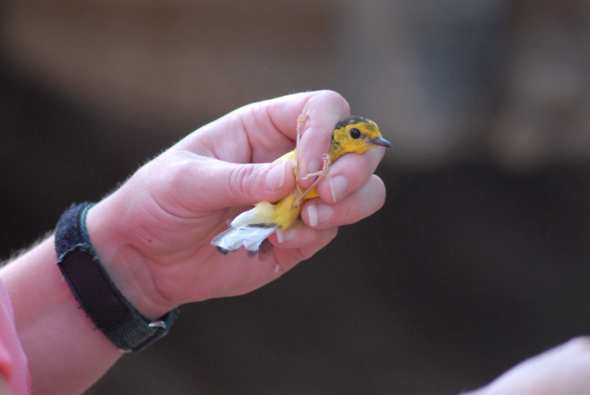
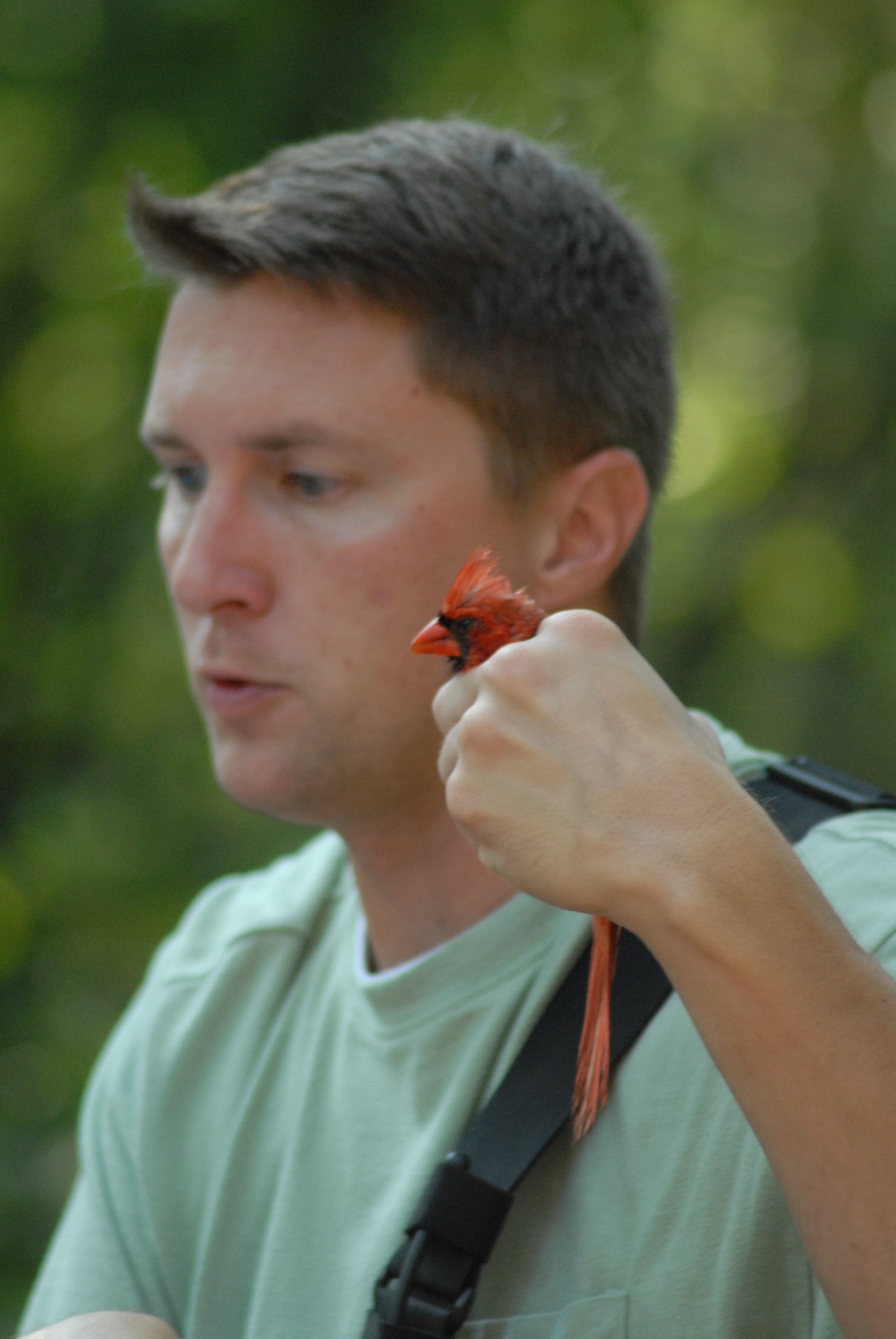
The program focuses specifically on migratory birds that breed on Fort Jackson. To gain data, Hawkins and Josh Arrants, a wildlife technician, set up 10 mist nets to capture birds throughout a day. The captured birds are banded and processed by collecting data, such as species, sex, breeding status, age, wing length, body fat, weight and overall condition.
After the birds are processed, they are released.
The monitoring is conducted nine times throughout the breeding period, with the nets set up in the same locations. Arrants explained that if the program is conducted each year, it gives a good indication of the health of the habitat and development of bird population on Fort Jackson.
Hawkins said that the South Carolina Department of Natural Resources has been running a MAPS station in the southeastern part of Fort Jackson for several years.
That station is located in an open field and focuses on monitoring different species of birds. The DPW station is in a riparian habitat -- a wooded area with a nearby creek. What makes the location of the station special is that it is close to the training area and near a roadway.
"This gives us a really great idea of not only what's here, but what is sustainable with the traffic and heavy training nearby," Arrants said.
Arrants said he considers Fort Jackson an island of habitat in the Columbia area.
"A place like Fort Jackson is very, very akin to a national forest or a national park or a national wildlife refuge. There are very, very strict limitations on what can be done for development," Arrants said. "If you look right outside the gates of Fort Jackson, there's nothing but development in most cases."
Although the program is still in the early stages, it has already yielded positive results with regard to one species. The Prairie Warbler is regarded as a species of concern in South Carolina, which means its population appears to be declining. Hawkins said the bird appears to be common on Fort Jackson.
"I've run MAPS stations before and never captured one," she said. "The first session we had out here, we got a number of them."
Hawkins explained that more than 30 South Carolina bird species are considered species of concern, but added that initial data shows that these birds seem to be doing well on post.
"What we found this year -- just in baseline documentation -- these species of concern to the state, the high priority ones, we have a lot of them here at Fort Jackson," she said.
"(This) indicates to me that Fort Jackson is doing a pretty good job of managing the habitat here."
Social Sharing