With the end of the Cold War and the Warsaw Pact there was an opportunity in Europe to improve relations between the Western and Eastern European nations. Beginning in 1990, the North Atlantic Treaty Organization, or NATO, had presented various initiatives to "[extend] a hand of friendship and (propose) cooperation to the former Warsaw Pact nations of Central and Eastern Europe." Among these was the Partnership for Peace, or PfP, program, initially proposed in January 1994 during the NATO Brussels Summit.
The goal of the PfP is to enhance cooperation and increase stability in central and Eastern Europe building partnerships between NATO and partner countries while at the same time increasing interoperability for partner nations and NATO members.
Activities under the PfP umbrella "touch upon virtually every field of NATO activity," and cover a wide range of opportunities including defense reform, policy development and planning, civil-military relations, education and training, civil emergency planning and disaster response and scientific and environmental cooperation. Depending upon their needs, member nations have the opportunity to select the areas in which they would like participate.
In that first year, 23 nations ranging from Albania and Sweden to Kazakhstan and Russia elected to participate in the NATO PfP program. Twelve of these have since become members of NATO themselves. As of January 2012, there were 34 member nations from across Europe and Central Asia.
The United States was a great supporter of the PfP program. Seven months after the Brussels Summit, while visiting Poland in July 1994, President William Clinton announced the Warsaw Initiative to emphasize American support for the PfP. The initiative provides funds to developing nations to participate in PfP programs.
The U.S. Army Space and Missile Defense Command/Army Forces Strategic Command, then known as the U.S. Army Space and Strategic Defense Command, or SSDC, contributed to the PfP through the recently established Disaster Preparedness and Studies Program. The original fiscal year 1993 program, established after Hurricane Andrew, sought to improve disaster preparedness for military installations in coordination with the civilian community.
Following the success of this project, in which the command created 120 integrated digital maps for Department of Defense installations, the Office of the Secretary of Defense tasked the command's disaster preparedness team to provide comparable assistance to the countries participating in the PfP program.
That fall, deputy commander Brig. Gen. Jan Van Prooyen led a team from the Systems Analysis Division attended the first International Civil Protection for Changing Times conference in Constanta, Romania. While there, the team under Rodger Qualls and Curtis Miller provided technical assistance during a four-hour seminar which demonstrated planning requirements and the specific response phases for a possible nuclear accident.
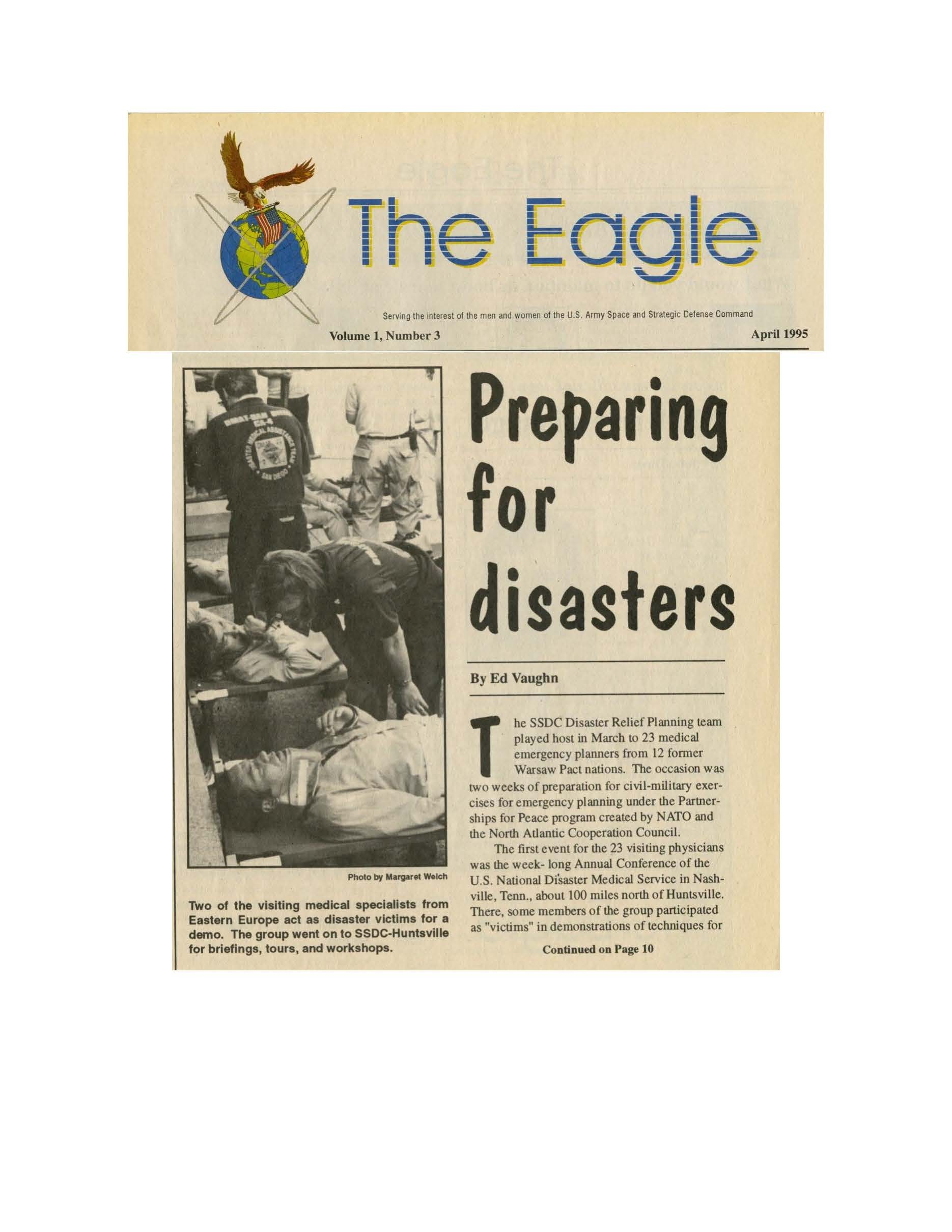
In 1995, some of the PfP participants came to the Tennessee Valley. In March 1995, SSDC's Disaster Relief Planning Team hosted a group of 23 medical emergency planners from twelve former Warsaw Pact nations.
After a week in Nashville for the annual conference of the U.S. National Disaster Medical Service, the group traveled down to Huntsville, Alabama, for a series of meetings and events in which they "provided input on the structure, interfaces and priorities of the medical function" to be incorporated into the computerized disaster preparedness planning exercise template being developed at SSDC.
As with the U.S. civil-military version, the computer tool provides planners and first responders with maps of disaster areas and inventories of local resources and response capabilities. Essentially the SSDC applied missile system research for siting missile defense systems to create a disaster preparedness plan with digital databases and exercise templates.
The result was an electronic mapping system with topographical features which shows affected areas, available roads and infrastructure, depicts population centers as well as nearby military and civil relief locations composed with real-time data.
During this first year, the command worked with representatives from 23 different nations. In this and subsequent visits, PfP participants received hands-on training with the SSDC's Systems Directorate.
In addition, while at SSDC, participants trained to develop their own disaster preparedness scenario(s) using commercial-off-the-shelf technology. Following the training, visitors have an opportunity to practice their disaster response planning. They were also given the opportunity to visit local medical facilities, the Emergency 911 Management Office, the Emergency Mobile Command Center, and the National Weather Service.
With this information at hand, the computerized templates are expected to reduce costs and increase preparedness for all types of disasters. As Qualls, program manager for the disaster preparedness studies and planning project, noted, "A picture may be worth a 1,000 words, but a map is worth 10,000 words."
Social Sharing